Researchers have discovered what may be the world’s oldest 3D map, located within a quartzitic sandstone megaclast in the Paris Basin.
A remarkable discovery at the Ségognole 3 rock shelter has revealed that Palaeolithic people, 13,000 years ago, sculpted sandstone to reflect natural water flows and geomorphological features. This intricate three-dimensional model, rather than a traditional map, demonstrates their advanced understanding of landscapes and hydrology.
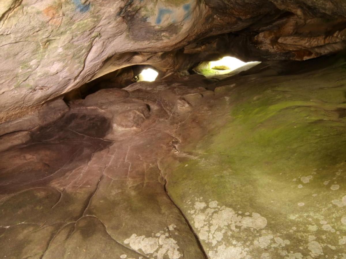
Ancient Rock Shelter’s Hidden Secrets
The Ségognole 3 rock shelter, recognized since the 1980s for its engraved depictions of two horses in a Late Palaeolithic style, has now revealed another remarkable feature — a miniature representation of the surrounding landscape.
This discovery is part of research led by Dr. Médard Thiry from the Mines Paris – PSL Centre of Geosciences, with contributions from Dr. Anthony Milnes of the University of Adelaide’s School of Physics, Chemistry, and Earth Sciences.
Dr. Thiry’s earlier studies, following his first visit to the site in 2017, showed that Palaeolithic people had deliberately shaped the sandstone to resemble a female form and manipulated fractures to channel water through the rock, creating an outflow at the base of the carved pelvic area.

A 13,000-Year-Old Hydrological Representation
Now, new findings suggest that part of the shelter’s sandstone floor, shaped by humans around 13,000 years ago, was intentionally modeled to reflect the region’s natural water flows and landforms. This indicates a sophisticated understanding of the landscape by Palaeolithic people.
“What we’ve described is not a map as we understand it today — with distances, directions, and travel times — but rather a three-dimensional miniature depicting the functioning of a landscape, with runoff from highlands into streams and rivers, the convergence of valleys, and the downstream formation of lakes and swamps,” Dr. Milnes explains.
“For Palaeolithic peoples, the direction of water flows and the recognition of landscape features were likely more important than modern concepts like distance and time.

Ingenious Engineering of the Ancient World
“Our study demonstrates that human modifications to the hydraulic behaviour in and around the shelter extended to modelling natural water flows in the landscape in the region around the rock shelter. These are exceptional findings and clearly show the mental capacity, imagination and engineering capability of our distant ancestors.”
Thanks to his extensive research on the origins of Fontainebleau sandstone, Dr. Thiry recognized several fine-scale morphological features that could not have formed naturally, suggesting they were modified by early humans.
“Our research showed that Palaeolithic humans sculpted the sandstone to promote specific flow paths for infiltrating and directing rainwater which is something that had never been recognized by archaeologists,” Thiry says.
Spiritual and Mythical Connections to Water
“The fittings probably have a much deeper, mythical meaning, related to water. The two hydraulic installations — that of the sexual figuration and that of the miniature landscape — are two to three meters from each other and are sure to relay a profound meaning of conception of life and nature, which will never be accessible to us.”
Milnes and Thiry’s latest study, published in Oxford Journal of Archaeology, discovered the presence of three-dimensional modeling by closely examining fine-scale geomorphological features.
“This completely new discovery offers a better understanding and insight into the capacity of these early humans,” Thiry says.
Redefining the Oldest Known 3D Maps
Before this discovery, the oldest known three-dimensional map was understood to be a large portable rock slab engraved by people of the Bronze Age around 3000 years ago. This map depicted a local river network and earth mounds, reflecting a more modern map concept used for navigation.
Dr. Milnes says that collaborating across disciplines — such as archaeology, geology, and geomorphology — is vital in science.
“We believe the most productive research outcomes are found at the boundaries between disciplines,” Dr. Milnes says.
“Re-evaluating field studies and conducting frequent site visits are important. It’s clear from our ongoing project that insights and interpretations do not appear immediately but emerge through new observations and interdisciplinary discussions,” Dr. Thiry suggests.
Reference: “Palaeolithic Map Engraved for Staging Water Flows in a Paris Basin Shelter” by Médard Thiry and Anthony Milnes, 22 December 2024, Oxford Journal of Archaeology.
DOI: 10.1111/ojoa.12316
Never miss a breakthrough: Join the SciTechDaily newsletter.
Follow us on Google and Google News.
2 Comments
Need is the mother of invention. Their map and land alteration were natural as practiced in all ages of human evolution.
“Lost for 13,000 Years, Scientists Have Finally Decoded This Ancient 3D Map”
Wow! That’s a long time for a bunch of scientists to be lost!