A significant water reservoir discovered beneath the ocean floor near New Zealand may offer insights into the mechanics of slow slip earthquakes and tectonic activity.
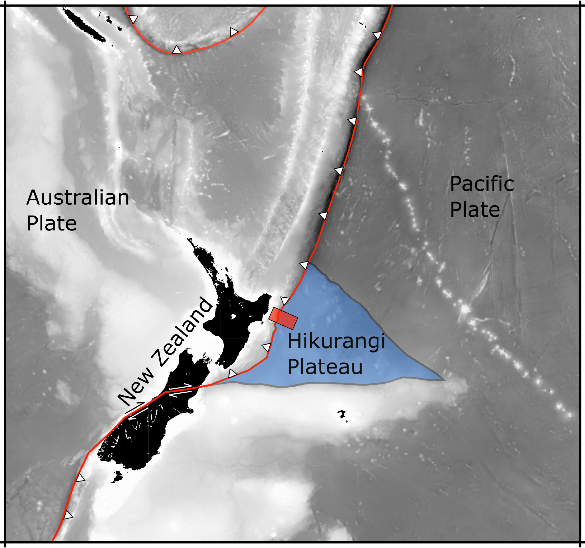
Researchers have discovered a sea’s worth of water locked within the sediment and rock of a lost volcanic plateau that’s now deep in the Earth’s crust. Revealed by a 3D seismic image, the water lies two miles under the ocean floor off the coast of New Zealand, where it may be dampening a major earthquake fault that faces the country’s North Island.
Slow Slip Earthquakes and Water
The fault is known for producing slow-motion earthquakes, called slow slip events. These can release pent-up tectonic pressure harmlessly over days and weeks. Scientists want to know why they happen more often at some faults than others.
Many slow slip earthquakes are thought to be linked to buried water. However, until now there was no direct geologic evidence to suggest such a large water reservoir existed at this particular New Zealand fault.
“We can’t yet see deep enough to know exactly the effect on the fault, but we can see that the amount of water that’s going down here is actually much higher than normal,” said the study’s lead author, Andrew Gase, who did the work as a postdoctoral fellow at the University of Texas Institute for Geophysics (UTIG).
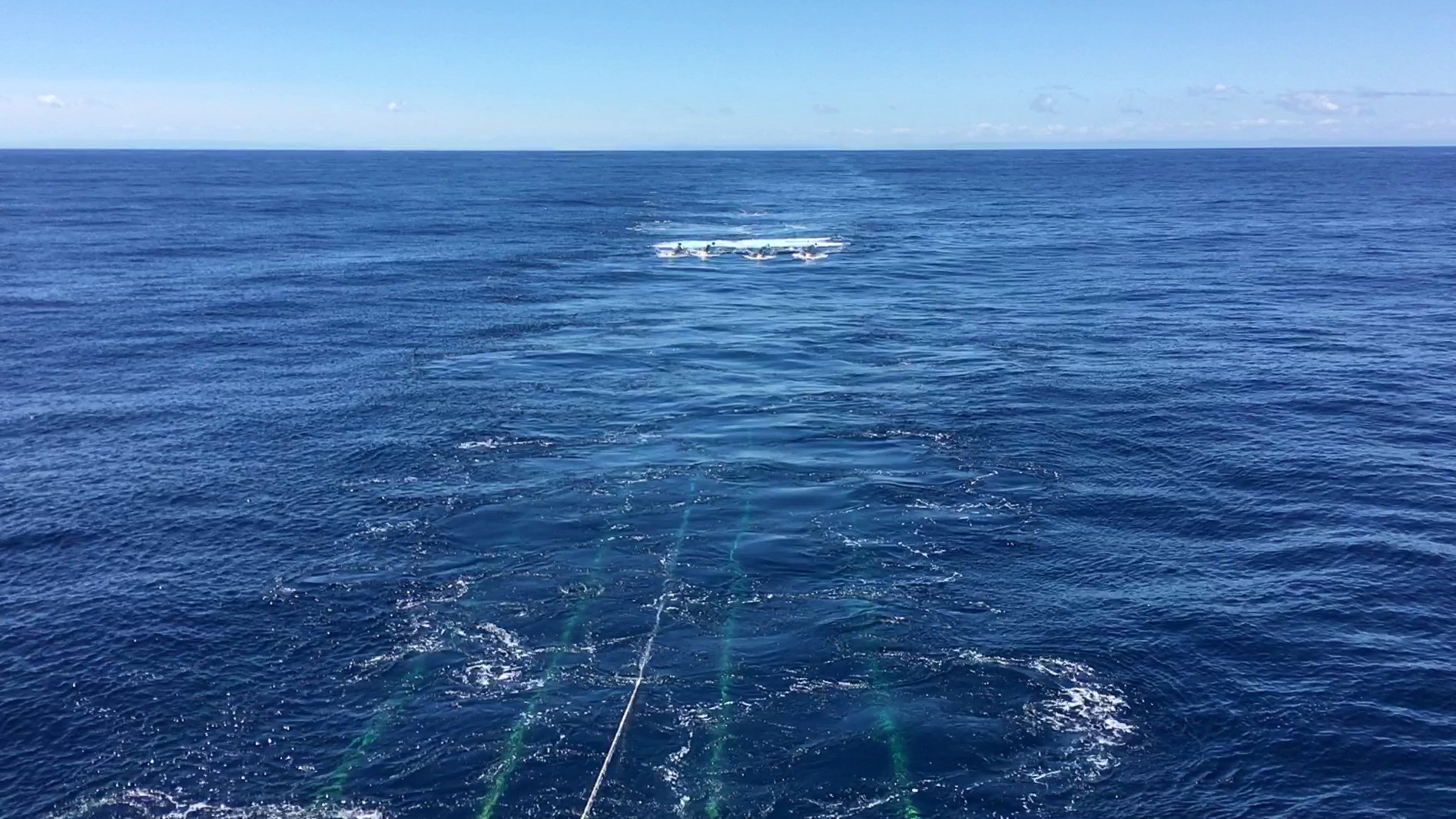
The research was published recently in the journal Science Advances and is based on seismic cruises and scientific ocean drilling led by UTIG researchers.
The Quest for a Deeper Understanding
Gase, who is now a postdoctoral fellow at Western Washington University, is calling for deeper drilling to find where the water ends up so that researchers can determine whether it affects pressure around the fault — an important piece of information that could lead to more precise understanding of large earthquakes, he said.
Origins of the Water Reservoir
The site where the researchers found the water is part of a vast volcanic province that formed when a plume of lava the size of the United States breached the Earth’s surface in the Pacific Ocean 125 million years ago. The event was one of the Earth’s largest known volcanic eruptions and rumbled on for several million years.
Gase used seismic scans to build a 3D picture of the ancient volcanic plateau in which he saw thick, layered sediments surrounding buried volcanoes. His UTIG collaborators ran lab experiments on drill core samples of the volcanic rock and found that water made up nearly half of its volume.
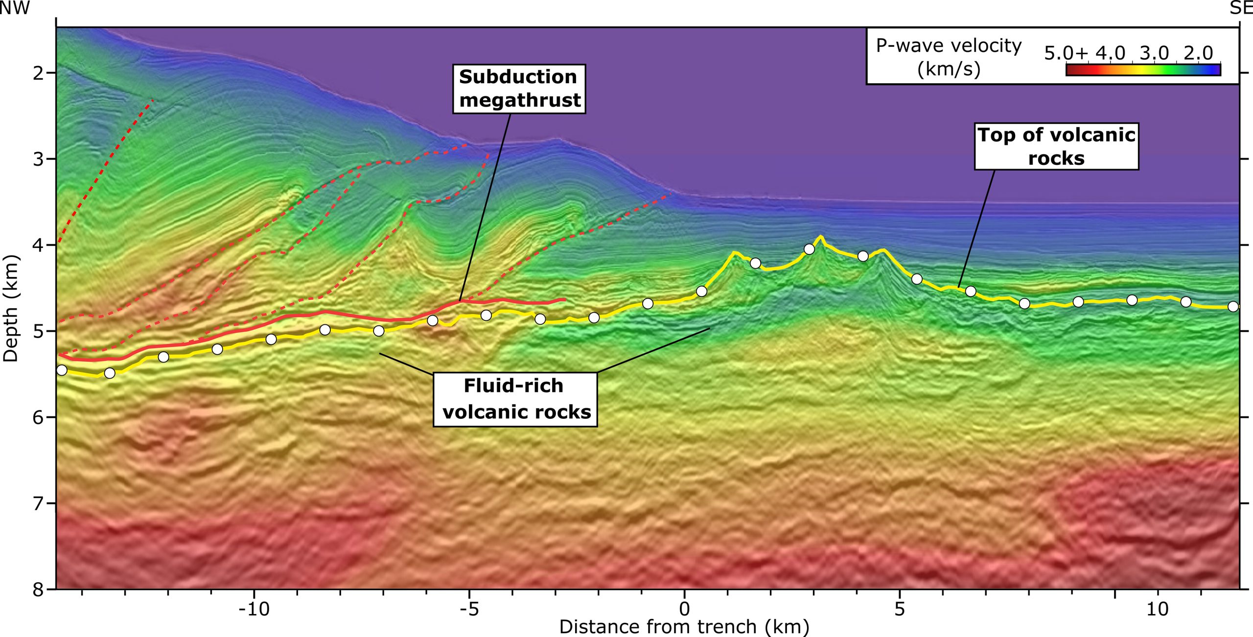
“Normal ocean crust, once it gets to be about 7 or 10 million years old should contain much less water,” he said. The ocean crust in the seismic scans was ten times as old, but it had remained much wetter.
Gase speculates that the shallow seas where the eruptions took place eroded some of the volcanoes into a porous, broken-up rock that stored water like an aquifer as it was buried. Over time, the rock and rock fragments transformed into clay, locking in even more water.
The Implications for Earthquake Understanding
The discovery is important because scientists think that underground water pressure may be a key ingredient in creating conditions that release tectonic stress via slow slip earthquakes. This usually happens when water-rich sediments are buried with the fault, trapping the water underground. However, the New Zealand fault contains little of this typical ocean sediment. Instead, the researchers think the ancient volcanoes and the transformed rocks — now clays — are carrying large volumes of water down as they’re swallowed by the fault.
UTIG Director Demian Saffer, a study coauthor and co-chief scientist on the scientific drilling mission, said the findings suggest that other earthquake faults around the globe could be in similar situations.
“It’s a really clear illustration of the correlation between fluids and the style of tectonic fault movement — including earthquake behavior,” he said. “This is something that we’ve hypothesized from lab experiments, and is predicted by some computer simulations, but there are very few clear field experiments to test this at the scale of a tectonic plate.”
Reference: “Subducting volcaniclastic-rich upper crust supplies fluids for shallow megathrust and slow slip” by Andrew C. Gase, Nathan L. Bangs, Demian M. Saffer, Shuoshuo Han, Peter K. Miller, Rebecca E. Bell, Ryuta Arai, Stuart A. Henrys, Shuichi Kodaira, Richard Davy, Laura Frahm and Daniel H. N. Barker, 16 August 2023, Science Advances.
DOI: 10.1126/sciadv.adh0150
The research was funded by the U.S. National Science Foundation and science and research agencies in New Zealand, Japan and the United Kingdom.
Never miss a breakthrough: Join the SciTechDaily newsletter.
Follow us on Google and Google News.