
A new study from MIT shows that heavy snowfall and rain may trigger earthquakes by affecting underground pressures, offering fresh insights into the relationship between climate and seismic activity in Japan. Credit: SciTechDaily.com
MIT researchers have linked heavy snowfall and rain to earthquake swarms in northern Japan, suggesting that extreme weather events can trigger seismic activity by altering underground pressures.
This groundbreaking study highlights the potential for climate to impact geological events, with implications for understanding earthquake triggers worldwide as climate change progresses.
Uncovering Earthquake Triggers: Beyond the Surface
When scientists look for an earthquake’s cause, their search typically starts underground. As centuries of seismic studies have made clear, a temblor is primarily triggered by the collision of tectonic plates and the movement of subsurface faults and fissures.
But MIT scientists have now found that certain weather events may also play a role in setting off some quakes.
Groundbreaking Research: Climate’s Role in Earthquake Induction
In a study published recently in the journal Science Advances, the researchers report that episodes of heavy snowfall and rain likely contributed to a swarm of earthquakes over the past several years in northern Japan. The study is the first to show that climate conditions could initiate some quakes.
“We see that snowfall and other environmental loading at the surface impacts the stress state underground, and the timing of intense precipitation events is well-correlated with the start of this earthquake swarm,” says study author William Frank, an assistant professor in MIT’s Department of Earth, Atmospheric and Planetary Sciences (EAPS). “So, climate obviously has an impact on the response of the solid earth, and part of that response is earthquakes.”
Seismic Activity and Climate Insights
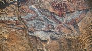
The new study focuses on a series of ongoing earthquakes in Japan’s Noto Peninsula. The team discovered that seismic activity in the region is surprisingly synchronized with certain changes in underground pressure, and that those changes are influenced by seasonal patterns of snowfall and precipitation. The scientists suspect that this new connection between quakes and climate may not be unique to Japan and could play a role in shaking up other parts of the world.
Looking to the future, they predict that the climate’s influence on earthquakes could be more pronounced with global warming.
“If we’re going into a climate that’s changing, with more extreme precipitation events, and we expect a redistribution of water in the atmosphere, oceans, and continents, that will change how the Earth’s crust is loaded,” Frank adds. “That will have an impact for sure, and it’s a link we could further explore.”
The study’s lead author is former MIT research associate Qing-Yu Wang (now at Grenoble Alpes University), and also includes EAPS postdoc Xin Cui, Yang Lu of the University of Vienna, Takashi Hirose of Tohoku University, and Kazushige Obara of the University of Tokyo.
Analyzing Seismic Patterns
Since late 2020, hundreds of small earthquakes have shaken up Japan’s Noto Peninsula — a finger of land that curves north from the country’s main island into the Sea of Japan. Unlike a typical earthquake sequence, which begins as a main shock that gives way to a series of aftershocks before dying out, Noto’s seismic activity is an “earthquake swarm” — a pattern of multiple, ongoing quakes with no obvious main shock, or seismic trigger.
The MIT team, along with their colleagues in Japan, aimed to spot any patterns in the swarm that would explain the persistent quakes. They started by looking through the Japanese Meteorological Agency’s catalog of earthquakes which provides data on seismic activity throughout the country over time. They focused on quakes in the Noto Peninsula over the last 11 years, during which the region has experienced episodic earthquake activity, including the most recent swarm.
With seismic data from the catalog, the team counted the number of seismic events that occurred in the region over time, and found that the timing of quakes prior to 2020 appeared sporadic and unrelated, compared to late 2020, when earthquakes grew more intense and clustered in time, signaling the start of the swarm, with quakes that are correlated in some way.
Seasonal Changes and Seismic Responses
The scientists then looked to a second dataset of seismic measurements taken by monitoring stations over the same 11-year period. Each station continuously records any displacement, or local shaking that occurs. The shaking from one station to another can give scientists an idea of how fast a seismic wave travels between stations. This “seismic velocity” is related to the structure of the Earth through which the seismic wave is traveling. Wang used the station measurements to calculate the seismic velocity between every station in and around Noto over the last 11 years.
The researchers generated an evolving picture of seismic velocity beneath the Noto Peninsula and observed a surprising pattern: In 2020, around when the earthquake swarm is thought to have begun, changes in seismic velocity appeared to be synchronized with the seasons.
“We then had to explain why we were observing this seasonal variation,” Frank says.
Hydromechanical Modeling and Seismic Analysis
The team wondered whether environmental changes from season to season could influence the underlying structure of the Earth in a way that would set off an earthquake swarm. Specifically, they looked at how seasonal precipitation would affect the underground “pore fluid pressure” — the amount of pressure that fluids in the Earth’s cracks and fissures exert within the bedrock.
“When it rains or snows, that adds weight, which increases pore pressure, which allows seismic waves to travel through slower,” Frank explains. “When all that weight is removed, through evaporation or runoff, all of a sudden, that pore pressure decreases and seismic waves are faster.”
Wang and Cui developed a hydromechanical model of the Noto Peninsula to simulate the underlying pore pressure over the last 11 years in response to seasonal changes in precipitation. They fed into the model meteorological data from this same period, including measurements of daily snow, rainfall, and sea-level changes. From their model, they were able to track changes in excess pore pressure beneath the Noto Peninsula, before and during the earthquake swarm. They then compared this timeline of evolving pore pressure with their evolving picture of seismic velocity.
“We had seismic velocity observations, and we had the model of excess pore pressure, and when we overlapped them, we saw they just fit extremely well,” Frank says.
In particular, they found that when they included snowfall data, and especially, extreme snowfall events, the fit between the model and observations was stronger than if they only considered rainfall and other events. In other words, the ongoing earthquake swarm that Noto residents have been experiencing can be explained in part by seasonal precipitation, and particularly, heavy snowfall events.
“We can see that the timing of these earthquakes lines up extremely well with multiple times where we see intense snowfall,” Frank says. “It’s well-correlated with earthquake activity. And we think there’s a physical link between the two.”
The research team suspects that heavy snowfall and similar extreme precipitation could play a role in earthquakes elsewhere, though they emphasize that the primary trigger will always originate underground.
“When we first want to understand how earthquakes work, we look to plate tectonics, because that is and will always be the number one reason why an earthquake happens,” Frank says. “But, what are the other things that could affect when and how an earthquake happens? That’s when you start to go to second-order controlling factors, and the climate is obviously one of those.”
Reference: “Untangling the environmental and tectonic drivers of the Noto earthquake swarm in Japan” by Qing-Yu Wang, Xin Cui, William B. Frank, Yang Lu, Takashi Hirose and Kazushige Obara, 8 May 2024, Science Advances.
DOI: 10.1126/sciadv.ado1469
This research was supported, in part, by the National Science Foundation.


“The study is the first to show that climate conditions COULD initiate some quakes.”
The idea of loading of crustal plates from ocean tides and/or crustal tides, has been around for a long time. Back in the 1960s and ’70s, the Santa Clara County (AKA Silicon Valley) geologist was a proponent of the idea. However, his research never met muster with the seismologists at the nearby Menlo Park US Geological Survey campus. We can tell that this is an article about climate because the ubiquitous “could” is used instead of the correlation coefficient and associated uncertainty interval.
Another possibility is that water is lubricating the fault(s) and that is responsible instead of the relatively thin coating of snow, which has a density about 1/3rd that of the basement rocks. That is to say that 30 feet of snow is going to be equivalent to about 10 feet of rock. Another possibility might be the changing weight of the overlying airmass along the fault could be leveraging the fault. This seems to be a case of claiming a bobcat’s tail is wagging the cat, without carefully observing the cat’s behavior. The Scientific Method demands that alternative hypotheses be considered and explored. That appears not to be the case here. Is climatology corrupting other sciences that were formerly more rigorous?
My estimate above, for the density of snow, was assuming a wet, dense snow. Checking online, it appears that it was off, because a common rule of thumb is that 10 inches of snow is equivalent to 1 inch of water. The conversion ratio for freshly fallen snow varies largely with the temperature, which in turn varies with elevation. For fresh ‘powder’ falling at a temperature colder than -20 deg F, 30 feet of snow would be equivalent to to about 0.3 feet of water, which has a density of about 1/3 that of rocks. That is, the weight of a column of water 0.3 feet deep would be equivalent to rocks about 0.1 feet thick, or an inch or two in thickness. Thirty feet of snow, even in the mountains, would be an extreme event for a single storm, and the topography of the mountains will have a relief of thousands of feet, with even ‘flat’ surfaces undulating more than an inch. I suspect that these geophysicists wanted to have an answer a little too badly.
https://www.ncei.noaa.gov/sites/default/files/2021-09/Estimating_the_Water_Equivalent_of_Snow.pdf