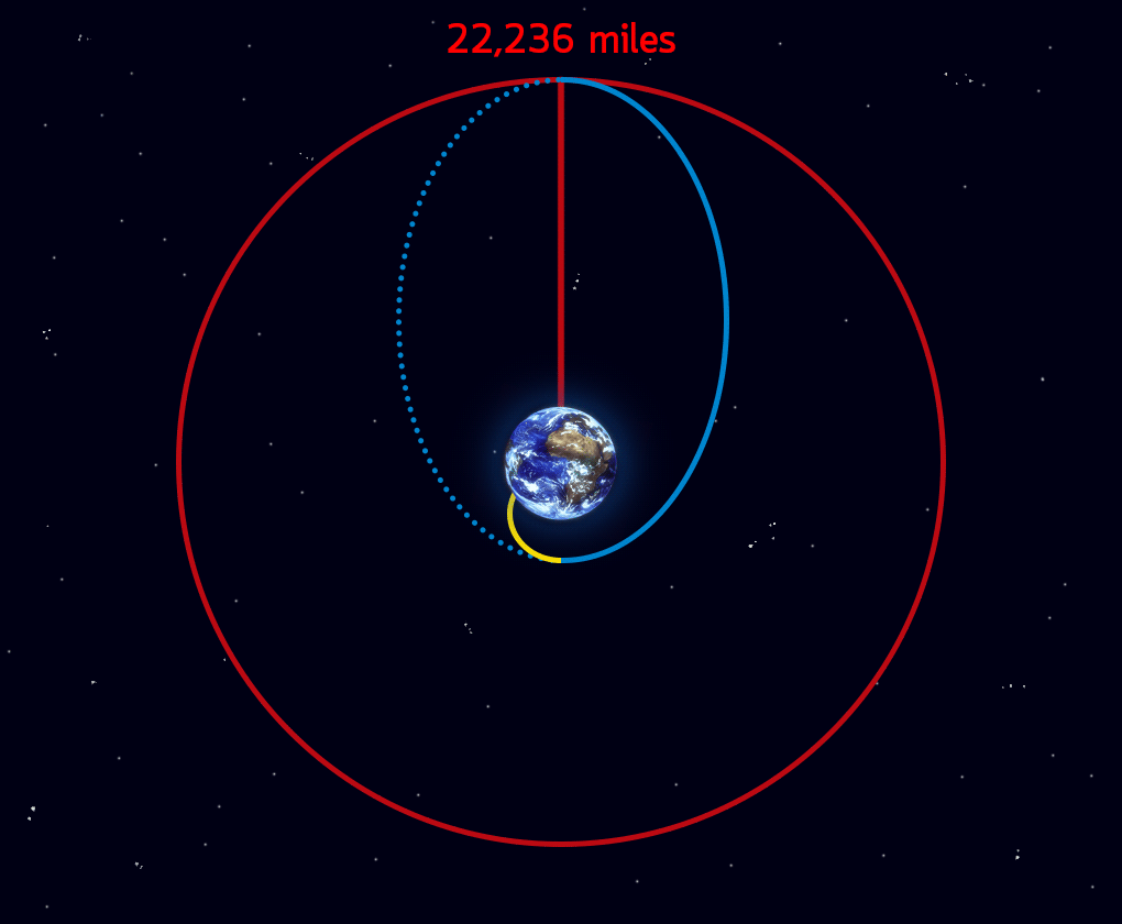
On March 14, 2022, GOES-T executed its final engine burn, placing the satellite in geostationary orbit 22,236 miles (13,816 miles) above Earth. Upon reaching this milestone, GOES-T was renamed GOES-18. GOES satellites are designated with a letter prior to launch and a number once they achieve geostationary orbit.
NOAA’s GOES-T satellite launched on March 1, 2022, at 4:38 p.m. EST, lifting off from Cape Canaveral Space Force Station in Florida. The satellite launched aboard a United Launch Alliance Atlas V rocket from Space Launch Complex 41. The launch was managed by NASA’s Launch Services Program, based at Kennedy Space Center.
GOES-T separated from the Atlas V Centaur upper stage at 8:11 p.m. EST on March 1. GOES-T mission managers confirmed that its solar arrays successfully deployed at 8:28 p.m. EST and the satellite was operating on its own power.
The launch vehicle delivered GOES-T to a geostationary transfer orbit, a highly elliptical orbit where the satellite is close to the Earth during one part of its orbit and far from the Earth on the opposite side. Placing GOES-T in a geostationary transfer orbit provides the satellite a path to reach its final geostationary orbit over the equator (see diagram below). After a series of orbit-raising maneuvers and engine burns, on March 14, GOES-T was delivered into a circular geostationary orbit. The satellite is now in position to orbit at the same rate Earth rotates, so it can keep constant watch over the same region.
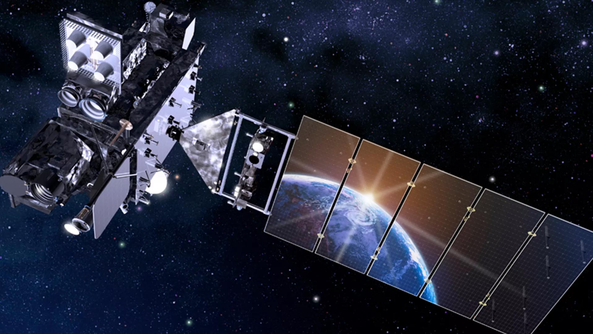
Next, GOES-18 will perform its second stage solar array deployment, releasing the solar array. The deployed solar panels will form a single solar array wing that will rotate once per day to continuously point its photovoltaic (solar) cells toward the sun. The photovoltaic cells will convert energy from the sun into electricity to power the entire satellite, including the instruments, computers, data processors, sensors, and telecommunications equipment.
In the days that follow, several maneuvers will be conducted to put GOES-T in its 89.5 degrees west longitude initial checkout position, between the operational GOES-East and GOES-West satellites. Then, the magnetometer boom will be deployed. The satellite will then begin on-orbit checkout and validation of its instruments and systems.
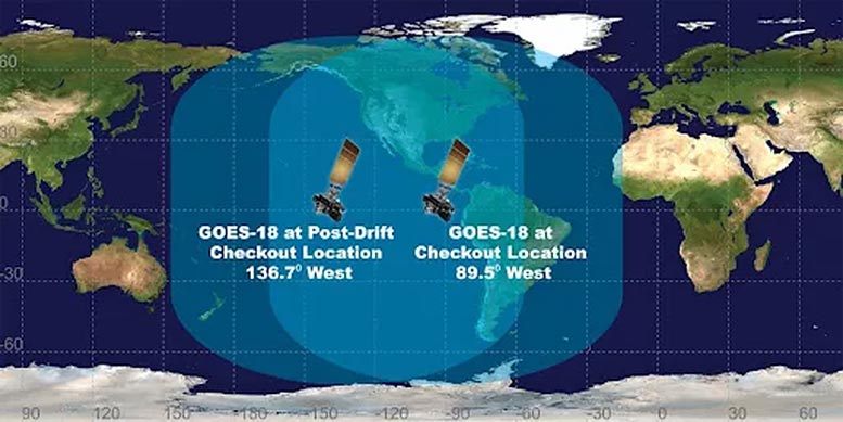
NOAA expects to see the first images from GOES-18 in May. Then GOES-18 will drift west to 136.8 degrees west longitude and finish post-launch testing. NOAA plans for GOES-18 to take over as the operational GOES-West satellite in early 2023, replacing GOES-17. GOES-17 will become the on-orbit backup.
GOES-18 will track destructive wildfires, lightning, Pacific Ocean-based storms, dense fog, and other hazards that threaten the U.S. West Coast, Hawaii, and Alaska. It will also monitor solar activity and space weather to provide early warnings of disruptions to power grids, communications, and navigation systems.
Never miss a breakthrough: Join the SciTechDaily newsletter.
Follow us on Google and Google News.