
How Are Clouds’ Shapes Made?
Explore the diverse world of cloud formations, from ground-level fog to high-flying cirrus clouds, and learn how these atmospheric features can help predict weather changes, including storms and tranquil conditions.
I’m a meteorologist, and I’ve been fascinated by the weather since I was 8 years old. Growing up in Minnesota, I experienced everything from wind-whipping blizzards in the winter to intense summer thunderstorms – even tornadoes. So, it’s no surprise that I’ve spent much of my life studying clouds.
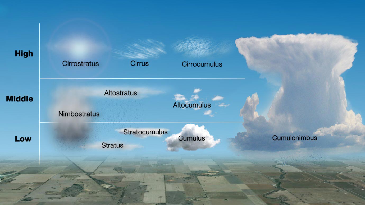
Clouds take shape when the air becomes saturated – meaning it holds so much water vapor that tiny droplets or ice crystals begin to form. Different types of clouds develop depending on temperature, humidity, and air movement. In fact, learning to recognize cloud shapes can help predict the weather.
Cotton Ball Cumulus Clouds
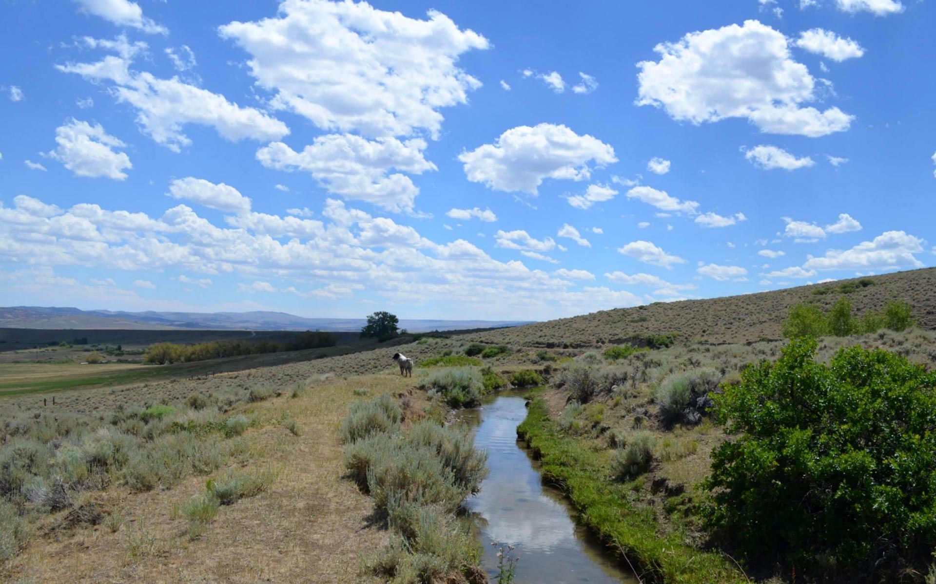
Some clouds look like big cotton balls or cauliflower in the sky. These are called cumulus clouds, and they’re made up of tiny water droplets.
Cumulus clouds often appear on warm, humid days when the Sun heats the ground, causing warm air to rise. These clouds usually signal fair weather.
However, when the air is especially warm and humid, and much colder air sits above it, cumulus clouds can grow taller and turn into cumulonimbus clouds – the ones that bring thunderstorms. If their edges look extra sharp and crisp, it could mean heavy rain or even snow is on the way!
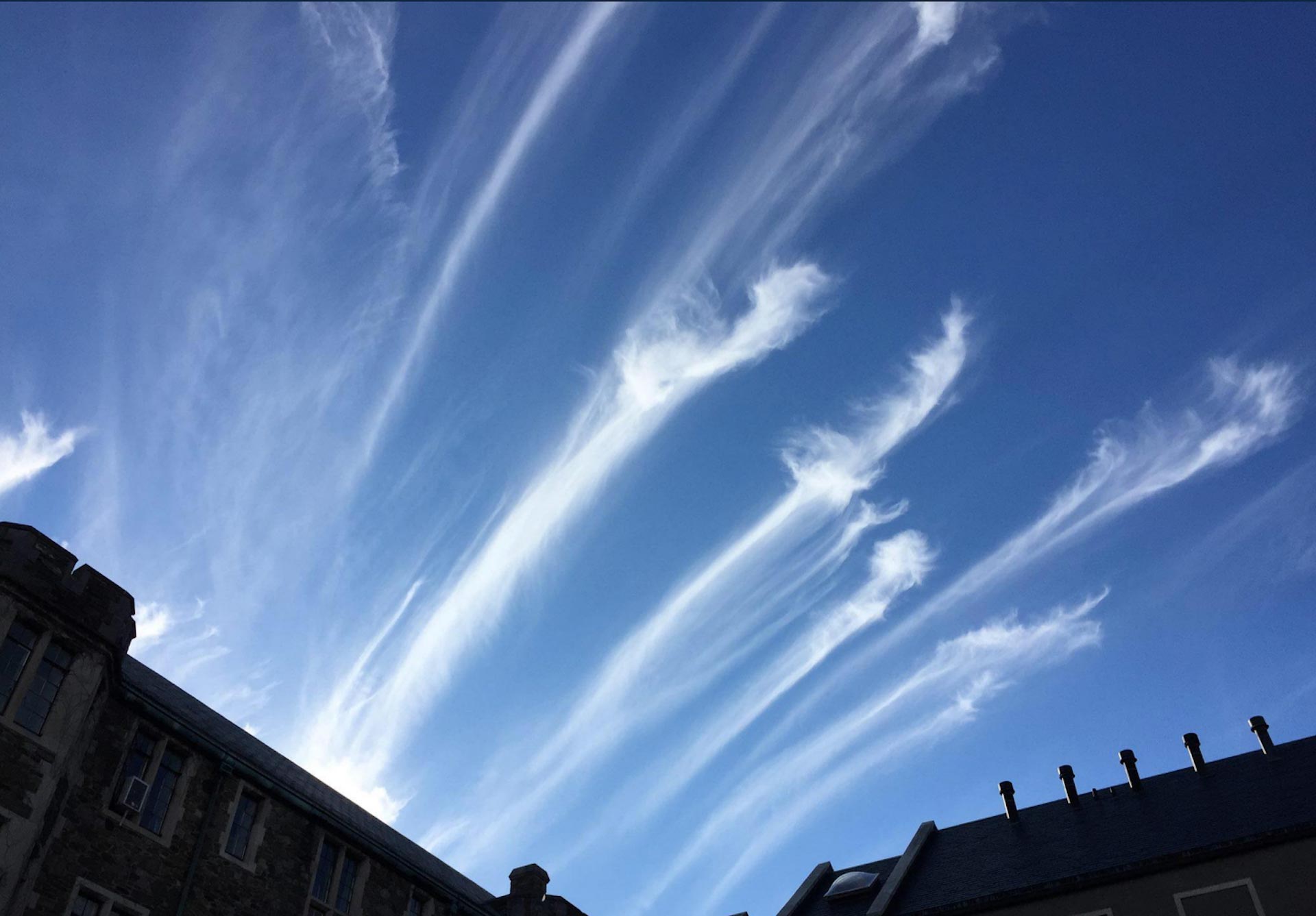
Wispy Cirrus Are Ice Clouds
When cumulonimbus clouds grow high enough into the atmosphere, the temperature becomes cold enough for ice clouds, or cirrus, to form.
Clouds made up entirely of ice are usually more transparent. In some cases, you can see the Sun or Moon through them.
Cirrus clouds that form atop a thunderstorm spread outward and can form anvil clouds. These clouds flatten on top as they reach the stratosphere, where the atmosphere begins to warm with height.
However, most cirrus clouds aren’t associated with storms at all. There are many ice clouds associated with tranquil weather that are simply regions of the atmosphere with more moisture but not precipitation.
Fog and Stratus Clouds
Clouds are a result of saturation, but saturated air can also exist at ground level. When this occurs, we call it fog.
In temperatures below freezing, fog can actually deposit ice onto objects at or near the ground, called rime ice.
When clouds form thick layers, we add the word “stratus,” or “layer,” to the name. Stratus can occur just above the ground, or a bit higher up – we call it altostratus then. It can occur even higher and become cirrostratus, or a layer of ice clouds.
If there’s enough moisture and lift, stratus clouds can create rain or snow. These are nimbostratus.
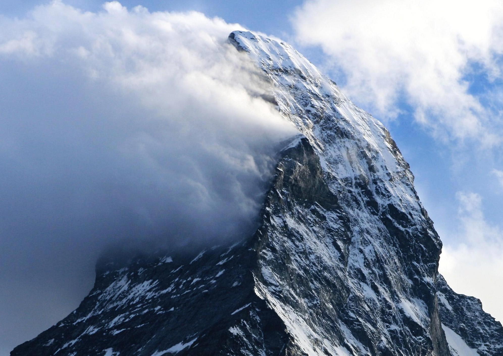
How mountains can create their own clouds
There are a number of other unique and beautiful cloud types that can form as air rises over mountain slopes and other topography.
Lenticular clouds, for example, can look like flying saucers hovering just above, or near, mountaintops. Lenticular clouds can actually form far from mountains, as wind over a mountain range creates an effect like ripples in a pond.
Rarer are banner clouds, which form from horizontally spinning air on one side of a mountain.
Wind plays a big role
You might have looked up at the sky and noticed one layer of clouds moving in a different direction from another. Clouds move along with the wind, so what you’re seeing is the wind changing direction with height.
Cirrus clouds at the level of the jet stream – often about 6 miles (10 kilometers), above the ground – can sometimes move at over 200 miles per hour (320 kilometers per hour). But because they are so high up, it’s often hard to tell how fast they are moving.
Written by Ross Lazear, Instructor in Atmospheric and Environmental Sciences, University at Albany, State University of New York.
Adapted from an article originally published in The Conversation.![]()
Never miss a breakthrough: Join the SciTechDaily newsletter.
Follow us on Google and Google News.
1 Comment
What about China…doing thr part in global warming. And all the volcanoes spewing?