
In this image, captured in the early morning hours of Monday, August 30, Tropical Storm Ida is seen moving inland over portions of southeastern Louisiana, southern Mississippi, and southern Alabama. A NOAA GOES-East ABI GeoColor imagery layer has been applied over this image for additional visibility. Explore more images and data via NASA Worldview.
More coverage:
Dramatic NASA Satellite Video Examines Hurricane Ida’s Eye in 3D

Hurricane Ida Batters Louisiana: 5th-Strongest Storm Ever To Make Landfall in the Continental U.S.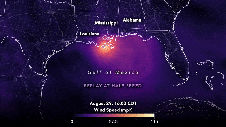
Never miss a breakthrough: Join the SciTechDaily newsletter.
Follow us on Google and Google News.
1 Comment
Why are the lights so bright in New Orleans in this image, since the whole city lost power before the storm got that far north?