Beneath the towering Guadalupe Mountains of Texas lies a dramatic story of transformation. Once part of an ancient sea, the fossilized Capitan Reef now forms craggy peaks and iconic cliffs like El Capitan and Guadalupe Peak.
This region, rich in marine fossils from the Permian Period, was later buried and then uplifted by tectonic activity. Guadalupe Mountains National Park preserves this rare underwater-to-uplifted narrative, with hiking trails like the Permian Reef Trail offering a hands-on journey through Earth’s ancient marine environments. On the park’s western side, shimmering gypsum dunes contrast this geologic grandeur with a surreal, ever-changing desert landscape.
Ancient Sea to Sky-High Peaks
Rocks that once lay beneath an ancient sea now rise to form some of the tallest peaks in Texas. Towering above the Chihuahuan Desert in West Texas and southern New Mexico, the Guadalupe Mountains are part of one of the world’s best-preserved fossil reefs from the Permian Period. This hardened layer of ancient plant and animal remains provides a detailed snapshot of marine life just before the mass extinction that ended the Permian.
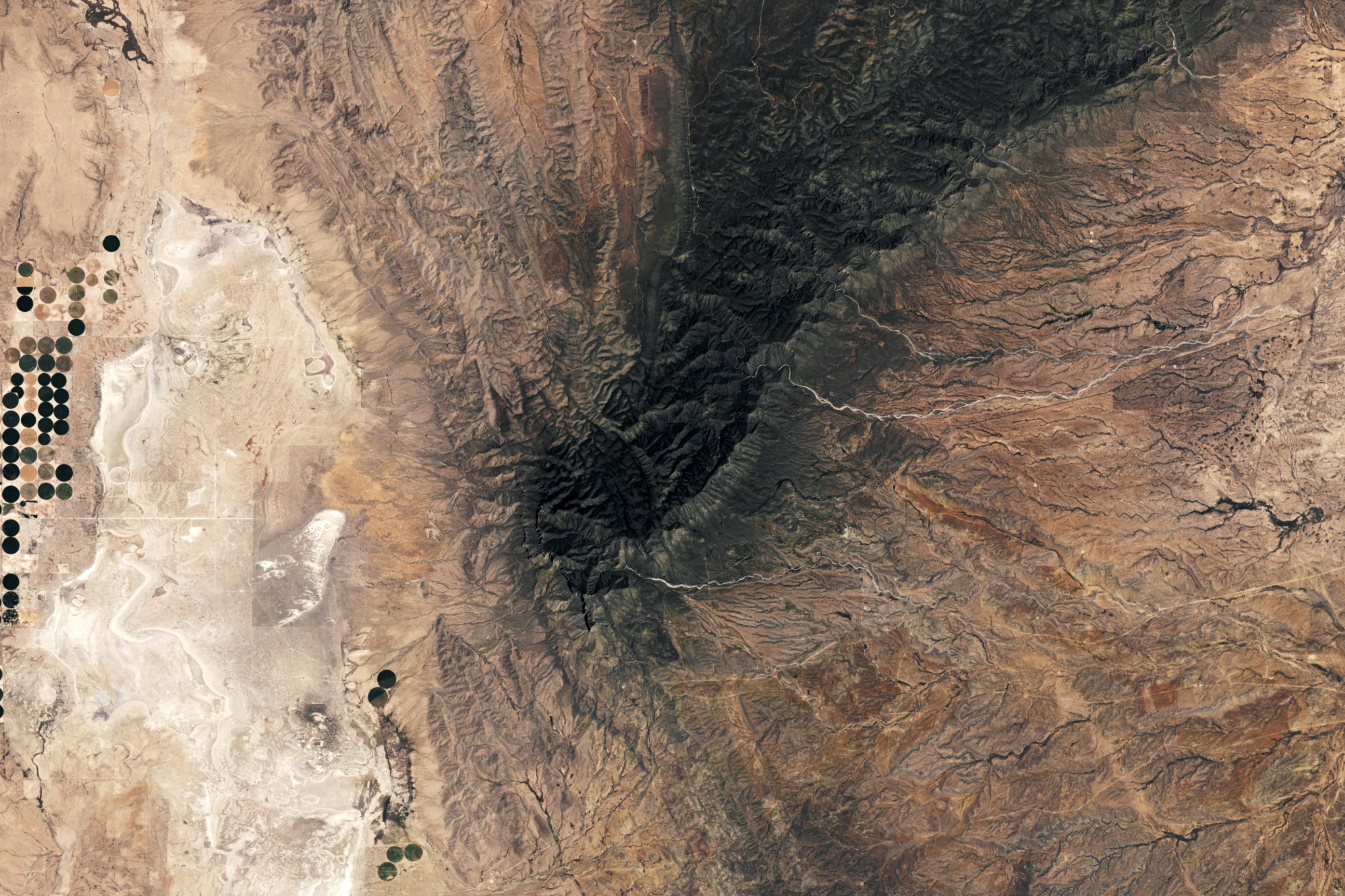
The Texas portion of the range lies within Guadalupe Mountains National Park, established in 1972. The park’s boundaries are visible in the satellite image above, captured by the OLI-2 (Operational Land Imager-2) aboard Landsat 9 on July 7, 2024. To the northeast, the fossil reef continues into New Mexico, where sulfuric acid has dissolved portions of the limestone, creating the vast underground chambers of Carlsbad Caverns National Park.
Life on the Edge of Pangea
During the Permian Period — roughly 300 to 250 million years ago — this region sat at the edge of a shallow inland sea along the coast of the supercontinent Pangea. Here, the Capitan Reef formed, made mostly of sponges and algae. Fossils of other ancient sea creatures, including ammonites, bivalves, brachiopods, crinoids, snails, and trilobites, have also been found throughout the area.
As sea levels dropped near the end of the Permian, the reef was buried beneath thousands of feet of sediment, preserving it for over 200 million years. Then, around 20 million years ago, tectonic activity pushed these layers upward. Over time, erosion stripped away the softer rock above, revealing the more durable fossil reef. In addition to the Guadalupe Mountains, exposed portions of the Capitan Reef also form the Apache and Glass Mountains in Texas.

Texas’s Towering Fossil Monuments
El Capitan (above) is a striking display of the fossilized reef and one of the more iconic vistas in Guadalupe Mountains National Park. Its sheer, 1,000-foot-high limestone cliff tops out at 8,085 feet (2,464 meters), making it one of the 10 highest peaks in the state. Most of Texas’s highest mountains—including the very tallest, Guadalupe Peak at 8,751 feet (2,667 meters) above sea level—are also in the park.
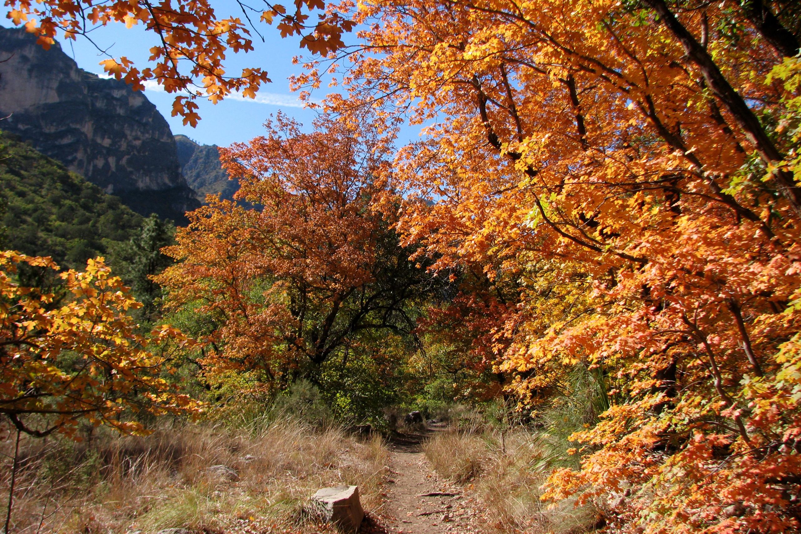
People seeking a more immersive encounter with the deep past may find it in the park’s northeast corner. The Permian Reef Trail brings hikers close to fossil beds and serves as a tour through the former marine environment, from seafloor to reef, as it ascends the north side of McKittrick Canyon. The canyon itself is sometimes referred to as the “most beautiful spot in Texas,” and a trail winding through it (below) is popular for viewing autumn colors.
Shifting Sands and Desert Lakes
The western side of the park offers an entirely different sort of landscape. There, piles of bright-white gypsum grains form dunes up to 60 feet (18 meters) tall. The dunes are located in a low-lying basin with no outlet; water that intermittently flows there evaporates to leave behind these mineral deposits. Today, with significant rain, an inches-deep lake may form temporarily in the basin. Otherwise, the deposits are left to be shifted about by prevailing westerly winds.
NASA Earth Observatory image by Wanmei Liang, using Landsat data from the U.S. Geological Survey. Photo of El Capitan courtesy of NPS. Photo of McKittrick Canyon courtesy of Matthew Lee High.
Never miss a breakthrough: Join the SciTechDaily newsletter.
Follow us on Google and Google News.
1 Comment
this is a travel brochure