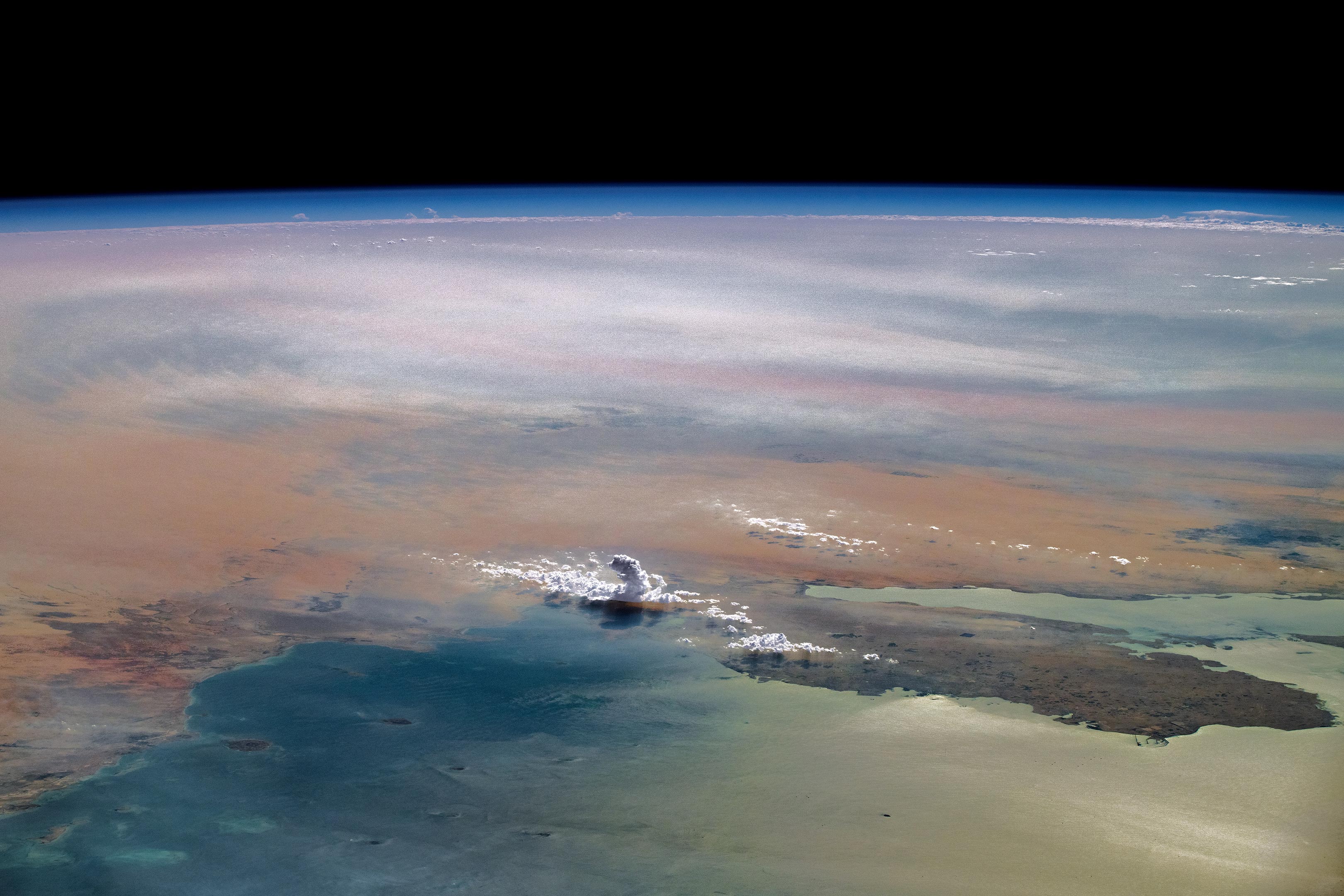
A striking image taken from the International Space Station provides a unique view of the Arabian Peninsula, featuring cumulus clouds indicating atmospheric instability and sunglint on the Persian Gulf.
An astronaut aboard the International Space Station (ISS) captured an angled photograph of the Arabian Peninsula while orbiting over South Asia. The western coastline of the Persian Gulf (also known as the Arabian Gulf) is outlined by the United Arab Emirates, Saudi Arabia, Qatar, and a small portion of Bahrain. On Qatar’s peninsula, the capital city of Doha and the industrial port city of Ras Laffan appear as dark patches along the coast. In Saudi Arabia, the city of Al Hufūf (right side of the image) and the nearby Al Hasa Oasis stand out as dark green and gray areas on the landscape.
Atmospheric Phenomena Observed
At the center of the image, a tall, narrow cloud casts a striking shadow. This is a cumulus congestus cloud, formed when warm, moist air rapidly rises, signaling atmospheric instability at high altitudes. These clouds can evolve into cumulonimbus under the right conditions. The astronaut’s vantage point provides a unique and detailed perspective on the intricate structure of these towering clouds.

Cloud Dynamics and Local Weather Patterns
Small cumulus clouds are visible around the base of the tower cloud and can act as precursors to cumulonimbus clouds. Because the cloud line has formed at the shoreline, the wind is likely blowing onshore (from the lower left to the upper right). The process of cloud formation begins when the air is heated as it flows over the land surface, moving with the direction of the wind.
The Interplay of Light and Water in Space Imagery
Sunglint is visible atop Persian Gulf waters on the lower right side of the image. This phenomenon is captured when light from a surface (like water) is reflected directly back toward the astronaut observer aboard the space station. At the bottom right of the image, waves are visible on the water surface, while at the top of the image, the atmosphere divides the horizon of Earth’s surface from the vastness of space.
Astronaut photograph ISS071-E-675996 was captured on September 19, 2024, using a Nikon Z9 digital camera with a 140-millimeter focal length. The image, taken by a member of the Expedition 71 crew, is provided by the ISS Crew Earth Observations Facility and the Earth Science and Remote Sensing Unit at NASA’s Johnson Space Center.
To enhance its clarity and visual quality, the image was cropped, contrast-adjusted, and cleared of lens artifacts. This work is supported by the International Space Station Program as part of the ISS National Lab, which enables astronauts to take high-value photographs of Earth. These images are made freely available online to benefit both scientists and the general public by offering unique insights into our planet.
Never miss a breakthrough: Join the SciTechDaily newsletter.
Follow us on Google and Google News.