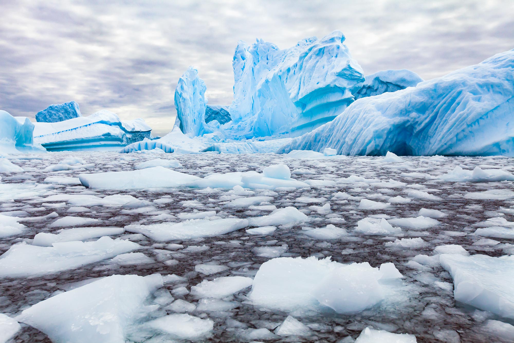
In a changing climate, the increasing meltwater from Antarctica is anticipated to play a major role in sea level rise. However, the bulk of scientific studies have centered on West Antarctica, particularly around areas such as the Thwaites Glacier, where there has been considerable melting observed in recent years.
In a paper recently published in Geophysical Research Letters, researchers at Stanford have shown that the Wilkes Subglacial Basin in East Antarctica, which holds enough ice to raise global sea levels by more than 10 feet, could be closer to runaway melting than anyone realized.
“There hasn’t been much analysis in this region – there’s a huge volume of ice there, but it has been relatively stable,” said Eliza Dawson, a PhD student in geophysics at Stanford and first author on the paper. “We’re looking at the temperature at the base of the ice sheet for the first time and how close it is to potentially melting.”
The Wilkes Subglacial Basin is about the size of California and empties into the Southern Ocean through a relatively small section of the coastline. Dawson and her colleagues found evidence that the base of the ice sheet is close to thawing. This raises the possibility that this coastal region, which holds back the ice within the entire Wilkes Subglacial Basin, could be sensitive to even small changes in temperature.
A mix of frozen and thawed
Previous research has shown that, because the ground in this region is below sea level and slopes downward away from the ocean, the Wilkes Subglacial Basin could be particularly vulnerable to irreversible melting if warming seawater were to get under the ice sheet. Dawson and her colleagues are the first to look at how the current temperature at the base of the ice sheet in the region could add to this vulnerability.
The researchers collected data from existing radar surveys conducted by planes flying over the glacier. The planes record reflections of electromagnetic signals that have traveled through the ice sheet and bounced off the ground beneath it. Dawson and her colleagues developed a new technique to analyze this data, turning cross-sectional images of ice and bedrock into information about the temperature conditions at the base of the ice sheet.
“The temperature of the ice affects how much the radar is reflected in multiple ways, so a single measurement is ambiguous,” said Dustin Schroeder, associate professor of geophysics and of electrical engineering. “This statistical approach involved essentially picking regions that you could assume were either frozen or thawed and comparing other radar signatures to them. It allowed us to say whether other areas of the ice sheet were definitely frozen, definitely thawed, or tough to call.”
The researchers found large areas of frozen and thawed ground interspersed across the region, but the majority of the area couldn’t be definitively classified as one or the other. In some cases, this may be because of changes in the geometry of the ice sheet or other complications in the data, but it could also mean that large sections of ground under the ice sheet are either close to thawing or made up of closely intermixed frozen and thawed areas. If the latter is true, the glaciers in the Wilkes Subglacial Basin could reach a tipping point with only a small increase in temperature at the base of the ice sheet.
“This suggests that glacial retreat could be possible in the future,” Dawson said. “This part of East Antarctica has been largely overlooked, but we need to understand how it could evolve and become more unstable. What would need to happen to start seeing mass loss?”
Better predictions for East Antarctica
Different models have predicted very different futures for the Wilkes Subglacial Basin and its impact on sea level rise because there simply hasn’t been enough data about the region. The researchers are planning to integrate their radar-based temperature observations into an ice sheet model to improve predictions about how the region will evolve under various climate scenarios.
They hope their work will highlight the importance of examining this and other areas of East Antarctica that have seemed stable, but could play a significant role in our future.
“This area has conditions that we could imagine changing,” Schroeder said. “And if warm ocean water gets there, it’s going to ‘turn on’ a whole sector of Antarctica we don’t normally think about as a contributor to sea level rise.”
Reference: “Heterogeneous Basal Thermal Conditions Underpinning the Adélie-George V Coast, East Antarctica” by Eliza J. Dawson, Dustin M. Schroeder, Winnie Chu, Elisa Mantelli and Helene Seroussi, 19 January 2024, Geophysical Research Letters.
DOI: 10.1029/2023GL105450
This work was funded by the National Science Foundation, the National Aeronautics and Space Administration, and the European Union.
Never miss a breakthrough: Join the SciTechDaily newsletter.
Follow us on Google and Google News.
7 Comments
“Dawson and her colleagues found evidence that the base of the ice sheet is close to thawing.”
If that is the case, and it is being blamed on anthropogenic global warming, how is the heat in the atmosphere being communicated to the BASE of the ice sheet without affecting the ice between the surface and base?
“The researchers found large areas of frozen and thawed ground interspersed across the region, …”
Why would that be if the upper surface is in contact with the presumably warming air that moves across the whole surface, distributing heat uniformly? I think a more reasonable working hypothesis would be that, as is known to be the case in West Antarctica, the geothermal gradient varies across the bedrock surface and the warmer regions are more prone to melt the base of the overlying ice.
In any event, I have two impertinent questions: 1) What is the numerical equivalent of “could,” expressed as a nominal probability, along with the uncertainty range, and 2) How long would it take to raise sea level 10 feet?
Just curious about something. Ice exists at any temperature between 0°C (32°F) and absolute zero. That’s a big range. It seems to me that the giant ice cube that is the Antarctic ice field could have warmed internally by a lot before anyone noticed. Is the only way to measure the internal temperature of a 2-mile thick block of ice by drilling a 1-mile deep hole and inserting a probe?
Clyde Spencer – If you look at the source paper for this article, which is cited in the article’s penultimate paragraph, then in the section labeled “Plain Language Summary”, you will find the following sentence:
“This could make irreversible retreat possible if warming seawater off the coast enters beneath the ice sheet.”
So it’s not the warming air, but instead the warming seawater that is directly causing the problem. The seawater, of course, is warmed by the air.
As for the two questions in your final paragraph, it would appear that current models are not precise enough to give concrete answers to these questions. The paper’s authors undoubtedly know more than I do on this subject, so you would have to ask them for further details.
Stan Chrzanowski – The Antarctic ice field is not a homogeneous cube of ice in any sense. For this reason, if you want to determine conditions at any particular point, you have to drill down to that point and take samples.
Something that you missed is that they nowhere claim that sea water is currently getting under the ice. Indeed, they very clearly say, “IF warming seawater off the coast enters beneath the ice sheet.” Therefore, that does not explain why there are melted areas right now. Their “could” or “may” is contingent on the existing melted areas expanding and allowing sea water to get under the ice. If the meltwater is thin and far from the glacier’s edge, circulation would be difficult and slow.
Currently, sea water is getting under the floating West Antarctic ice, and because the depth is great, water is able to enter, lose its heat, leave, and allow more ‘warm’ sea water to enter. We don’t really know about the detailed conditions in East Antarctica. Point in fact, from the plain language summary, “However, predicting the region’s vulnerability is difficult, in part, because there is limited information about the conditions beneath the ice sheet.” In other words, “could” is conjecture with no evidence to support it.
I’m reminded of Mark Twain’s quip that he had been on the verge of being an angel his whole life. I don’t subscribe to the idea of “irreversible retreat” inasmuch as there is plenty of evidence of Earth not only having had several ‘ice house’ episodes, but both Greenland and Antarctic having experienced waxing and waning of ice.
There has been talk of sub-ice-sheet lakes in assorted places under the East Antarctic ice-cap since around 1977 and I recall that included parts of the Wilkes basin. Presumably pressure-melting has something to do with it, and any surface melt-water might be able to find its way down via assorted linked tension cracks etc within the ice-cap. It is happening in Greenland.
Obviously much more research needed.
Deep tension cracks in glaciers are an interesting phenomenon. Ice with a thickness greater than about 50 meters tends to flow plastically, although it can also shear. Thus, tension cracks at the surface would only be expected to propagate downward about 50m. However, there is field evidence of cracks much deeper than that. They are called moulins and serve to drain surface meltwater to depths claimed to be as much as 800m. There are two things that can affect vertical cracks; 1) If the down-slope movement of a glacier is high enough, the tension cracks may propagate faster than the ice can flow plastically to heal the crack(s); 2) If Summer, surface-melt water pours down a crack, it may melt the ice and propagate the crack faster than it can be closed by slow plastic flow. Also, the hydrostatic pressure of the incompressible water may force the walls apart, although that is a bit like the proverbial irresistible force meeting an immovable object. Moulins are a recent discovery and there is still a lot that isn’t known about them.