
Close Menu
    Facebook X (Twitter) Instagram
    SciTechDaily
    • Biology
    • Chemistry
    • Earth
    • Health
    • Physics
    • Science
    • Space
    • Technology
    Facebook X (Twitter) Pinterest YouTube RSS
    SciTechDaily
    Home»Earth»Torrential Downpours and Destructive Flash Floods Swamp Hawaii
    Earth

    Torrential Downpours and Destructive Flash Floods Swamp Hawaii

    By Adam Voiland, NASA Earth ObservatoryMarch 13, 20212 Comments2 Mins Read
    Facebook Twitter Pinterest Telegram LinkedIn WhatsApp Email Reddit
    Share
    Facebook Twitter LinkedIn Pinterest Telegram Email Reddit
    Hawaii Rainfall March 2021 Annotated
    March 5 – 12, 2021

    Flash floods, landslides, and power outages plagued the islands after torrential rains fell.

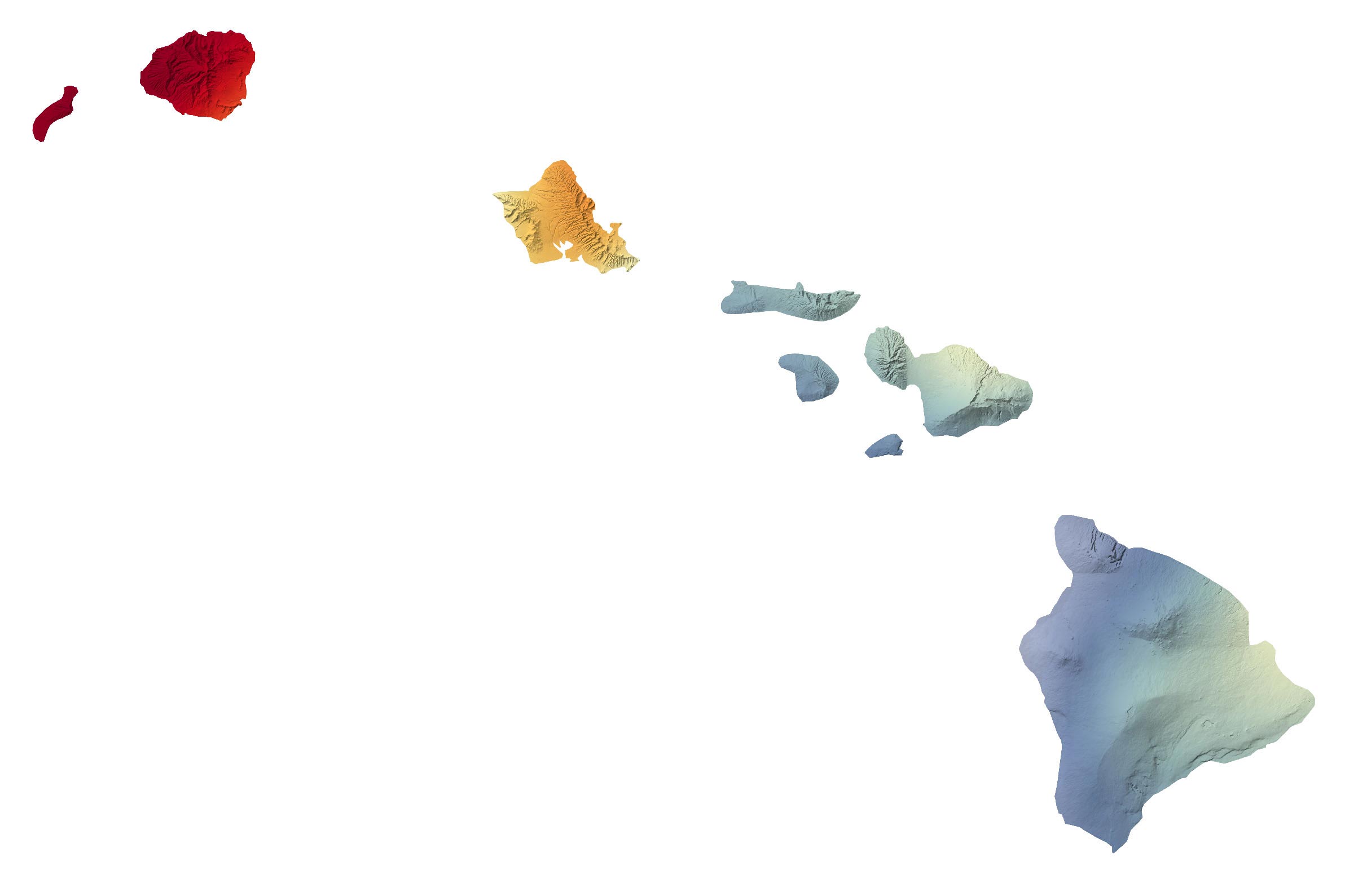
    Torrential downpours and destructive flash floods swamped parts of Hawaii in March 2021. A strong low-pressure system fed by abundant moisture from the tropics fueled slow-moving storms that dropped inches of rain per hour in certain areas.

    Hard hit areas included the northeastern side of Kauai, the windward slopes of the Ko‘olau Range on the island of O’ahu, the windward slopes of Haleakalā volcano on the island of Maui, and the southeast side of the Big Island of Hawai’i, according to National Weather Service meteorologists.

    This map shows the rainfall accumulation across the region from March 5 to 12, 2021. The data are remotely-sensed estimates that come from the Integrated Multi-Satellite Retrievals for GPM (IMERG), a product of the Global Precipitation Measurement (GPM) mission. The darkest oranges and reds indicate places where GPM detected rainfall totals exceeding 4 inches (10 centimeters) during this period. Due to averaging of the satellite data, local rainfall amounts may be significantly higher when measured from the ground. The National Weather Service reported rainfall totals in several towns that topped 10 inches (25 centimeters) over a 72-hour period.

    Dozens of homes have been damaged or destroyed and many roads have been closed due to floods and landslides. Some areas faced widespread power outages. According to news reports, flooding was particularly severe in Haleiwa, a community in Honolulu. In Maui, thousands of people were forced to evacuate after water filled the Kaupakalua dam and reservoir, prompting fears that the dam could fail. On March 9, the governor declared a state of emergency.

    While the most intense rains had subsided by March 11, forecasters are continuing to monitor unsettled weather and the possibility of more flash floods in the coming days.

    NASA Earth Observatory image by Joshua Stevens, using IMERG data from the Global Precipitation Mission (GPM) at NASA/GSFC, and topographic data from the Shuttle Radar Topography Mission (SRTM).

    Never miss a breakthrough: Join the SciTechDaily newsletter.
    Follow us on Google and Google News.

    NASA NASA Earth Observatory Weather
    Share. Facebook Twitter Pinterest LinkedIn Email Reddit

    Related Articles

    Brace for an Active 2020 Hurricane Season

    Incredible Rare Peek at Patagonia in Winter

    “Godzilla” Dust Cloud Described As “Amazing” by NASA Astronaut Aboard Space Station

    Satellite Maps Shows Signs of Drought in European Groundwater

    Meteorologists Shocked as Heat and Fire Scorches Siberia

    Unusual “Volcano Track” Clouds Investigated

    After Two Years of Drought Ends, Southeastern Australia Turns Green

    “Wedge Failure” Landslide in Alaska

    Muddy Flooding After Catastrophic Dam Failures in Michigan Seen From Space

    2 Comments

    1. The 10th Man on March 13, 2021 6:16 am

      It is only destructive if corrupt zoning officials let people build in places that flood. Human greed wins every time.

      Reply
    2. bingo on March 18, 2021 9:19 am

      I remember living on the Big Island and a storm (was it a hurricane?) came through and it rained something like 60 inches (50? 70? I forget now) in a weekend in Waiākea Uka (upside of Hilo). More rain than the Pacific Northwest coast (USA) gets in a year. Downtown Hilo at the bayfront was under several feet of water (near the tops of cars), as the river and canals were overflowing their banks, even with the ocean 1000 feet away.

      Reply
    Leave A Reply Cancel Reply

    • Facebook
    • Twitter
    • Pinterest
    • YouTube

    Don't Miss a Discovery

    Subscribe for the Latest in Science & Tech!

    Trending News

    Two Drinks a Day May Be Riskier Than Many Americans Think

    A Lost Human Lineage May Have Left a Genetic Legacy in People Today

    Study Reveals a Surprising Link Between Birth Control Pills and Binge Eating

    NASA’s HiRISE Captures Perseverance Rover Completing a Marathon on Mars

    Ancient DNA Reveals the Hidden Origins of China’s Mysterious Shimao Civilization

    Scientists Discover a Surprising Link Between Sleep, Genes, and Alzheimer’s

    Popular Childhood Drinks Linked to Higher Blood Pressure Later in Life

    Scientists Just Challenged a 70-Year-Old Myth About the Human Brain

    Follow SciTechDaily
    • Facebook
    • Twitter
    • YouTube
    • Pinterest
    • Newsletter
    • RSS
    SciTech News
    • Biology News
    • Chemistry News
    • Earth News
    • Health News
    • Physics News
    • Science News
    • Space News
    • Technology News
    Recent Posts
    • Common Mouth Bacteria May Trigger Dangerous Calcium Buildup in the Heart
    • New CRISPR Tool Gives Scientists Control Over Cellular Protein Production
    • Natural Supplement May Boost Cancer-Fighting Immunity
    • Scientists Overcome a Major Electrical Bottleneck in Next-Generation Semiconductors
    • Mysterious Radio Beacon Near a Black Hole Defies Expectations
    Copyright © 1998 - 2026 SciTechDaily. All Rights Reserved.
    • Science News
    • About
    • Contact
    • Editorial Board
    • Privacy Policy
    • Terms of Use

    Type above and press Enter to search. Press Esc to cancel.