
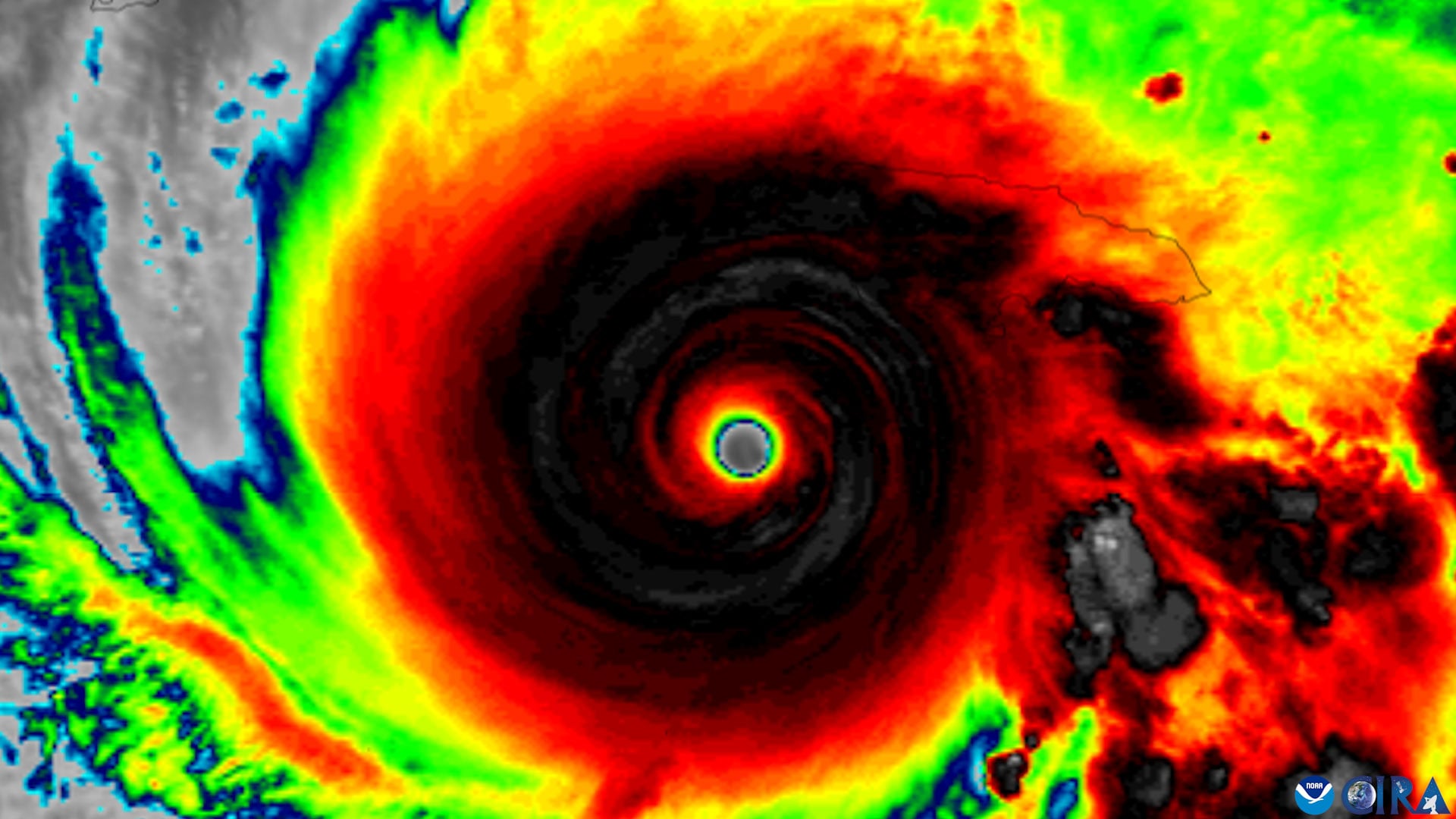
Nearly three decades of airborne radar observations have identified four features that help storms become organized before they intensify.
A tropical cyclone can look powerful from above yet still struggle to strengthen if its circulation is leaning through the atmosphere. Before substantial intensification can occur, the rotating centers at different heights generally need to line up vertically, and nearly three decades of NOAA Hurricane Hunter observations now reveal four features associated with that transition.
Scientists at the University of Miami Rosenstiel School of Marine, Atmospheric, and Earth Science and NOAA’s Atlantic Oceanographic and Meteorological Laboratory found that whether a tilted storm becomes vertically aligned depends on its internal structure, the direction of its tilt relative to surrounding winds, and environmental conditions.
That transition matters because rapidly intensifying storms can dramatically shorten the time coastal communities and emergency managers have to prepare. Recognizing the structural signs of impending alignment could help forecasters identify disorganized tropical cyclones that are becoming more capable of strengthening, potentially providing additional time for evacuation decisions and other preparations.
“A tropical cyclone has to stand up straight before it can intensify,” said Michael S. Fischer, the lead author and an assistant professor in the Department of Atmospheric Sciences at the Rosenstiel School. “Strong winds higher in the atmosphere can push the top of a storm’s circulation away from the center near the ocean surface. Until those centers come back together, the storm usually cannot intensify substantially.”
Four features favor storm alignment
Four characteristics stood out as indicators that a tilted tropical cyclone was more likely to become vertically aligned. These were a compact circulation close to the ocean surface, a tilt oriented favorably relative to wind shear, stronger rising air and heavier rainfall near the low-level center, and an environment with warm ocean water, plentiful atmospheric moisture, and relatively weak midlevel winds.
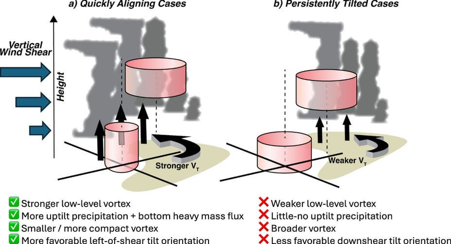
Meteorologists use the term “tilt” to describe the horizontal separation between a storm’s lower- and middle-level circulation centers. Vertical wind shear, meaning changes in wind speed or direction with height, can interfere with storm organization by pushing those centers apart.
Decades of radar reveal early differences
To identify the patterns, the researchers examined the Tropical Cyclone Radar Archive of Doppler Analyses with Recentering, known as TC-RADAR. Developed by Fischer and colleagues, the database contains 1,510 radar analyses gathered by NOAA Hurricane Hunter aircraft across 28 hurricane seasons from 1997 through 2024.
“The storms that aligned already looked different about a day beforehand,” said Fischer, who also is a core faculty member of the Frost Institute for Data Science and Computing. “They had stronger, more tightly wound circulations near the surface and more widespread, vigorous thunderstorms lifting air near that center. Our findings suggest those thunderstorms are not simply a sign of organization. They may also help pull the storm’s leaning circulation upright.”
Earlier signals could improve forecasts
During operational reconnaissance missions, aircraft can measure many of the features identified in the study, including low-level wind strength, storm size, thunderstorm coverage, and tilt direction. That means the observations could also be used to evaluate whether high-resolution hurricane models accurately reproduce the process that brings a tilted cyclone into vertical alignment.
“Even a modest increase in forecast confidence a day earlier can provide more usable preparation time for communities in a storm’s path,” Fischer said. “This study gives us real-world evidence about what separates a storm that is becoming organized from one that remains tilted and less capable of strengthening.”
Reference: “To Align or Not to Align? That Is the Question” by Michael S. Fischer, George R. Alvey, Deelan Jariwala and Paul D. Reasor, 17 July 2026, Journal of Geophysical Research: Atmospheres.
DOI: 10.1029/2025JD045986
The research was supported by the National Science Foundation under award No. 2241605.
Never miss a breakthrough: Join the SciTechDaily newsletter.
Follow us on Google and Google News.