Launched less than three weeks ago, the Copernicus Sentinel-6 Michael Freilich satellite has not only returned its first data, but results also show that it is functioning far better than expected. Thanks to its new, sophisticated, altimetry technology, Sentinel-6 is poised to deliver exceptionally precise data on sea-level height to monitor the worrying trend of sea-level rise.
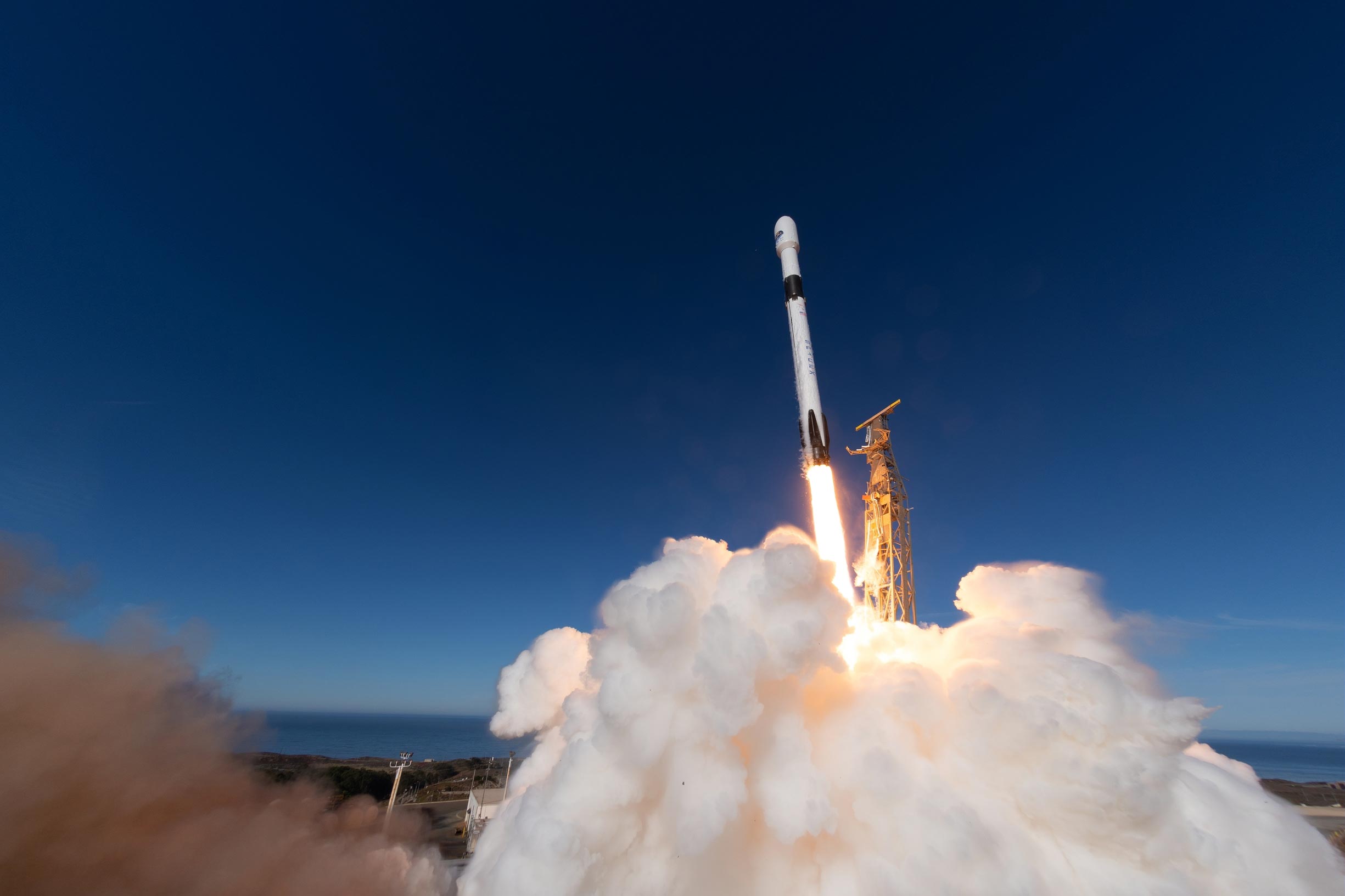
Sentinel-6 Michael Freilich was lofted into orbit on November 21, from California. After it had sent back its first signal showing that it was alive and well in space, ESA’s Operations Centre in Germany took care of the satellite’s first few days in orbit before handing it over to Eumetsat for commissioning, and eventual routine operations and distribution of data.
The satellite carries Europe’s latest radar altimetry technology to extend the long-term record of sea-surface height measurements that began in the early 1990s.
On November 30, flight operators switched on Sentinel-6’s Poseidon-4 altimeter instrument, which was developed by ESA. Analyzing its initial data, specialists were astonished by the quality. These first data were presented today, by way of three main images, at the European Space Week.
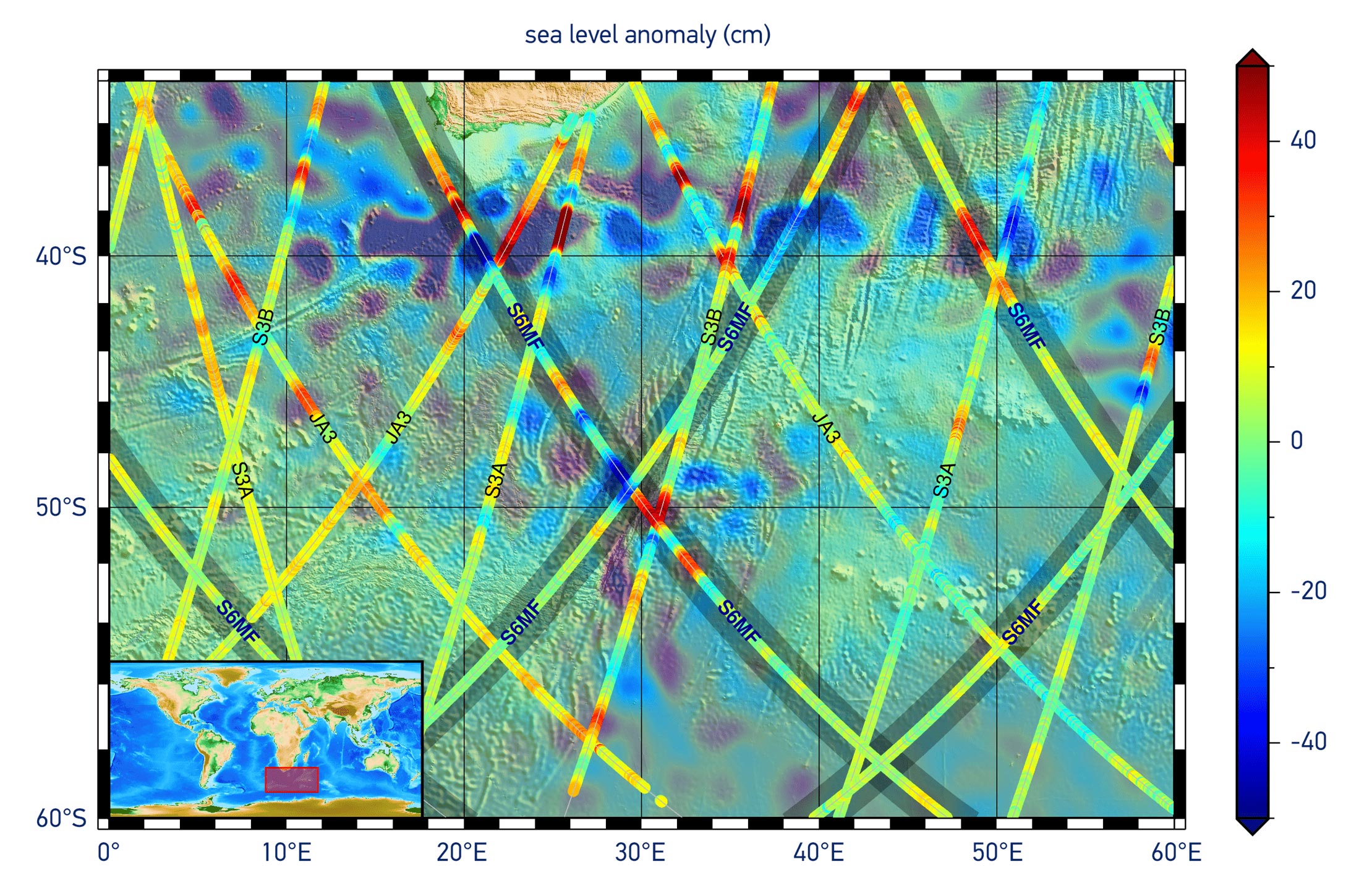
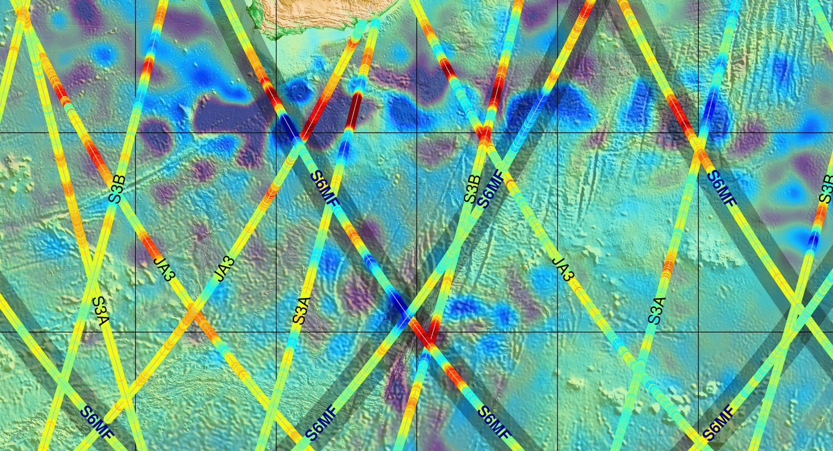
The first image (at the top and repeated to the left) shows some preliminary results of sea-surface height. The data are overlaid on a map showing similar products from all of the Copernicus altimetry missions: Jason-3, Sentinel-3A and Sentinel-3B. The background image is a map of sea-level anomalies from satellite altimeter data provided by the Copernicus Marine Environment Monitoring Service for December 4, 2020. The Sentinel-6 data products were generated on December 5.
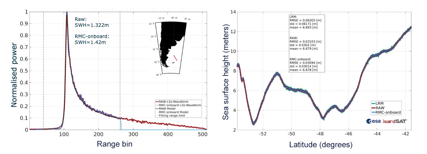
The image below shows a comparison between data processed on board the satellite and downlinked (blue line), compared to full raw data processed on the ground (red line). By removing the trailing edge of the data before being transmitted to Earth, the data rate is reduced by 50%. High fidelity low-noise data are thanks to Sentinel-6’s Poseidon-4 digital instrument architecture, which is a first.
ESA’s mission scientist for Copernicus Sentinel-6, Craig Donlon, explained, “We can already see that the satellite is delivering incredible data, thanks to the digital architecture of Poseidon-4 and the inclusion of simultaneous high-resolution synthetic aperture radar processing and conventional low-resolution mode into altimetry for the first time. This gives us the opportunity to make measurements with much finer synthetic aperture radar techniques that can be compared to Jason-3 to understand the improvement of the climate record.”
“Importantly, we can also see that there is very little noise in the data, so we have extremely clean data to work with.”
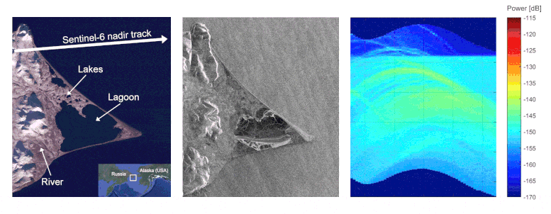
The set of images below of Russia’s Ozero Nayval Lagoon and surrounding rivers show multiple views from Copernicus satellites. The first is a ‘camera-like’ image from Sentinel-2; the second is a radar image from Sentinel-1; and next is from Sentinel-6 in its conventional ‘low-resolution’ mode, which does not reveal a lot of information. However, by processing the altimetry data using fully-focussed synthetic aperture techniques usually used for imaging radar data, the resulting image reveals exceptional detail, highlighting the power of the instrument.
Director of ESA’s Earth Observation Programmes, Josef Aschbacher, said, “We are delighted with these first results and proud to see our ESA-developed radar altimeter is working so well. Nevertheless, Copernicus Sentinel-6 is a mission that has been built in cooperation with the European Commission, Eumetsat, NASA, NOAA and CNES – with all parties playing essential roles that make this mission the success we are seeing today.”
Another surprising result suggests that the satellite’s position in space can be better understood than previously thought. A radar altimeter derives the height of the satellite above Earth by measuring how long a transmitted radar pulse takes to reflect from Earth’s surface. Sentinel-6 therefore carries a package of positioning instruments, including a system that can make use of both GPS and Galileo signals. Remarkably, the addition of Galileo measurements brings an improvement in orbit determination quality – which adds to the overall performance of the mission.
More about Copernicus Sentinel-6
Rising seas are at the top of the list of major concerns linked to climate change. Monitoring sea-surface height is critical to understanding the changes taking place so that decision-makers have the evidence to implement appropriate policies to help curb climate change and so that authorities can take action to protect vulnerable communities.
The first sea-surface height ‘reference’ measurements were supplied by the French–US Topex-Poseidon satellite, which was followed by three successive Jason missions. They show that since 1993 the global sea level has risen, on average, by just over 3 mm every year. Even more worryingly, over the last few years the global ocean has risen, on average, by 4.8 mm a year.
While the Copernicus Sentinel-6’s role is to continue this legacy of critical measurements, the satellite carries new digital altimeter technology with dedicated onboard processing that will return even more precise measurements of the height of the sea surface.
Sentinel-6 brings, for the first time, synthetic aperture radar into the altimetry reference mission time series. To ensure that the multi-satellite data time series remains stable, Sentinel-6 delivers simultaneous conventional low-resolution mode measurements, that are similar to measurements from Jason-3, as well as the improved performance of the synthetic aperture radar processing that yields high-resolution along-track measurements. A 12-month tandem flight, where Sentinel-6 flies just 30 seconds behind Jason-3, will be used to compare measurements from the two independent satellites in order to extend the sea-level climate record with confidence.
Never miss a breakthrough: Join the SciTechDaily newsletter.
Follow us on Google and Google News.
3 Comments
I’m sure scientists will bias the data to ensure Climate Change is not disproven. Just like they did with land based measurements.
Pete Moss is sure scientists will bias the data. Here we have an example of poor critical thinking First he thinks the scientist that will bias the data will not be challenged by other scientist who will not bias the data. I wonder how he missed that range of human values and actions . Can you explain how you missed that ?
What I can’t determine from all this data are people who write comments about something so awesome and technologically positive with comments that create doubt. Why not look at the data and be glad we have it. Analyze the data yourself and see what you can determine from it. I’m no scientist, but be damn if this type of awesome technology doesn’t inspire me to be a better person.