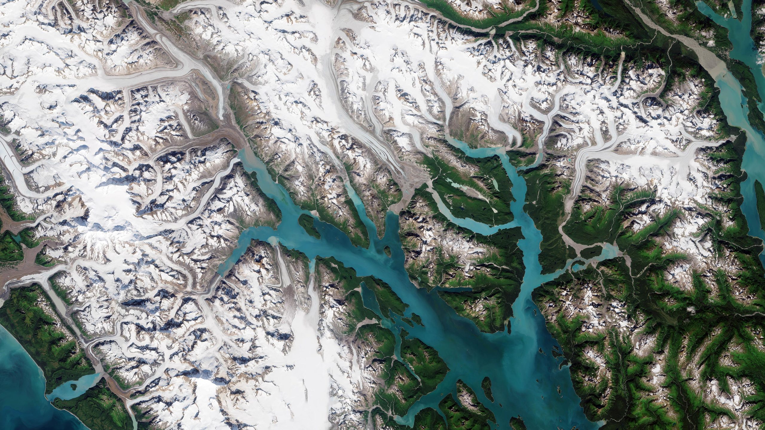
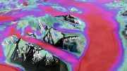
Part of the Glacier Bay National Park and Preserve, which lies along the coast of southeast Alaska, is featured in this image captured by the Copernicus Sentinel-2 mission. Credit: Contains modified Copernicus Sentinel data (2021), processed by ESA, CC BY-SA 3.0 IGO
Part of the Glacier Bay National Park and Preserve, which lies along the coast of southeast Alaska, is featured in this detailed satellite image captured by the Copernicus Sentinel-2 mission.
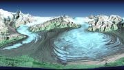
Covering over 13,000 sq km (5,000 sq miles) of rugged, snow-capped mountains, freshwater lakes, glaciers, and deep fjords, Glacier Bay National Park and Preserve is one of the highlights of Alaska’s Inside Passage. As marine waters make up almost one-fifth of the park, Glacier Bay is rich with marine life, including humpback whales, orcas and sea otters. It’s also home to a large population of bears, moose, wolves, and mountain goats.
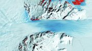
Glacier Bay National Park, which encompasses 3.3 million acres of dynamic glaciers, rugged mountains, wild coastlines, temperate rainforest, and deep sheltered fjords, is a highlight of Alaska’s Inside Passage and part of a 25-million-acre World Heritage Site—one of the world’s largest international protected areas. Glacier Bay, from sea to summit, presents unlimited options for adventure and inspiration.
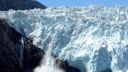
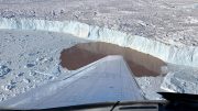
The bay contains some of the world’s most impressive glaciers that descend from the ice-covered St. Elias Range in the east and the Fairweather Range in the west, with a few notable tidewater glaciers extending all the way to the sea.
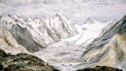
John Hopkins Glacier, visible in the far left of the image, is the largest tidewater glacier in the region. Muir Glacier, formerly the most famous of the tidewater glaciers, once rose around 80 meters (260 feet) above water and was nearly 3 km (2 miles) wide but has now shrunk and receded and no longer reaches the sea.
Glacier Bay is just one of the many areas suffering from the effects of global warming. The bay is expected to become warmer and drier over the next century, with widespread effects including the further shrinking glaciers, reduced sea ice, and shoreline erosion.
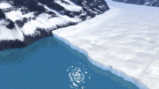
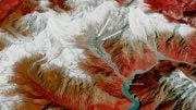
Monitoring glaciers is often a challenge considering their sheer size, remoteness, and rugged terrain they occupy. Satellites, including ESA’s CryoSat mission, with its elite spaceborne sensor – the radar altimeter – allows for the mapping of glaciers in fine detail. In a study published last year in the Cryosphere, scientists utilized data from the CryoSat mission to show how much ice had been lost from mountain glaciers in the Gulf of Alaska.
June 17, 2022, marked the opening of the “Earth’s Memory — glaciers witnesses to the climate crisis” exhibition, which follows the scientific and photographic journey of glaciers around the world, premiering the results of the “On the trail of the glaciers” project directed by Italian photographer Fabiano Ventura. The exhibition offers its visitors the opportunity to witness the effects of global warming through the power of both photography and ESA satellite imagery. It is being held in the Forte di Bard Museum, Aosta Valley, Italy.
The exhibition focuses on the world’s largest mountain glaciers with 90 photographic comparisons displayed alongside scientific data collected during the team’s expedition to the world’s largest mountain glaciers. It runs until 18 November 2022 and includes images such as the one featured on this week’s Earth from Space program. More information on the exhibition, which is part of a scientific collaboration between ESA and is sponsored by UNESCO, can be found here.
This image is also featured on the Earth from Space video program that is embedded above.
Be the first to comment on "Exploring Earth From Space: Glacier Bay National Park and Preserve, Alaska"