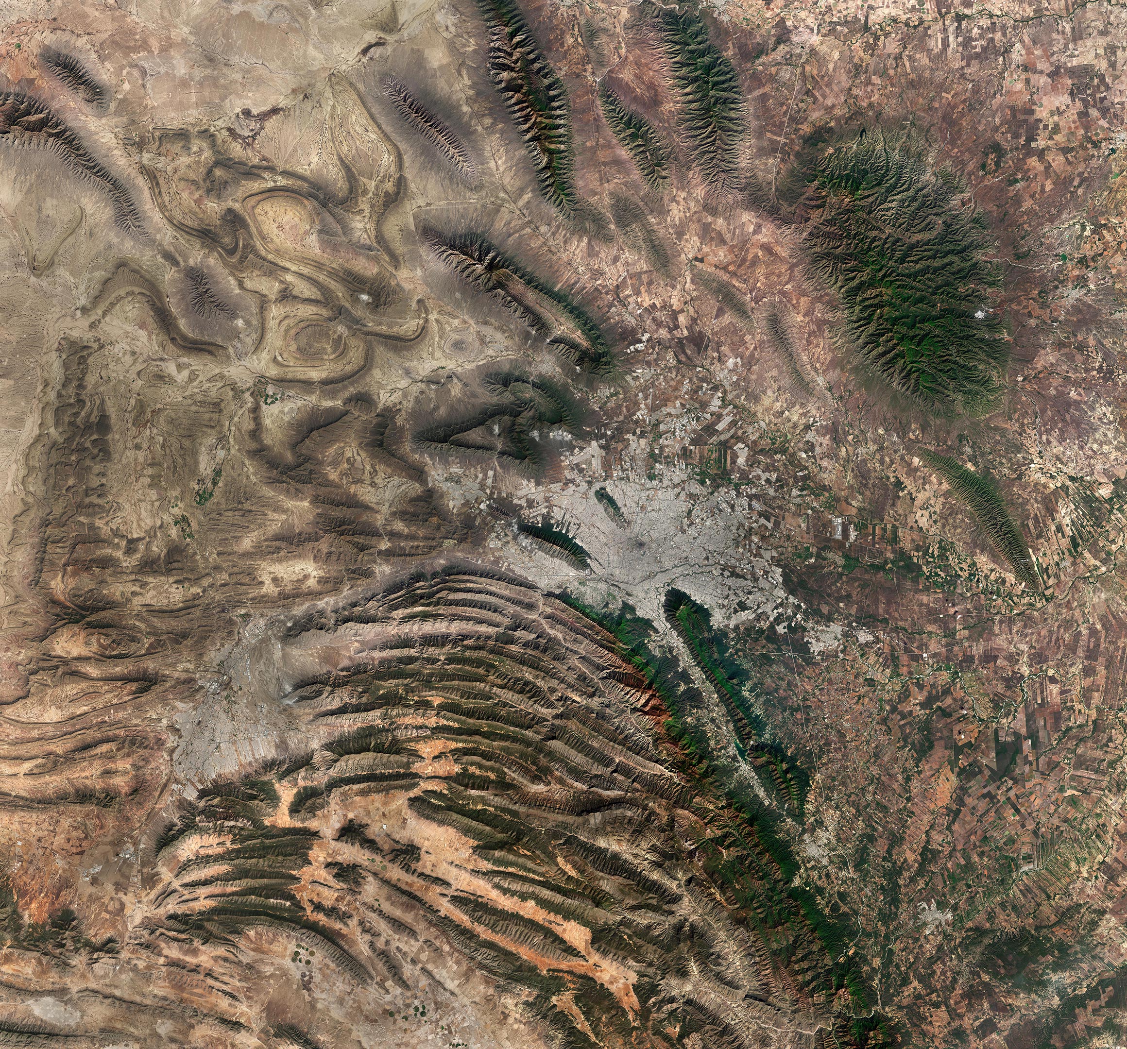
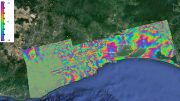
Diverse landscape surrounding Monterrey, the capital of the northeast state of Nuevo León, Mexico, is featured in this stunning satellite image. It was acquired by the Copernicus Sentinel-2 mission on March 5, 2023, and shows a region which combines mountain ranges, agricultural plains, arid areas, as well as densely populated urban centres. Credit: Contains modified Copernicus Sentinel data (2023), processed by ESA, CC BY-SA 3.0 IGO
This Copernicus Sentinel-2 satellite image features the diverse landscape surrounding Monterrey, the capital of the northeast state of Nuevo León, Mexico.
This image, acquired on March 5, 2023, shows a region which combines mountain ranges, agricultural plains, arid areas, as well as densely populated urban centres.
The metropolitan area of Monterrey, visible in shades of grey in the centre of the image, is the second largest in Mexico with around five million inhabitants. It is crossed by the Santa Catarina River, which is usually fed by flowing underground water, although the river was predominantly dry when this image was acquired.
Monterrey is 540 m (1,772 feet) above sea level and is nestled at the foothills of the Sierra Madre Oriental, the folded mountain range that can be seen in the bottom-left of the image.
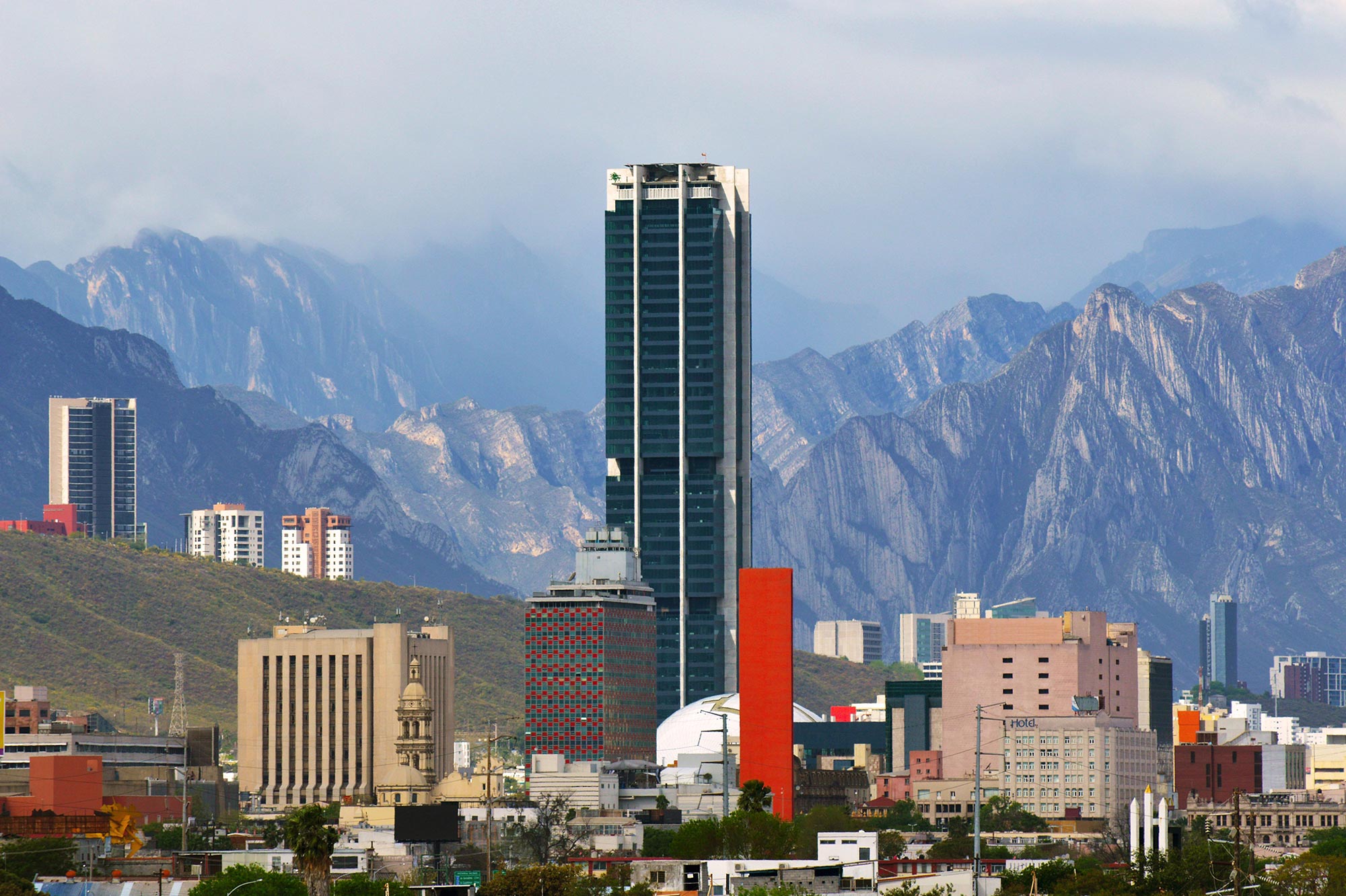
Monterrey, a thriving metropolis nestled in the northeastern region of Mexico, is surrounded by the breathtaking Sierra Madre Oriental mountain range. As the capital city of the state of Nuevo León, it is an economic and industrial powerhouse, contributing significantly to the country’s overall growth. Monterrey’s rich cultural heritage is reflected in its vibrant arts scene, fascinating museums, and stunning historical architecture, such as the Baroque-style Metropolitan Cathedral and the iconic Cerro de la Silla mountain.
The Cumbres de Monterrey National Park lies in the northern part of the Sierra Madre Oriental and includes the famous Cerro de la Silla (or Saddle Mountain), which dominates Monterrey’s skyline. The park is a UNESCO Biosphere Reserve and provides approximately 50% of the water consumed in Monterrey and its metropolitan area.
The grey area visible west of the park is the city of Saltillo, the capital of the Mexican state of Coahuila. Saltillo is one of the most industrialised areas in the country and, thanks to its dry and cool climate, has become a popular holiday destination.
The region south of the park appears mostly arid, with only a few centre-pivot irrigation fields visible in the brown areas in the bottom of the image. On the contrary, numerous agricultural areas stand out in the right of the image, with many square-shaped fields thickening along the course of small rivers and canals.


Be the first to comment on "Exploring Earth From Space: Monterrey, Mexico"