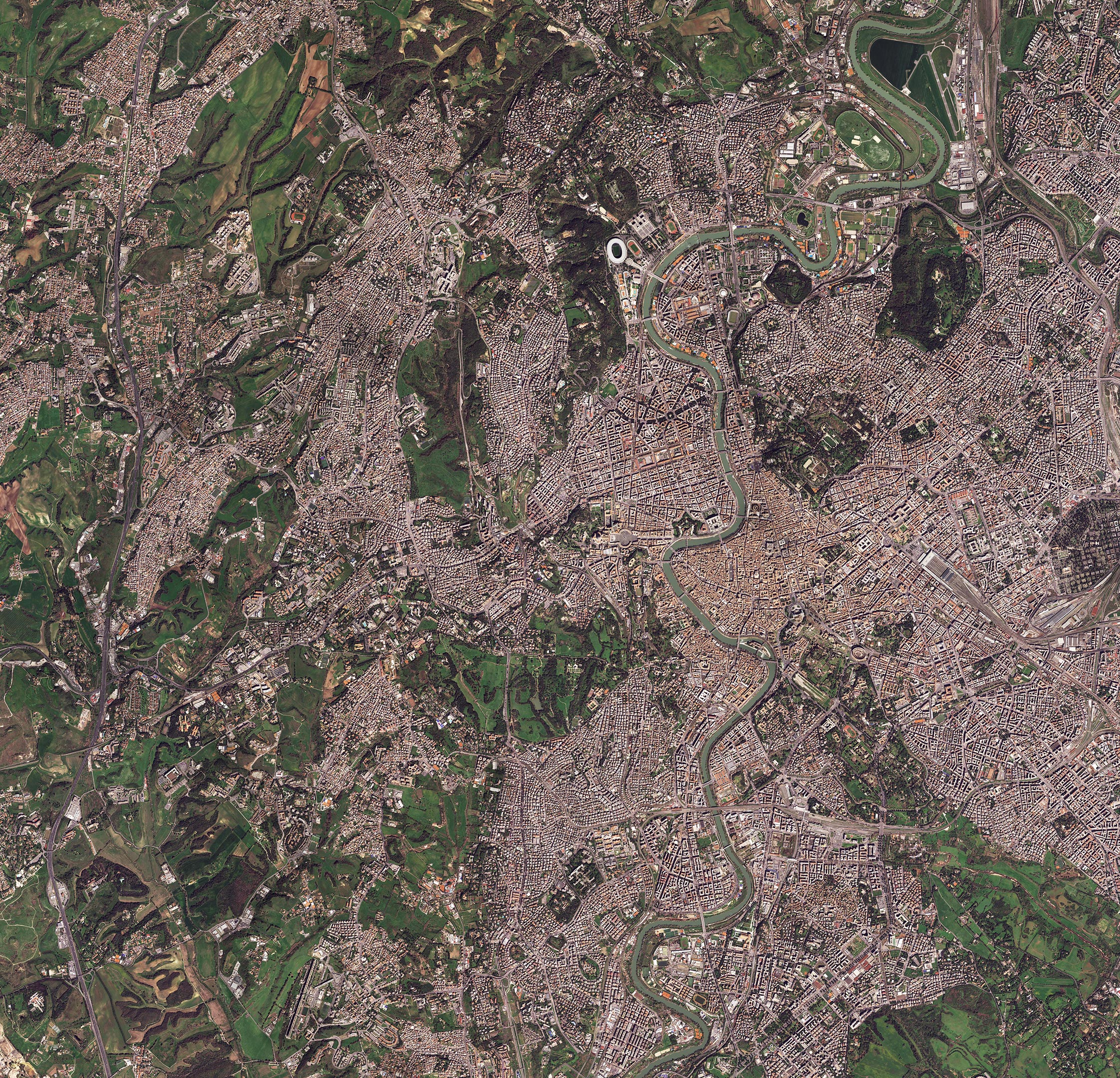
The historic center of Rome, Italy’s capital city, is featured in this satellite image captured on March 28, 2023.
Known as the Eternal City, Rome lies on the banks of the Tiber River, the third longest river in Italy. The Tiber can be seen snaking its way through the city. The color of the river water, owing to the sandy and silty riverbed, is why the Tiber is sometimes known as the “blond river.”
A number of world-famous sites are visible in this image.
The distinctive oval shape of the Colosseum, the largest Roman amphitheater ever built, stands out near the center-right of the image, on the east side of the river and adjacent to the ruins of the Roman Forum and Palatine Hill.
Below that is the elongated outline of the Circus Maximus, which was the largest chariot racetrack in ancient Rome. To the left on a bend in the river, is the boat-shaped Tiber Island, the only island in the urban part of the river.

Following the Tiber northwards, we find, to the east of the elliptical shape of Piazza Navona, the white open-topped dome of the Pantheon, which is 142 feet (43 meters) in diameter.
A little further north on the other side of the river, we can see the sovereign state of Vatican City, with St. Peter’s Basilica and its famous square. The star-shaped Castel St. Angelo is also visible nearby. It was the tomb of Emperor Hadrian, but later served as a fortress.
As evident in the image, Rome has many green spaces: parks, historic villas, and public gardens, together covering about 4000 hectares.
This image was acquired by the Pléiades Neo mission, a very high-resolution optical constellation. Pléiades Neo is part of ESA’s Third Party Missions program, which means ESA uses its multi-mission ground systems and expertise to acquire, process, distribute and archive data from a wide range of satellite missions developed and operated by other agencies.
Never miss a breakthrough: Join the SciTechDaily newsletter.
Follow us on Google and Google News.