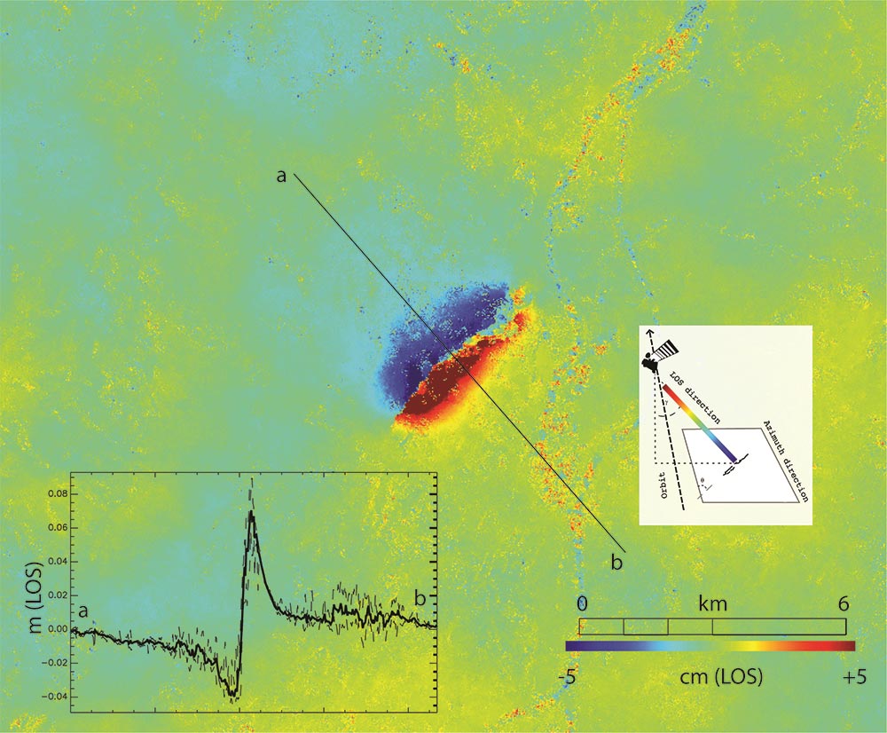
On 11 November 2019, the southeast of France was hit by a magnitude 5 earthquake with tremors felt between Lyon and Montélimar. The Copernicus Sentinel-1 radar mission was used to map the way the ground shifted as a result of the quake. Displacement of the ground in the satellite line-of-sight direction. This product is derived from the Copernicus Sentinel-1 mission using the acquisitions of 6 and 12 November 2019. The interferogram was generated with the GAMMA processing chain. Credit: contains modified Copernicus Sentinel data (2019), processed by BRGM
This past week, southeast France was hit by a magnitude 5 earthquake with tremors felt between Lyon and Montélimar. The Copernicus Sentinel-1 radar mission has been used to map the way the ground shifted as a result of the quake.
Earthquakes are unusual in this part of France, but on November 11, 2019, at noon (local time) part of the Auvergne-Rhône-Alpes region was rocked by a quake leading to people having to be evacuated and buildings damaged.
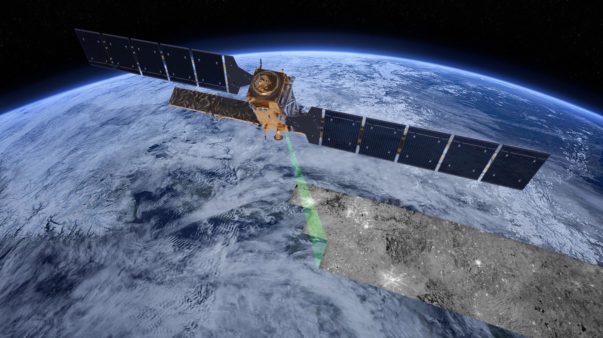
Scientists are turning to satellite-based radar observations to help understand the nature of the seismic fault and map its location.
By combining imagery acquired before and after a quake, changes on the ground that occurred between the two acquisition dates lead to rainbow-colored interference patterns in the combined image, known as an ‘interferogram’, which allows scientists to quantify ground movement.
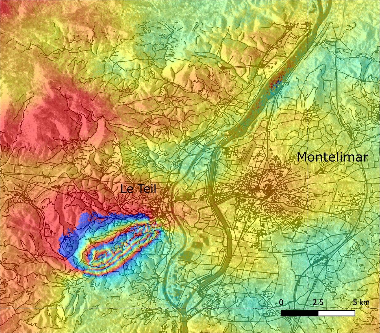
On 11 November 2019, the southeast of France was hit by a magnitude 5 earthquake with tremors felt between Lyon and Montélimar. The interferogram here shows a series of fringes in the area west of the city of Le Teil and has allowed scientists to identify the fault at the origin of the earthquake. The fringes are characteristic of ground motion. This product is derived from the Copernicus Sentinel-1 mission using the acquisitions of 6 and 12 November 2019. The interferogram was generated on GEP with the Diapsaon processing chain from CNES/TRE Altamira. Credit: contains modified Copernicus Sentinel data (2019), processed by ESA
An acquisition by Copernicus Sentinel-1 was made on November 12, one day after the event, and was ready to process on ESA’s Geohazards Exploitation Platform (GEP), which is a cloud-based processing environment with on-demand terrain motion mapping services.
Several users have computed interferograms over the concerned region.
While several faults are present in the region and marked in geological maps, none were known to be seismically active. The interferogram here shows a series of fringes in the area west of the city of Le Teil and has allowed scientists to identify the fault at the origin of the earthquake. The satellite observation also measured a ground displacement that corresponds to an uplift of up to 8 cm (3 in) in the southern part of the fault.
The intensity of the ground motion felt by the inhabitants and measured from space is unusual for this magnitude of event unless the earthquake epicenter is shallow and, indeed, seismic data put the epicenter at between 1 km (0.6 m) and 3.5 km (2.2 m) below the surface. Observations in the field on 13 November suggest that the rupture propagated up to the surface.
Floriane Provost, Research Fellow at ESA, said, “The rapid release to the public of up-to-date Copernicus Sentinel-1 based products visualized in a friendly fashion on the GEP geobrowser was followed by a peak of connections. It helped the scientific community better map the location of the fault and to confirm the mechanism of the earthquake.
“This example shows how the GEP environment contributes to the rapid processing and exchange of information within the geohazards community.”
Michael Foumelis, researcher at the French Geological Survey BRGM, added, “Field investigations by BRGM experts are on-going, while interferometric synthetic aperture radar results are actually helping them to correlate the distribution of damage with the location of the activated fault and measured ground displacements.”
Never miss a breakthrough: Join the SciTechDaily newsletter.
Follow us on Google and Google News.
1 Comment
sentinel1 see the drilling aeras ?