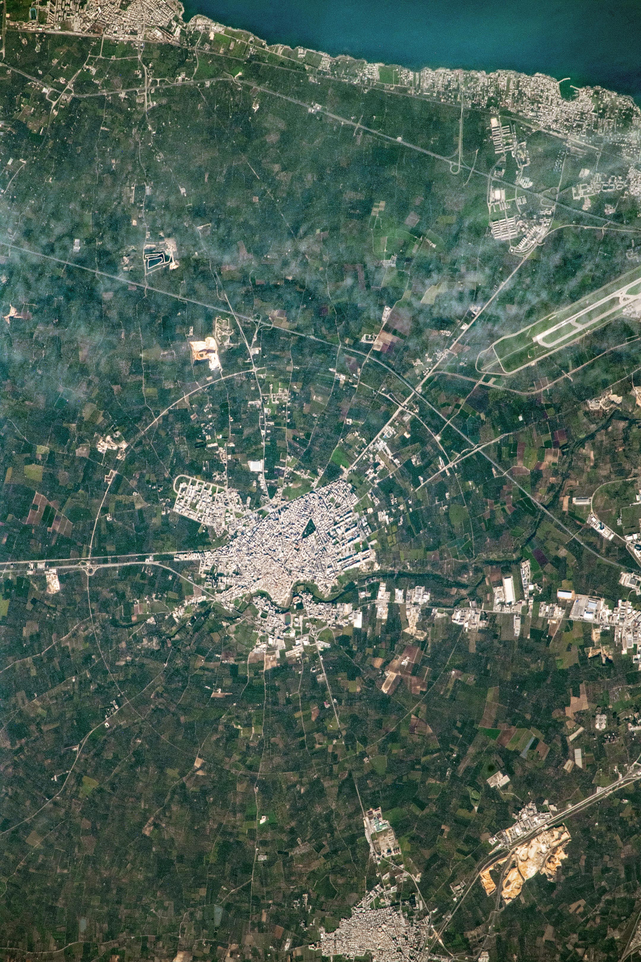
From space, the southeastern Italian region of Puglia bursts with contrast: bright city clusters, dark angular farms, and winding roads all converge around Bitonto, a town nestled between Bari and the Adriatic.
This astronaut-snapped image reveals a region where ancient agriculture and modern infrastructure coexist, from grapevines and olive groves to rail lines and airports.
Orbiting Over Puglia
An astronaut aboard the International Space Station captured this photograph while passing over Puglia, the southeastern region of Italy that forms the “heel” of the country’s boot-shaped peninsula. In the image, towns and cities appear as lighter, irregularly shaped areas, standing out against the dark-green, angular plots of surrounding farmland.
At the center of the image is the township of Bitonto. To the north, dense urban development lines the Adriatic coast, supporting a thriving tourism industry in towns like Giovinazzo, Santo Spirito, and Palese. Just east of the frame lies Bari, the regional capital and a major port city.
Highways and Railways from Space
A network of roads and railways connects communities throughout the region. One of the most visible features is a straight transportation corridor linking Bitonto to Palese and Bari. This light-toned line includes highway SP91 and a parallel railway line, running side by side across the landscape.
A ring-shaped road circles the northern half of Bitonto. The southern half of this ring road runs through agricultural areas and is less visible in the image. This detailed photo—taken with a long (1,200 millimeter) focal length lens—shows a major highway interchange connecting SP231 to the ring road on the west side of Bitonto. The Palese Airport, just east of the SP91 transportation corridor, serves the entire region. The Autostrada Adriatica is a regional highway that passes near Bitonto’s ring road.
Farming the Heel of Italy
Local agriculture primarily comprises permanent crops, such as grape vines and olive trees. A waterway winds along the southern margin of Bitonto and is visible as a dark meandering line. The associated floodplain runs northeastward to the coast and into the Adriatic Sea. The waterway and its banks are part of the Lama Balice Regional Natural Park.
This photograph, designated ISS070-E-105442, was taken on December 19, 2023, by a member of the Expedition 70 crew aboard the International Space Station. It was captured using a Nikon D5 digital camera with a 1,200-millimeter telephoto lens. The image is provided by NASA’s Earth Science and Remote Sensing Unit and the ISS Crew Earth Observations Facility at Johnson Space Center. To enhance clarity, the photo has been cropped, contrast-adjusted, and cleaned of lens artifacts. The ISS National Lab, supported by the International Space Station Program, helps astronauts capture images of Earth that are valuable to scientists and the public. These photos are made freely available online.
Never miss a breakthrough: Join the SciTechDaily newsletter.
Follow us on Google and Google News.