Researchers used satellite imagery to reveal where and when the discolored patches of water appeared between 2003 and 2020 and found a puzzling temporary increase in events in some areas.
As early as the 1930s, researchers noticed that odd, milky-white patches of water sporadically discolor the generally bluer and shallow waters of the Bahama Banks. Sampling the discolored water patches made clear that these whiting events were caused by an abundance of fine-grained calcium carbonate particles suspended in the water.
However, why surges of calcium carbonate end up suspended in the water at particular times has never been clear. Some experts have argued that it is mainly a mechanical process, with currents dredging up calcium carbonate sediments. Others have proposed that phytoplankton blooms and other biological or chemical processes might be key to triggering whiting events.
“But in actuality, there is no scientific consensus on what causes them,” explained Chuanmin Hu, an oceanographer at the University of South Florida.
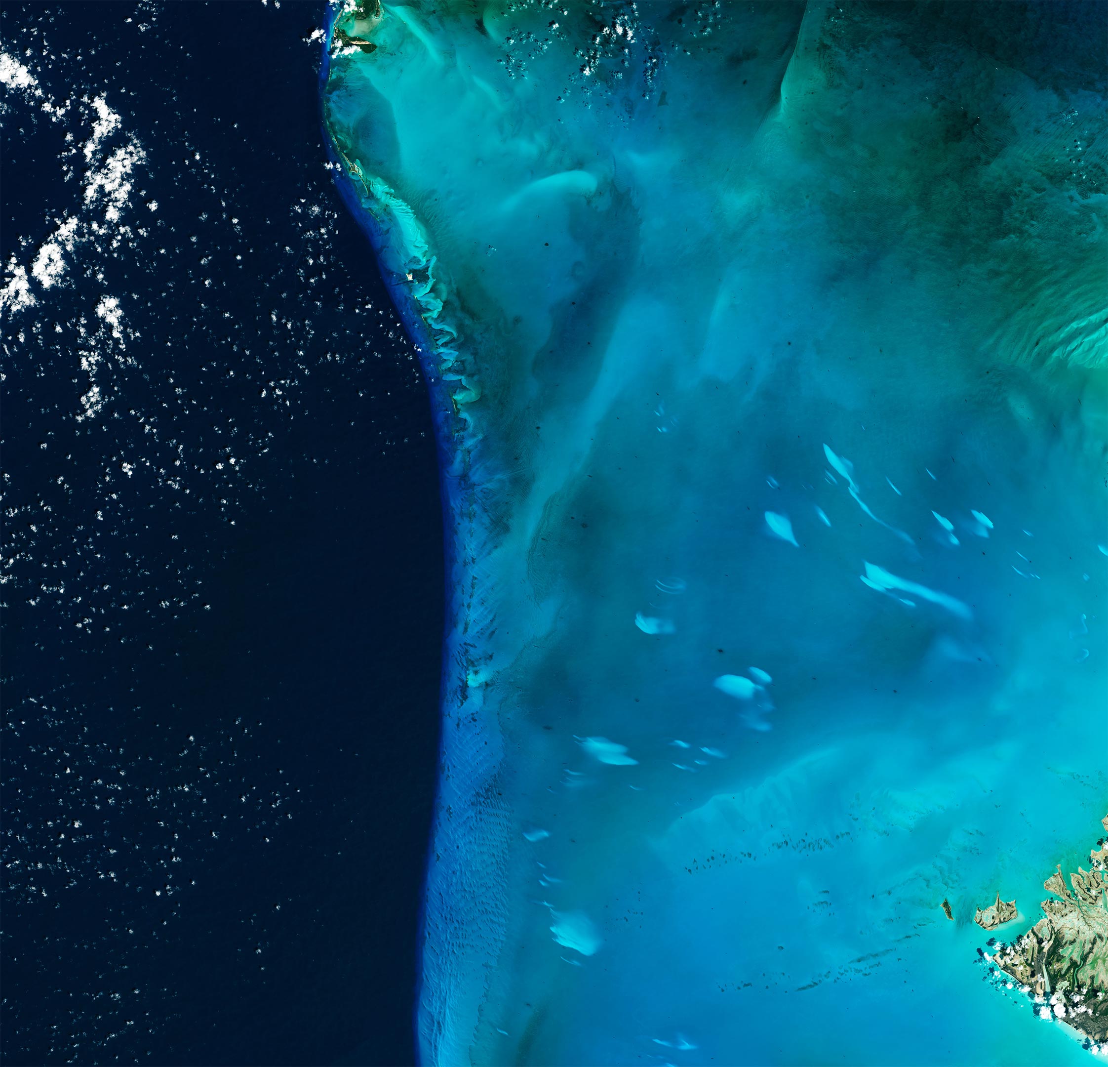
The Operational Land Imager (OLI) on Landsat 8 captured this natural-color image of a whiting event off the west coast of Great Bahama Bank on April 4, 2015. The bright spots—whitings—are surrounded by shallow water. Whiting events generally persist for a few days to three months; the event shown here lasted for about two months before fading away.
In a recent attempt to better understand what causes whiting events, a team of University of South Florida researchers, led by Hu, developed a machine learning model that analyzed thousands of satellite images of the Bahama Banks collected by NASA’s Aqua satellite between 2003-2020. In doing so, the research team assembled the longest and most detailed monthly, seasonal, and annual records of Bahama Bank whiting events ever created, according to Hu. The results were recently published in Remote Sensing of Environment.
The researchers reported stark seasonal patterns in the timing of whiting events, with significantly more of them happening in the spring and winter. They found large variations in the size of individual whiting patches, from 0.1 to 226 square kilometers, with the average size being 2.4 square kilometers for the Great Bahama Bank, roughly the size of 450 American football fields.
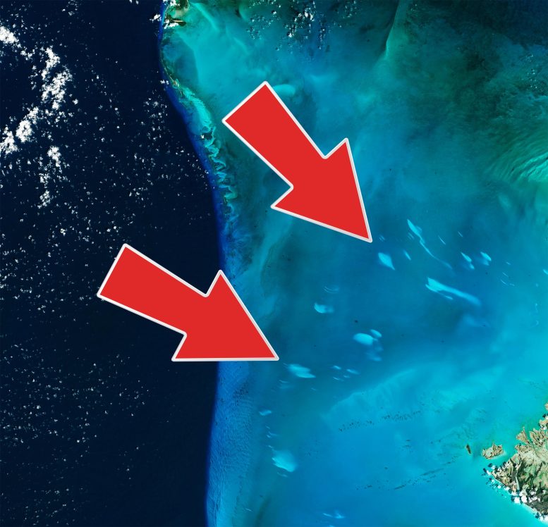
Most striking, the team observed what they termed a “mysterious” increase in the total area affected by whiting events, which rose from an average of about 25 square kilometers in 2003 to as much as 300-350 square kilometers in 2014-2015. After 2015, the total area affected began to decline gradually, returning to about 25 square kilometers by 2020. The image above shows an event during the peak of whiting activity in January 2015.
“I wish I could tell you why we saw that peak in activity, but we’re not there yet,” said Hu. “We do see some interesting relationships between environmental conditions, such as the pH, the salinity of water, and the behavior of winds and currents, but we can’t yet say what exact mechanical, biological, or chemical processes were responsible for that peak in activity. Ultimately, we need to do more field experiments and pair that with remote sensing research like this to better understand the formation processes.”
NASA Earth Observatory image by Joshua Stevens, using Landsat data from the U.S. Geological Survey.
Never miss a breakthrough: Join the SciTechDaily newsletter.
Follow us on Google and Google News.
2 Comments
From what is said, and if the whiting ares are not far from dryland, I would suspect an Hydrogeological phenomena: groundwater discharging into the bottom of the ocean, after circulating thorugh limestone. It would be perhaps interesting to check out with the precipitation and any other metheorological events, temperature and the geochemical profile of the groundwaters in the area
From what is said in this page, and if the whiting ares are not far from the coastline, I would suspect an Hydrogeological phenomena: groundwater discharging into the bottom of the ocean, after circulating thorugh limestone. It would be perhaps interesting to check out with the precipitation and any other metheorological events, temperature and the geochemical profile of the groundwaters in the area