A mysterious 2,000-mile igneous rock belt formed underground during the Laramide orogeny may have resulted from water-induced melting, offering new insights into magma formation and resource discovery.
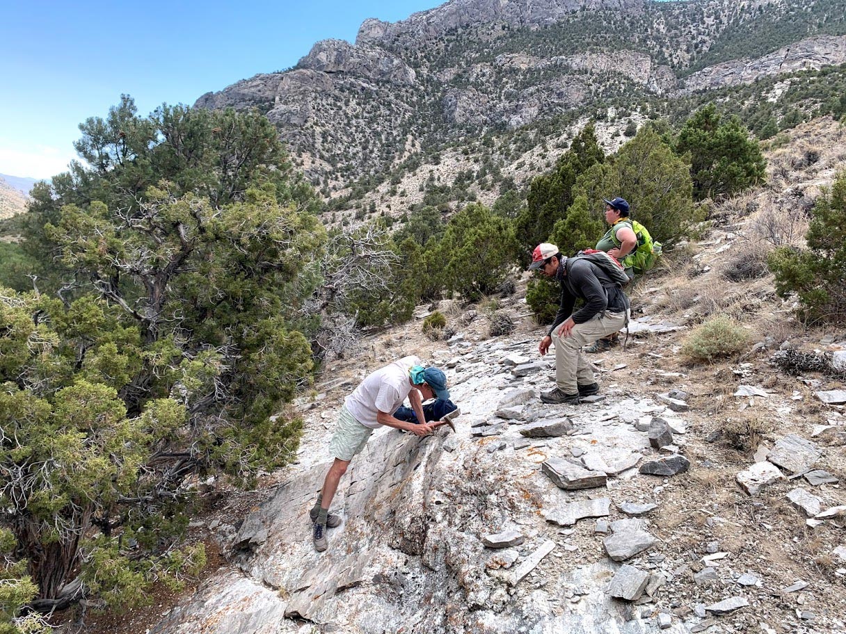
A group of University of Wyoming professors and students has identified an unusual belt of igneous rocks that stretches for over 2,000 miles from British Columbia, Canada, to Sonora, Mexico.
The rock belt runs through Idaho, Montana, Nevada, southeast California, and Arizona.
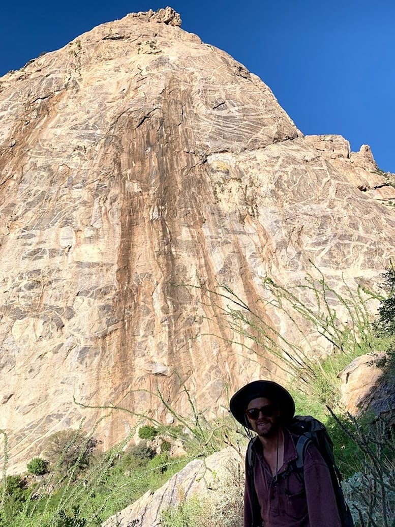
“Geoscientists usually associate long belts of igneous rocks with chains of volcanoes at subduction zones, like Mount Shasta, Mount Hood, Mount St. Helens and Mount Rainer,” says Jay Chapman, an assistant professor in UW’s Department of Geology and Geophysics. “What makes this finding so interesting and mysterious is that this belt of igneous rocks is located much farther inland, away from the edge of the continent, and doesn’t contain any evidence for producing volcanoes. In fact, all of the melting to generate the igneous rocks originally took place deep underground, five to 10 miles beneath the surface.”
Chapman is lead author of a paper, titled “The North American Cordilleran Anatectic Belt,” which was published online in February in the journal Earth-Science Reviews. The print version will be published this month.
The paper is a result of a special course taught by Simone Runyon, an assistant professor in UW’s Department of Geology and Geophysics, and Chapman. Runyon, six UW graduate students and one undergraduate student, who took part in the course, are co-authors of the paper.
“It was really fascinating to start with a scientific question in a classroom, then collect and analyze data, and eventually publish our results,” says Cody Pridmore, a UW graduate student from Orange, California, and co-author of the paper. “It’s a process most college students don’t get to experience.”
Formed During the Laramide Orogeny
One clue to the origin of the belt of igneous rocks is that the rocks chiefly formed 80 million to 50 million years ago, during a mountain-building event called the Laramide orogeny.
“The Laramide orogeny created most of the major mountain ranges we have in Wyoming, and the name actually comes from the Laramie Range,” Chapman says. “Although there are no igneous rocks of this type and age present in those mountains, we suspect that the tectonic processes that created the mountains also contributed to melting Earth’s crust.”
The researchers have several working hypotheses about what caused the rocks to melt. One hypothesis is that water infiltrated the deep crust.
“The geochemistry of these rocks indicates that melting may have occurred at relatively low temperatures, below 800 degrees Celsius,” says Jessie Shields, a Ph.D. student at UW from Minneapolis, Minn., who is working to solve this mystery. “That is still very hot, but not hot enough to produce very large volumes of magma. Water lowers the melting point of rocks, similar to how salt lowers the melting point of ice, and could increase the amount of magma generated.”
This work has implications for what causes rocks to melt and where specific types of magmas can be found.
“Many of the igneous systems in the study area contain economically important ore deposits,” says Runyon, who specializes in ore deposits. “Understanding the large-scale igneous processes that form these provinces helps us to better understand how ore deposits form and to better explore for natural resources.”
Reference: “The North American Cordilleran Anatectic Belt” by James B. Chapman, Simone E. Runyon, Jessie E. Shields, Brandi L. Lawler, Cody J. Pridmore, Shane H. Scoggin, Nathan T. Swaim, Adam E. Trzinski, Hannah N. Wiley, Andrew P. Barth and Gordon B.Haxel, 24 February 2021, Earth-Science Reviews.
DOI: 10.1016/j.earscirev.2021.103576
The research project is a joint effort involving UW; Andy Barth, a professor at Indiana University-Purdue University Indianapolis; and Gordon Haxel, a U.S. Geological Survey scientist based in Flagstaff, Arizona. Other UW students involved were graduate students Brandi Lawler, of Gordon, Wisc.; Shane Scoggin, of Reston, Va.; Nathan Swaim, of Monument, Colo.; and Adam Trzinski, of Manteno, Ill.; and undergraduate Hannah Wiley, of Sheridan.
Never miss a breakthrough: Join the SciTechDaily newsletter.
Follow us on Google and Google News.
7 Comments
“In fact, all of the melting to generate the igneous rocks originally took place deep underground, five to 10 miles beneath the surface.”
My first, gut reaction, is that these rocks were emplaced deeper than 5 to 10 miles, despite the inferred low temperature.
Go to the following address and take a look at the structure of the solar system and the history of humans in tens of millions of years ago when they lived and drew the American continent in the form of a bird and South America in the form of a human. God and your Lords and His Lords who sent Jesus and Muhammad and other Prophets and some of our forefathers, God and the Lords of the Earth that Muhammad Mehr observed in Iran have explained to you whether the original language of the Gods and the Lords of the Earth was Farsi and Arabic. The progress that humans had made on earth, their language was Persian and Arabic, why all the important names of the continents are Persian, and some countries have Persian names, and some seas and some cities are Persian? Were they cultivated millions of years ago? For example, why is the name of the country Panama in Farsi? In fact, when you follow the country of Panama to the south, you will see the face of a man whose face and name is a map of the entire continent of South America. In fact, Panama is the foot of a bird, the image of a bird of the North American continent is a wing. His right is Alaska, his left wing is the northeast of the American continent, which is fragmented and there are many islands that are near the North Pole. In every corner of the world, the pictures they drew of the continents, seas, or islands were related to the life of the same creatures in the same environment. which was their place of residence, for example, the island of Papua is in the north of Australia, on this island you can see the image of a dinosaur whose mouth is open and is looking towards the west, and in the Philippines, there is an image of a baby dinosaur that drowned under the water of the ocean, the image of a baby dinosaur is because When the meteorites fell on the earth from the planet that hit the sun and the materials inside the planet after the disintegration of two thousand meters of soil and the elements inside the said planet ten million years ago were spilled over the entire ocean and the surface of the earth and the images that humans have of dinosaurs with shape-shifting The Philippine Islands had given the shape of the Philippine Islands that had been drawn by the dinosaur due to the rise of the ocean water, but in Papua Island, because it was easier to take the soil to that Papua Island, the shape of the dinosaur is clearly visible, but the Philippine Island was more difficult to take the soil to draw. The creation of a dinosaur means that less land was taken, so due to the low height of the Philippine island, the image of the dinosaur under the ocean sunken the Philippine island, which is exactly the shape of a baby dinosaur, but on the island of Papua, the image of the created dinosaur is better visible. They lived, refer to the following address and your comments will be interesting for us. Anyone who has a god above them knows better the history of the earthlings and the fate of the earth. God and the lords of the earth who lived for tens of millions of years know better that they had at least hundreds of thousands of years of civilization. And they have been bred to exist on earth by knowledgeable people, but this is not a matter that we can simply know and be informed. You must gain a lot of experience and research to understand what I have discovered. Be sure to click on the address below and contact us. Be with us, God will protect you dear ones
2014 – A look back on a significant year for NASA
It seems my friend is not well.
Unfortunately, I am also Iranian and that means I am your compatriot.
I request those who read the comments of this site not to judge us Iranians by this man’s opinion. For example, I am evolved enough to recognize that the continents were not made by anyone, but formed through a chain of events. Or if our language is a language sent from God and other superstitions, we should not be forced to publish our opinion in the official language of the world.
I really don’t understand why religious absolutists base their ideas on the discoveries of institutions that usually forbid them, like dinosaurs. Isn’t it already written in the Quran that: And we created the Philippines in the shape of a dinosaur’s head so that Dr. Mehrdad Sahib Zaman can prove himself in the comments of a site?! Finally, I apologize to others if my English is not perfect…
Hello
I am sorry for my compatriot friend who does not have a correct understanding of God. I say that God and Satan are conventional names that we use to attribute, but is Satan a being? No, Satan and God are nominal adjectives and titles that we use in a complete sentence. We can use these relative and superlative adjectives for others or not, that is, you cannot say in one word and convey your meaning, what does God mean, what does Satan mean? Let’s understand what I mean. When you want to talk about the nature of the devil and the character of the devil, you must explain what the devil means. You must explain what God means. Can I or others describe the devil to a child in one word, and the existence of the devil to a child or knowledge? It is not possible for students to explain in one word or two words. We must explain in one sentence or a few words to a student that the devil is what God is. The same is true about the word God to a student. Let’s understand what God means. We need to describe God with a few words or a complete sentence. That’s why I explained to you at the beginning of the discussion that God and Satan are relative adjectives, meaning that they are related to the character and essence of existence and existence. Religious issues I didn’t want to talk about the nature and existence of God and Satan on this page, because there is no place for these words on this page, but my fellow countryman, who I don’t know who he is and where he came to this scientific and technical site… He left a comment and introduced himself under the pseudonym SENW and says that he is separate from us and says that he does not accept Dr. Kathiri, but I say that there is nothing wrong with him. The famous white and black people can be found in the water. If this Mr. SENW is a good swimmer, why doesn’t he comment on the issue he raised? Those who criticize always have to explain and provide proof. I have almost reached the end about the nature of God and knowledge And it is not possible for me to explain more on this page, but I can only say this one verse of a poem by Mohammad Zakaria, a discoverer of alcohol, an astronomer, and an Iranian physician, who says in these two verses (Inside every piece of wood-splitting armor, the wonder of vision) (Rasd Adami We have also reached a place where we have not seen anything but God. There are Gods in the heavens and under the earth. You know that in Iran, the system of super computer servers and operators bought from China is used
And you must have a good VPN so that you can bypass the strong filtering that the dirty dictator regimes apply. The leaders of these dictator regimes are very stupid. Of course, these stupid leaders are both religious and non-religious. Why do we say that these leaders are ignorant because they Dictator regimes can’t stop the publication of news, events and facts with severe censorship and censorship. Yes, I wrote it in less than ten minutes during the holy month of Ramadan in 1989 and after 12 years I found out that it is related to the 89 verses of the holy books. until the guidance of God is around the world) After some time of spreading these surahs in Iran, I realized that there are 43 alphabets in the first verse of the Lord’s Surah, and I had written this surah at the age of 46, and my birth number is the same as 43 and I realized that some of the words of the eight chapters are related to time, which I do not want to explain here, and I learned from the Prophets chapter, which has 101 words and 389 alphabets, that it is true that God changes the shape of the continents and seas with connection They interfered with humans and cooperated with humans to change the shape of the seas and continents in the form of terrestrial creatures and they also announced the end of time in the last surah which is the surah of the Prophets. There is a milky way galaxy, where the stars and planets of the milky way of the galaxy, which are very, very small compared to the sun and the planets of the solar system, these stars of the milky way are thousands of times smaller than the sun. But the speed of the sun is lower than the milky way and the stars and their planets collide with the solar bodies and the planets of these small stars collided with the sun and solar bodies like Venus and Mercury, their shrapnel, of course, after they collided with the sun and exploded due to the presence of sulfur And the materials of gunpowder, kurorat, and zermikh and other materials that burn in the said planets that come close to the sun through the milky way, maybe they disintegrate before impact, and several thousand meters of soil on the surface of the planet earth and metal rocks inside the planets are disintegrated every few hundred million years. Less and more of the shattered core of the said planets is spilled on the surface of the planets and all the moons of the solar system, always when the big arms of the Milky Way pass through the solar bodies, but why when several thousand meters of soil and rocks were spilled on the earth tens of millions of years ago. and whales, dinosaurs and humans disappeared. Why are there no traces of huge meteorite impact on the surface of the earth? This is because of the rotation of the moon, which plows the delicate crust of the earth every tens of thousands of years, and you can see the layers of the earth that are in Different parts of the continents rotated up to 360 degrees
Yes, and all traces of meteorites have been destroyed on the surface of the earth, and over millions of years of rain, several hundreds of meters of earth have been cracked, and the images created by humans, with the smallest changes in the seas and islands, such as the continents and islands such as the Philippines who formed the Philippine Islands in the shape of a dinosaur for us with the settlement of soil and rocks from planets that exploded and hit the entire surface of the ocean, causing the Philippine Islands to go under the water of the ocean and the images of the dinosaur to go under the water of the ocean, but half of the image of the dinosaur which is in the Philippine islands, it is definitely known that it is a dinosaur, go to this duplicate website address that I have posted above, God is everywhere with your eyes watching our work and this is how we communicate with God and the lords of the earth and revelation. And…..later I will explain the continuation of this discussion, which is related to the people under the ground and the cause of the oil under two thousand meters of soil on the coasts, and the tools left under the cities, which are related to tens of millions of years ago when humans used the seas. and they changed the islands and continents a little, but they did not have the opportunity to complete the created images for us today’s humans due to the impact of the big arm of the Milky Way galaxy on solar bodies and the impact of meteorites that were made of metals that were broken up from the core of the planets of the Milky Way. They exploded by approaching the sun, and I explained that the reason for the explosion of the planets was due to burning materials and then they disintegrated, the soil, rock, and mantle of these planets were dumped on the earth for months and years and caused the death of dinosaurs, and humans caused the death of dinosaurs. and the people who lived with these creatures promised that I have to explain, wait for us again, but we know that the Americans, their important scientists, may not be allowed or their pride does not allow them to communicate with Iranian scientists in this regard, especially astronomical issues. I know that I am not going to talk about it right now, but maybe in the future I will talk about it with you on this interesting website. For now, you self-proud Iranians and foreigners should know that God is watching people everywhere and it is possible that From our point of view, humans who have bodies, God and even the evil spirits of our ancestors are watching over us, but this issue is very complicated, but you should know that always or sometimes the spirits have control over humans. Only those who, like us, the chosen people of God, have been in contact with the unseen world for decades, and we have a relationship with God, I myself have hundreds of signs that I was shown to the time, place and verses of the holy books, and somehow I am Zaman, I said earlier about how Iranian people are among the companions of Imam Zaman or the special chosen ones of God, if you, the respected administrators of this great site who are affiliated with the great NASA site, very very is good. with the administrators of this website or site, just know that I found and discovered a secret in the words that I realized that in this century and several centuries, God and the Lords of the Earth are fluent in Persian words and alphabets, and the Persian language, which is the most complete language at the moment The world is everyone’s properties, we prove this claim with evidence and so on
In conclusion, I would like to remind you that I wrote a verse from the Surah of God in this regard, which is related to the Surah that I named Lord, and it is the first Surah that I wrote in less than ten minutes in the holy month of Ramadan at the age of 46. It was during the solar year of 89. I remembered that I left these few sentences when translating this part, you should somehow put it in the middle of this text so that the composition of this text is complete. I will send it in parentheses, but it may not be necessary to send this text and verse, you intelligent readers may understand what I mean, but I will repeat another issue that is related to the last single-digit numbers, which are 89, which means 8 and 9. These two numbers are related to verse 89 of the first and greatest surah of God in the Muslim holy book, and those who I mentioned in a way may be the companions of Imam Zaman, you must refer to verse 89 to understand what we mean, God protects those in all stages. The lives of human beings, who are especially special personalities of God and the special chosen ones of God and the lords of the earth, these people may be in any country, but it is also possible that they are mostly in Iran and speak Persian. I know that God and… the world is in Persian language. They are more fluent. Of course, I already said that God, the Lord of the Jinn, speaks in all languages, but do we have God rather than God
I sent this comment again so that if it is possible, you can display it again because there are many important contents in this text and I wanted the Iranian who did not accept me to review this text, of course this text is not bad for some people, thank you From the good administrators and teachers of this site who displayed my opinion, we doubt or should I say we believe that the American CIA knows about the life of humans decades ago, that the traces of human life and tools are 100% below three thousand meters. The cities of the countries are located and the superpowers must have understood that there are 100% under three thousand meters of all big cities, bigger cities with at least tens of thousands of years of civilization and Latin and Persian inscriptions.
Thank you
Very nice; in addition to reading science, I love to read theological mythology as well (whether true or not, just like science) because it originates from the mind it’s all the same, even science itself is a crime against humanity in the minds of those who would make it as such. I’ll read and save your comments for later. Thank you.
Hello, I thank Liz. She said that she reads and follows both scientific and mystical material, and it is interesting to her. That incident informed me, I also know about the past and future of the earth and the fate of the earth. To see my comments, you can enter my mobile number in Google and comment on the pages where you will see my comments. Dr. Mehrdad’s mobile number is 00989332197646
سلام برای اطلاعات بیشتر در مورد سرنوشت زمین دو کلمه انگلیسی kasiri sahebzaman را در گوگل سرچ کنید و وارد اولین پنجره شوید گذینه 540 محمد مهرداد آقاکثیری معروف به مهدی صاحب زمان در مورد سرنوشت رژیم آخوندصفت پست و تروریسم و منافق جمهوری اسلامی توضیحات کاملی ارائه دادند و در مورد بازگشت شاهزاده رضا پهلوی ولیعهد ایران که این ولیعهد شده برمیگردد به تاج و تخت توضیحات کاملی ارائه دادم در آخر از مدیران این سایت علمی فنی بروز وابسته به ناسا تشکر میکنم به امید پیروزی مللت شهیدپرور ایران و آزادی ایران از دست رژیم حرام لقمه آخوندی