
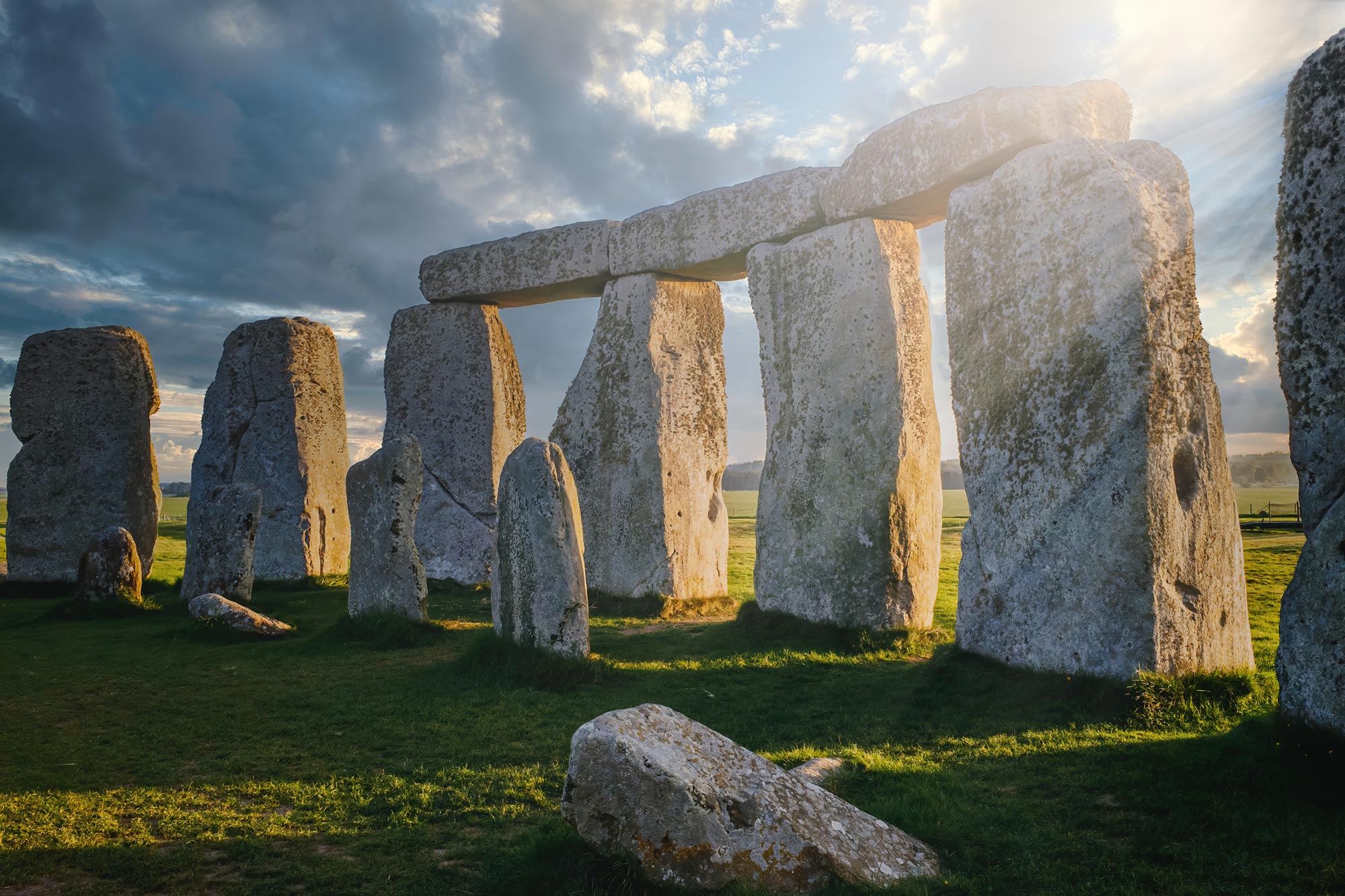
Stonehenge’s Altar Stone may have traveled south through a combination of glacial transport and deliberate human movement.
Stonehenge was assembled from stones weighing between 2 and 25 tons, an astonishing construction effort for people living before the wheel was invented. Yet the puzzle extends beyond how such massive rocks were raised. Many of the stones came from distant geological sources rather than the bedrock surrounding the monument. Why were they selected, and how did they reach the site?
Research I conducted with geochemist Anthony Clarke of the University of Curtin in Australia may help answer both questions for the Altar Stone, the Stonehenge rock that traveled the greatest distance.
Geological evidence traces the Altar Stone to the Orcadian Basin in northeast Scotland, about 700 kilometers from Stonehenge. The region was once occupied by Lake Ocradie, and sediments deposited in that ancient lake eventually formed the sandstone found in the stone. Our international group investigated whether glacial ice could have carried the rock part of the way south.
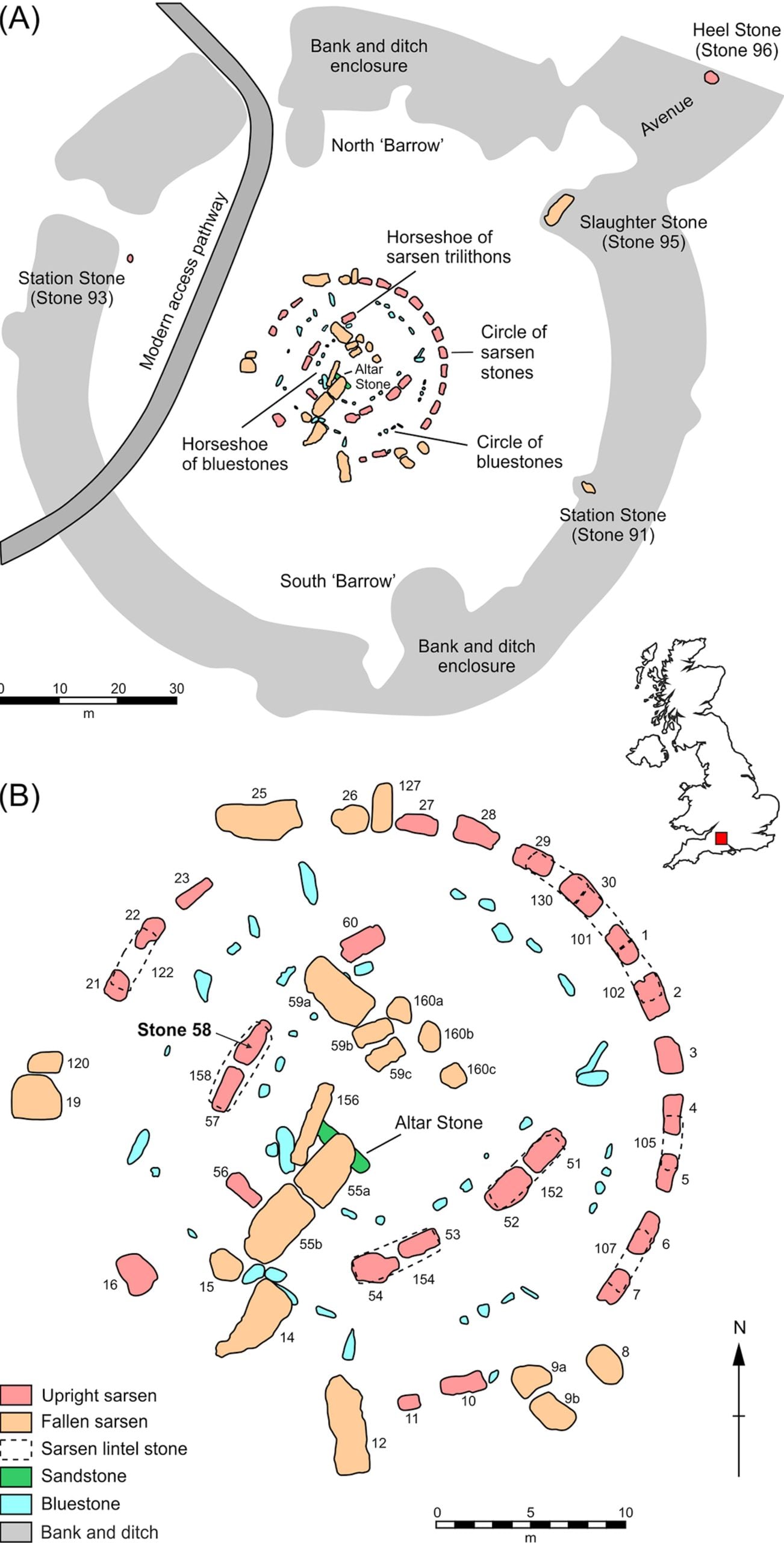
Weighing 6 tons and measuring 4 meters long, the Altar Stone is the largest and heaviest of the bluestones (Stonehenge’s traveled rocks). These bluestones were placed at Stonehenge about 2,000 years before the larger stones that form its familiar arches.
Glaciers could explain the first journey
Until roughly 15,000 years ago, near the end of the last ice age, a vast sheet of ice covered northern Britain. The ice was thick enough to flow slowly across the landscape, collecting rocks and debris and transporting them over long distances. We wanted to determine whether this moving ice could have carried material from the Orcadian Basin closer to Stonehenge.
To follow the possible route, we used a new numerical model that I have spent five years developing. It predicts where rocks moved by glaciers (known as erratics) might eventually have been deposited. The results showed that material from the Orcadian Basin could have traveled with the ice to Dogger Bank, a region now located beneath the sea off England’s east coast.
Dogger Bank becomes the missing link
Although today Doggerland is known for cod fishing and wind farms it is thought to have once been a Neolithic site of significance as early humans moved from southern Europe north and west into the UK as the climate warmed at the end of the last ice age approximately 12,000 years ago. Dogger Bank represented a local topographic high point within the Doggerland region, rich in archaeological evidence.
What is interesting about Dogger Bank is that it is formed in part by a large glacial moraine (a ridge of rock and debris deposited by a glacier). This moraine marks the end of a glacial “conveyor belt”, where a range of glacially transported rocks and boulders from the north would have been deposited during the last ice age.
Walking around Dogger Bank at the time, the site would probably have looked like something in between a building demolition site and an interesting rock museum. We know Neolithic people were really knowledgeable about rocks, and were selective about the stones they chose for tools. Which suggests they might have deliberately chosen the Altar Stone for some of its attributes.
More recently, there are countless examples of people realizing the landscape’s glacial erratics were out of place. The Victorians in Britain, for example, chose the name “erratic” due to the rocks’ unusual locations (at the time they were thought to be the result of the biblical flood). On the other side of the North Sea, Scandinavians know erratics as “troll stones”, having realized these boulders came from the upland mountains.
They used to think the only explanation was that they had been thrown hundreds of kilometers by playful trolls, with the early Swedish term for erratics (jättekast) literally translating to giant throw. It’s hard to say what exactly made the Neolithic people of Dogger Bank choose the Altar Stone. But if it was transported by ice to Dogger Bank, they would have needed to move it at least once before taking it 400 km to Stonehenge.
Rising seas may have forced relocation
Doggerland was gradually flooded as large ice sheets around the world melted at the end of the last ice age. We know it stayed above sea level until around 8-9,000 years ago (perhaps even as late as 7,000 years ago). However, throughout that time the landscape saw dramatic change. It transitioned from a land bridge connecting Europe to Britain, to a small island, where the Altar Stone stood. This island eventually slipped below the sea too.
This is interesting because Doggerland was inundated before the construction of Stonehenge. Therefore, the Altar Stone would have had to be transported to at least one intermediate site before finally being incorporated into Stonehenge.
A human route becomes more plausible
Once the Altar Stone was safely on the east coast of England, the idea that it was moved by humans to the Salisbury Plains becomes more plausible. This distance would be roughly the same distance as the other bluestones, the next most far-traveled stones, but still ten times the distance of the more locally sourced larger Sarsen Stones. Around the time of the construction of Stonehenge, we know that east-west travel was happening along the Berkshire Ridgeway, a Neolithic high route often touted as the oldest road in Europe, leading directly to the Salisbury Plains.
Our recent study opens up a new hypothesis for how the Altar Stone could have traveled south to Stonehenge, and why people might have been motivated to first move the stone in response to rising sea levels threatening its initial site.
This work suggests that Neolithic people not only had the agency and coordination to move a large rock hundreds of kilometers but also to potentially realize that their landscape was changing and that they needed to act.
Reference: “From Highlands to Henge: Refining the Provenance and Transport Pathways of Stonehenge’s Altar Stone” by Anthony J. I. Clarke, Remy L. J. Veness, Christopher L. Kirkland, Chris D. Clark, Niall Gandy, Andy Emery, Sarah L. Bradley, Jeremy C. Ely and Ignéczi Ádám, 4 June 2026, Journal of Quaternary Science.
DOI: 10.1002/jqs.70080
Adapted from an article originally published in The Conversation.
Never miss a breakthrough: Join the SciTechDaily newsletter.
Follow us on Google and Google News.
1 Comment
A lot of ifs and maybes.