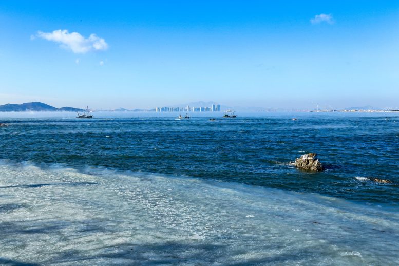
Arctic sea smoke near Qingdao, China on January 7th, 2021 when cold surge hit northern China. A result of frigid air passing over relatively warm water, the phenomenon is rare, even in the Arctic. Credit: Shaoqing Wang
El Niño–Southern Oscillation (ENSO) is an irregular periodic variation in winds and sea surface temperatures over the tropical eastern Pacific Ocean that affects the climate of much of the tropics and subtropics. This natural phenomenon is important to study because of the socioeconomic impacts it can have on critically important global issues such as food security, agricultural production, human health, and water resources, to name but a few.
ENSO rarely maintains for long in either its cold phase (La Niña) or warm phase (El Niño). Historically, it has a strong preference to peak during boreal winter and rapidly decay in spring (known as “phase-locking”), with quasi-periodic oscillations of 2–7 years. However, since the turn of the current century, three instances of so-called “double dip” La Niña events have occurred, in 2007–09, 2010–12, and 2020–22.
This succession of double-dip La Niña events is intriguing enough in itself; but now, based on updated data from several organizations issued in April 2022, it seems that the current event is likely to continue through the boreal summer and fall of 2022, suggesting a strong possibility of a third-year La Niña lasting from 2020-23.
“This would be the first third-year La Niña since the 1998–2001 event, which was the only such event observed since 1980,” explains Dr. Xianghui Fang from Fudan University, China.
By examining the status of the atmosphere–ocean system over the tropical Pacific in March 2022, Fang and his collaborator, Prof. Fei Zheng, from the Institute of Atmospheric Physics, Chinese Academy of Sciences, found that the equatorial central to eastern Pacific was still maintaining colder conditions than normal, and the southeasterly winds over the equatorial Pacific were appreciable.
The team analyzed the possible contributions of four physical factors related to the thermocline (the boundary between warmer ocean water at the surface and cooler water below) and surface winds in this potential third-year La Niña. Historically, the atmospheric variables in spring 2022 indicate the easterly and southerly winds will reach their largest amplitude since 1980, which supports the emergence of a third-year La Niña.
The team further discusses the possible global climate impacts of this impending third-year La Niña event in a News & Views article published in Advances in Atmospheric Sciences. Specifically, they examine the only two other similar events in history, in 1973–1976 and 1998–2001, and, based on the similarities and differences, conclude that there is much uncertainty in predicting the climatic effects of the current event, both in terms of summer precipitation and winter temperature.
“Nonetheless, we should be aware of the risk of intense cold surges in Eurasia, which could also produce more cold extremes either in eastern or northeastern China,” Fang warns.
Reference: “Will the Historic Southeasterly Wind over the Equatorial Pacific in March 2022 Trigger a Third-year La Niña Event?” by Xianghui Fang, Fei Zheng, Kexin Li, Zeng-Zhen Hu, Hongli Ren, Jie Wu, Xingrong Chen, Weiren Lan, Yuan Yuan, Licheng Feng, Qifa Cai and Jiang Zhu, 26 July 2022, Advances in Atmospheric Sciences.
DOI: 10.1007/s00376-022-2147-6
Basics of El Niño–Southern Oscillation (ENSO)
Though ENSO is a single climate phenomenon, it has three states, or phases, it can be in. The two opposite phases, “El Niño” and “La Niña,” require certain changes in both the ocean and the atmosphere because ENSO is a coupled climate phenomenon. “Neutral” is in the middle of the continuum.
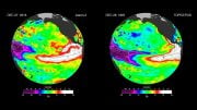
- El Niño: A warming of the ocean surface, or above-average sea surface temperatures (SST), in the central and eastern tropical Pacific Ocean. Over Indonesia, rainfall tends to become reduced while rainfall increases over the tropical Pacific Ocean. The low-level surface winds, which normally blow from east to west along the equator (“easterly winds”), instead weaken or, in some cases, start blowing in the other direction (from west to east or “westerly winds”).
- La Niña: A cooling of the ocean surface, or below-average sea surface temperatures (SST), in the central and eastern tropical Pacific Ocean. Over Indonesia, rainfall tends to increase while rainfall decreases over the central tropical Pacific Ocean. The normal easterly winds along the equator become even stronger.
- Neutral: Neither El Niño or La Niña. Often tropical Pacific SSTs are generally close to average. However, there are some instances when the ocean can look like it is in an El Niño or La Niña state, but the atmosphere is not playing along (or vice versa).




Be the first to comment on "Scientists Warn of a Rare Third-Year La Nina – Risk of Intense Cold Surges in Eurasia"