Spain faces deep freeze after record snowfall, visible in Sentinel-3 satellite imagery.
The heavy snowfall that hit Spain a few days ago still lies heavy across much of the country as this Copernicus Sentinel-3 satellite image shows.
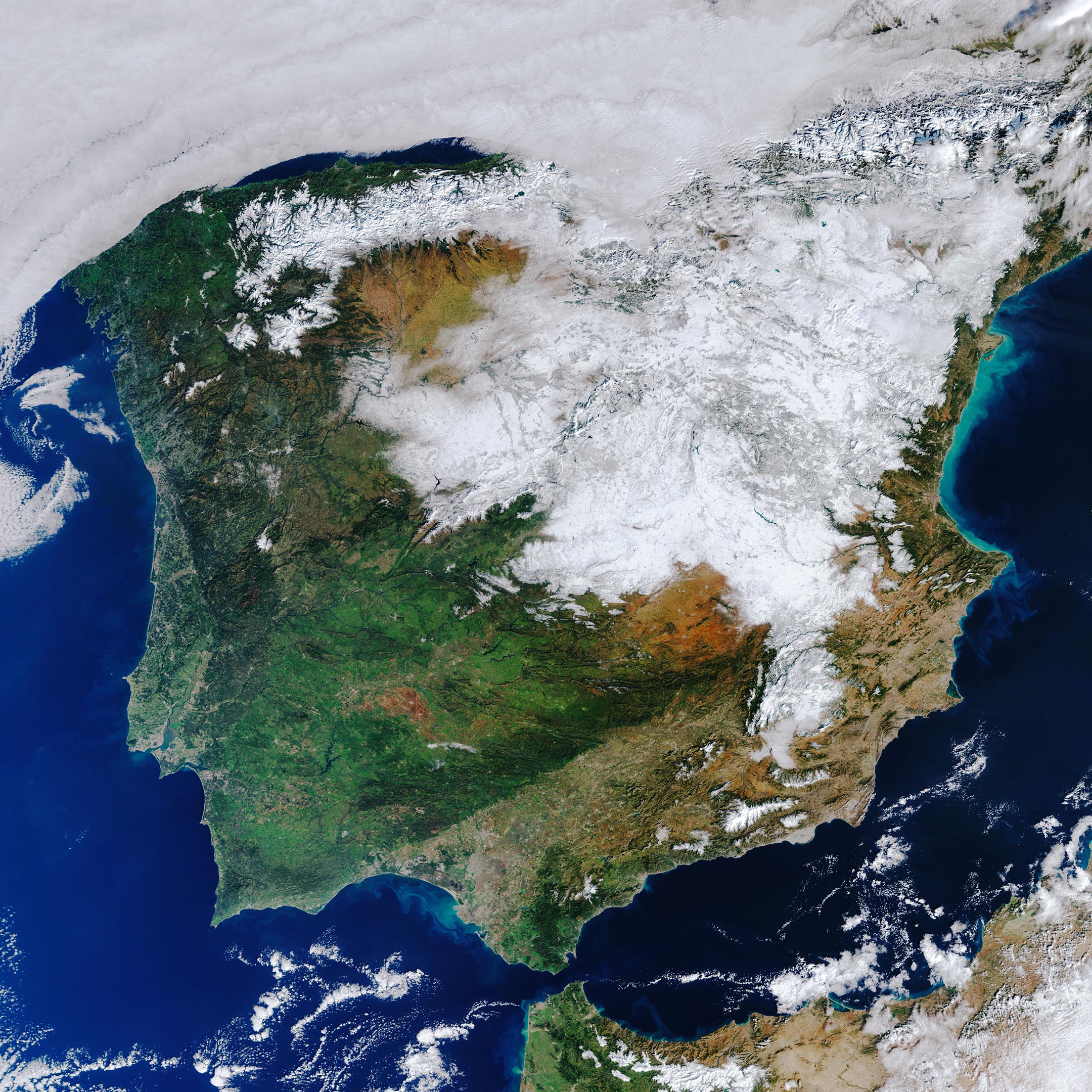
While the idea of snuggling under a blanket in the cold winter months is very appealing, the blanket that covers half of Spain is not remotely comforting. This satellite image, captured on 12 January at 11:40 CET, shows how much of the country is still facing hazardous conditions following the snow that fell at the weekend – the heaviest snowfall the country has had in five decades.
Storm Filomena hit Spain over the weekend, covering a large part of the country in thick snow. Madrid one of the worst affected areas (see satellite image), was brought to a standstill with the airport having to be closed, trains canceled, and roads blocked.
People in central Spain are struggling as a deep freeze follows the heavy snow. Yesterday, the temperature plunged to –25°C (-13°F) in Molina de Aragón and Teruel, in mountains east of Madrid – Spain’s coldest night for at least 20 years.
Copernicus Sentinel-3 is a two-satellite mission. Each satellite carries a suite of cutting-edge instruments to measure systematically Earth’s oceans, land, ice, and atmosphere to monitor and understand large-scale global dynamics. For example, with a swath width of 1,270 km (790 mi), the ocean and land color instrument, which acquired the two tiles for this image, provides global coverage every two days.
Never miss a breakthrough: Join the SciTechDaily newsletter.
Follow us on Google and Google News.