From the International Space Station, an astronaut photographed Madagascar’s Ambohiby volcanic complex, showcasing a blend of ancient geology and modern human pressures.
The image reflects both the stark beauty of the landscape and the environmental challenges posed by significant deforestation linked to Madagascar’s surging population.
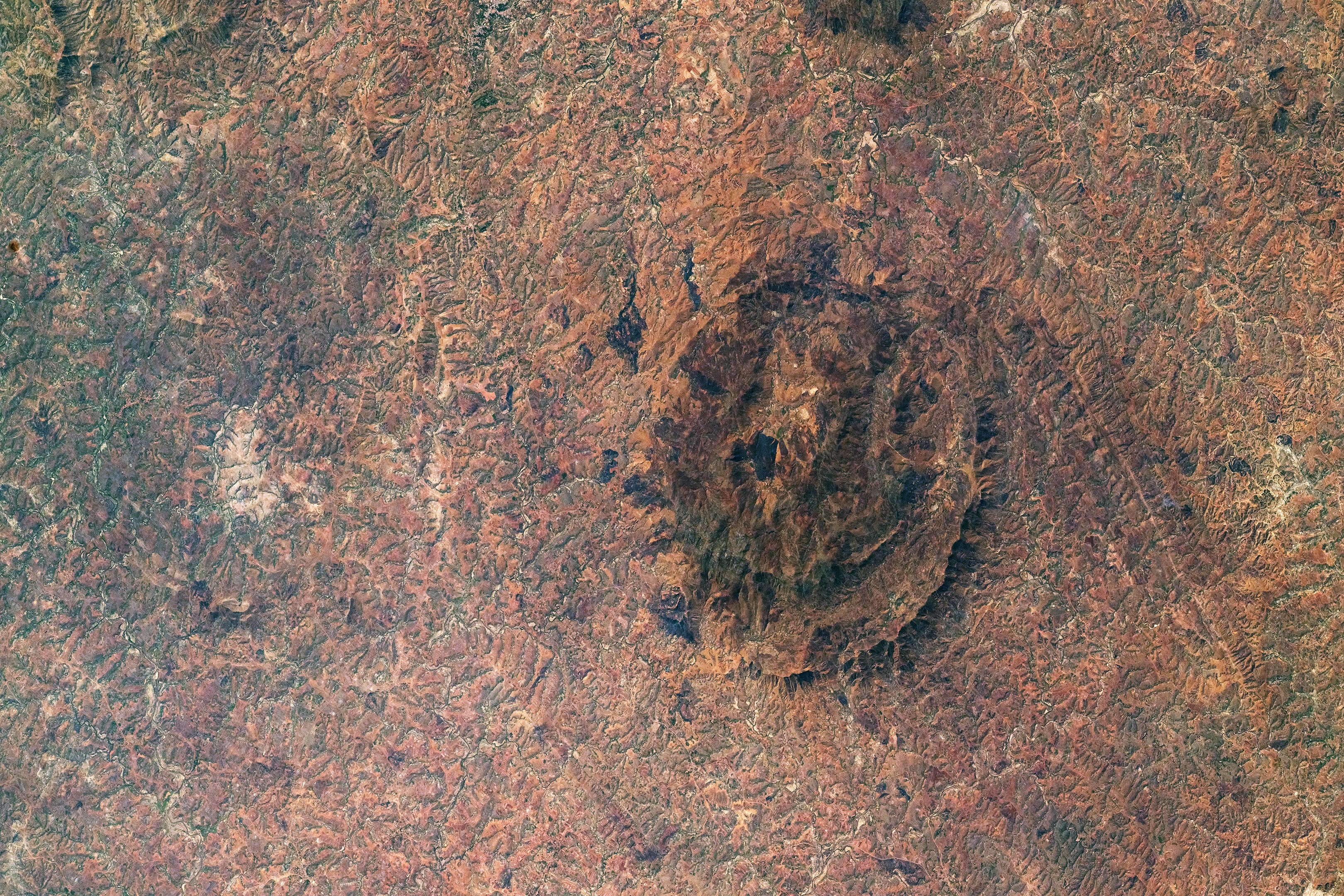
Ambohiby’s Volcanic Features
An astronaut aboard the International Space Station (ISS) captured the image above of the Ambohiby volcanic complex, located in the central highlands of Madagascar. The extinct volcanic crater is approximately 15 kilometers (9 miles) wide. Most of the landscape in the image is light brown, indicating a lack of forest cover. In contrast, greener areas farther west (along the left third of the image) retain more of the original forest of Madagascar’s central highlands.
Geological History and Structure
Geologists estimate that the Ambohiby complex formed around 90 million years old, during the breakup of the ancient supercontinent Gondwana. The volcanic structure is characterized by semi-concentric rings, which are highlighted by dark rock ridges that form curved hills. Just east of the crater, two parallel fault lines can be seen. These faults are common in areas where volcanic activity has occurred in the past.
Human Impact and Local Agriculture
Towns exist in and around Ambohiby, but their small size makes them difficult to discern at the resolution of this image. Brighter patches are fields on flat, easy-to-plow upland surfaces. A dark, rectangular patch within the crater appears to be a burned area over a plot of land.
Environmental Changes in Madagascar
Natural forests once covered a majority of Madagascar’s surface. But in the past several decades, the island nation’s population has increased rapidly—from 5 million in 1960 to 27 million in 2020. One major consequence of the population growth is that the natural forest is now being lost at one of the fastest rates in the world. Trees are cut to clear the land for new pasture and farmland and for fuel and building materials.
This photograph, designated ISS071-E-673752, was taken on September 15, 2024, by a member of the Expedition 71 crew aboard the International Space Station. It was captured using a Nikon Z9 digital camera with a 400-millimeter lens. The image, provided by the ISS Crew Earth Observations Facility and the Earth Science and Remote Sensing Unit at NASA’s Johnson Space Center, has been cropped and enhanced to improve contrast, with lens artifacts removed for clarity. The International Space Station Program, through the ISS National Lab, enables astronauts to capture valuable images of Earth for scientific research and public interest, making them freely accessible online.
Never miss a breakthrough: Join the SciTechDaily newsletter.
Follow us on Google and Google News.