Satellites observed Saharan dust moving from Morocco across the Atlantic, highlighting the Sahara’s role as a major dust source.
This dust affects weather across the globe, and a recent study has shown how varying concentrations of Saharan dust can either suppress or enhance rainfall in tropical storms.
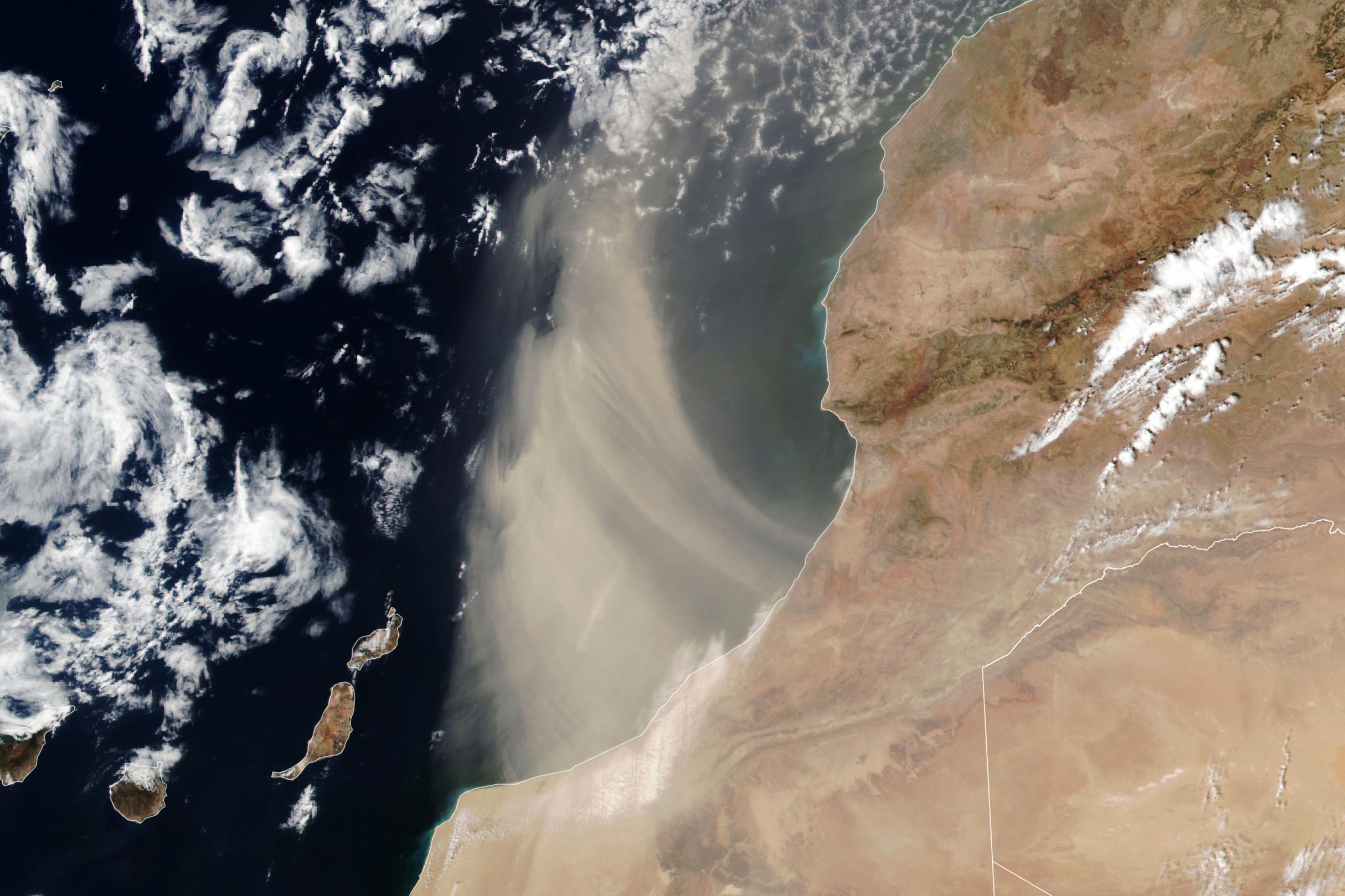
Saharan Dust Events Captured by Satellite
Dense bands of dust streamed offshore from southern Morocco in the summer of 2024. The VIIRS (Visible Infrared Imaging Radiometer Suite) on the Suomi NPP satellite acquired this image of a plume of Saharan dust as winds lofted it over the Atlantic Ocean on August 24, 2024.
The Sahara Desert is Earth’s largest source of airborne dust, and the particles can travel for thousands of miles. From late spring to early fall, it is common for the dry, dusty Saharan Air Layer to carry the particles westward across the Atlantic Ocean high in the atmosphere. With different wind patterns in the winter and spring, dust emerging from North Africa can drift over the United Kingdom and western Europe at relatively low altitudes.
Seasonal Patterns and Impacts of Saharan Dust
Saharan Air Layer activity subsides after mid-August, according to NOAA, making it less likely that the plume shown here is bound for a transoceanic journey. Instead, it arcs to the north after blowing out over the ocean. Earlier in the summer, however, several clouds of fine dust from the Sahara reached the United States, creating hazy skies over Texas.
Scientists are interested in summertime Saharan dust events in part because of the influence they can have on large storm systems. Dry, stable, dust-laden air can inhibit tropical cyclone formation in the North Atlantic. And in a new study, researchers found that dust can modulate the amount of rainfall brought by these storms.
Influence of Saharan Dust on Weather Patterns
Using a machine-learning model based on meteorological data, NASA’s IMERG (Integrated Multi-Satellite Retrievals for GPM) precipitation estimates, and other satellite measurements, the study’s authors found that dust optical depth—a measure of how much light filters through a dusty plume—was a key predictor of rainfall from tropical cyclones. They concluded that, at lower amounts, dust particles promote the formation of rain-producing clouds, while at higher concentrations, the sunlight-blocking effects of dust serve to suppress precipitation.
NASA Earth Observatory image by Lauren Dauphin, using VIIRS data from NASA EOSDIS LANCE, GIBS/Worldview, and the Suomi National Polar-orbiting Partnership.
Never miss a breakthrough: Join the SciTechDaily newsletter.
Follow us on Google and Google News.
3 Comments
Strangely, despite the Sahara dust getting attention from the press, it seems that those making hurricane predictions haven’t factored that in with their stubbornly pessimistic forecast of an exceptionally bad hurricane season. The season, starting June 1st, has gotten off to a slow start. It typically peaks in September and drops off quickly. Yet, the organizations doing the predicting just recently issued new forecasts, leaving all their chips on the table. When the season is over, if their forecast turns out to be a bust, will they acknowledge that and explain why they not only initially forecast an historic season, but upped the ante despite a lackluster start?
At least one organization sees the handwriting in the sand, as it were:
https://www.msn.com/en-us/weather/topstories/hurricane-storm-forecast-slashed-by-experts/ar-AA1pW75h?ocid=winp1taskbar&cvid=9e53e7b5aa774b6b88157dccf4619548&ei=5
“In fact, the lack of tropical activity from Aug. 12 through Sept. 3 marked the quietest period in tropical weather development in 56 years, with the basin now starting to fall behind key metrics for an average season.”
https://www.msn.com/en-us/weather/topstories/hurricane-forecasters-expect-below-normal-cyclone-activity-through-september-s-season-peak/ar-AA1pWD8M?ocid=winp1taskbar&cvid=cfbf970661664d5d857605e81b4e8d9e&ei=43