Sentinel-6 Michael Freilich, the latest spacecraft to monitor sea surface height, releases its first science measurements to users.
After six months of check-out and calibration in orbit, the Sentinel-6 Michael Freilich satellite made its first two data streams available to the public on June 22, 2021. It launched from Vandenberg Air Force Base in California on November 21, 2020, and is a U.S.-European collaboration to measure sea surface height and other key ocean features, such as ocean surface wind speed and wave height.
One of the sea surface height data streams that will be released is accurate to 2.3 inches (5.8 centimeters) and will be available within hours of when the instruments aboard Sentinel-6 Michael Freilich collect it. A second stream of data, accurate to 1.4 inches (3.5 centimeters), will be released two days after collection. The difference in when the products become available balances accuracy with delivery timeliness for tasks like forecasting the weather and helping to monitor the formation of hurricanes. More datasets, which will be accurate to about 1.2 inches (2.9 centimeters), are slated for distribution later this year and are intended for research activities and climate science including tracking global mean sea level rise.
The satellite, named after former NASA Earth Science Division Director Michael Freilich, collects its measurements for about 90% of the world’s oceans. It is one of two satellites that compose the Copernicus Sentinel-6/Jason-CS (Continuity of Service) mission. The second satellite, Sentinel-6B, is slated for launch in 2025. Together, they are the latest in a series of spacecraft starting with TOPEX/Poseidon in 1992 and continuing with the Jason series of satellites that have been gathering precise ocean height measurements for nearly 30 years.
Shortly after launch, Sentinel-6 Michael Freilich moved into position, trailing the current reference sea level satellite Jason-3 by 30 seconds. Scientists and engineers then spent time cross-calibrating the data collected by both satellites to ensure the continuity of measurements between the two. Once they have are assured of the data quality, Sentinel-6 Michael Freilich will then become the primary sea level satellite.
“It’s a relief knowing that the satellite is working and that the data look good,” said Josh Willis, project scientist at NASA’s Jet Propulsion Laboratory in Southern California. “Several months from now, Sentinel-6 Michael Freilich will take over for its predecessor, Jason-3, and this data release is the first step in that process.”
Keeping an Eye on Rising Seas
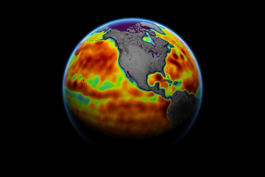
The ocean absorbs more than 90% of the heat trapped in the Earth system by increasing concentrations of greenhouse gases, which causes seawater to expand and sea level to rise. Monitoring ocean height is important because it helps forecasters predict things, including ocean currents and potential hurricane strength.
“These initial data show that Sentinel-6 Michael Freilich is an amazing new tool that will help to improve marine and weather forecasts,” said Eric Leuliette, program and project scientist at the
National Oceanic and Atmospheric Administration in Maryland. “In a changing climate, it’s a great achievement that these data are ready for release.”
Ocean Altimetry Programme Manager Julia Figa Saldana of EUMETSAT (European Organisation for the Exploitation of Meteorological Satellites), added that the operational release of the first data streams from this unique ocean altimetry mission was a significant milestone at the start of the Atlantic hurricane season.
“The altimetry data are now being processed at EUMESAT headquarters in Darmstadt, from where the satellite is also being controlled, and released to ocean and weather forecasting data users around the world for their operational usage,” Saldana said.
Scientists also anticipate using the data to gauge how fast sea levels are rising because of climate change. The expansion of warm seawater accounts for about one-third of modern-day sea level rise, while meltwater from glaciers and ice sheets accounts for the rest. The rate at which the oceans are rising has accelerated over the past two decades, and researchers expect it to speed up more in the years to come. Sea level rise will change coastlines and increase flooding from tides and storms. To better understand how rising seas will impact humanity, researchers need long climate records – something Sentinel-6 Michael Freilich will help provide.
Read more about this here: Major Ocean-Observing Satellite – Copernicus Sentinel-6 – Goes Live!
More About the Mission
Sentinel-6/Jason-CS is being jointly developed by ESA (European Space Agency), EUMETSAT, NASA, and NOAA, with funding support from the European Commission and technical support from France’s National Centre for Space Studies.
JPL, a division of Caltech in Pasadena, is contributing three science instruments for each Sentinel-6 satellite: the Advanced Microwave Radiometer, the Global Navigation Satellite System – Radio Occultation, and the Laser Retroreflector Array. NASA is also contributing launch services, ground systems supporting operation of the NASA science instruments, the science data processors for two of these instruments, and support for the U.S. members of the international Ocean Surface Topography Science Team.
Never miss a breakthrough: Join the SciTechDaily newsletter.
Follow us on Google and Google News.
2 Comments
“One of the sea surface height data streams that will be released is accurate to 2.3 inches (5.8 centimeters) …”
Accuracy and precision are related, but are different. If the 5.8 cm is really a measure of systematic accuracy, then it can be corrected. However, then the question of precision isn’t addressed! If the 5.8 cm is really the precision, which means that there is a 90% probability that the true value lies in the range of +/-5.8 cm of the nominal value, then it raises the question of how sub-millimeter precision can be obtained from data with at least 2 orders of magnitude greater range than what is desired.
Even the research-grade data stream, +/-29 mm, is still more than 2 orders of magnitude too coarse! If one were measuring the same, unchanging point of land, then one could take 1,000,000 measurements to increase the precision 3 orders of magnitude, assuming that there was significant variation in the measurements. However, the satellite isn’t measuring the same, fixed point because it can’t hover over the spot; it is moving at approximately 18,000 MPH! Also, it is measuring a constantly changing surface, where the probability distribution is principally a function of the moment-by-moment, daily changing water surface height, not the random variation in the timing error.
“Scientists also anticipate using the data to gauge how fast sea levels are rising because of climate change.”
There is currently disagreement on how fast the oceans are rising. Tide gauge measurements give about 2 mm/yr, while satellites estimate about 3 mm/yr. Much hand wringing occurs both over the disagreement, and the magnitude of the change, with all kinds of forecasts of dire consequences of a couple of millimeters per year. It seems to not have occurred to anyone that tectonic plate motion and glacial isostatic rebound have rates of movement of about 6 to 100 mm/yr, dwarfing the measured sea level rise! The claimed anthropogenic contribution to sea level rise is practically at the noise level compared to changes induced by the plastic flow of the mantle.