People have long noticed that the waters around Cabo Frio are unusually cool.
More than 500 years ago, European explorers sailing along Brazil’s southeastern coast came across a striking landscape: white-sand beaches, turquoise waters, and steep green mountains rising from the sea. But one spot stood out—not for its beauty, but for its chill. The waters there were so unexpectedly cold that the area was named Cabo Frio, or “Cape Cold.”
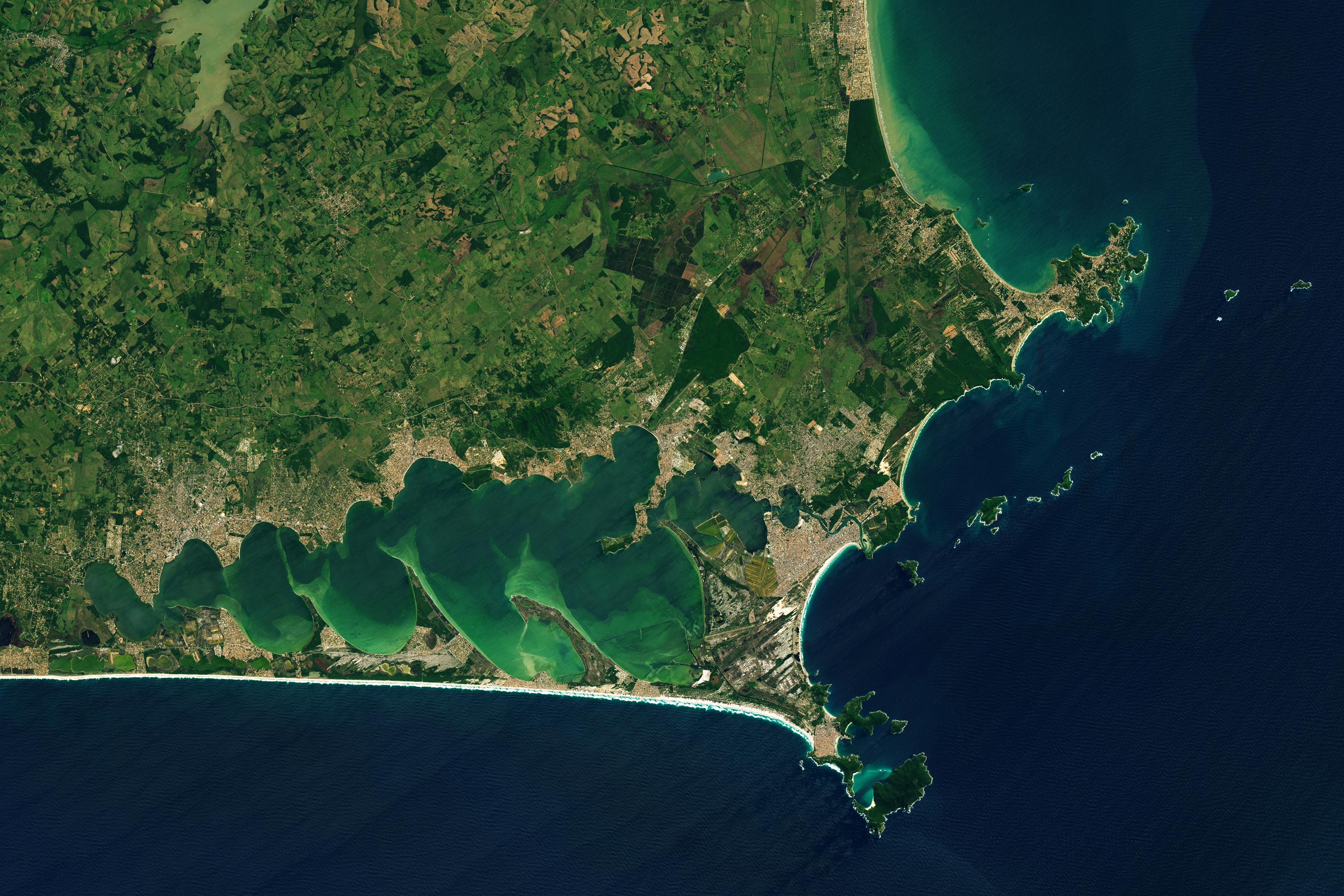
Now, NASA’s Landsat 9 satellite has captured a spectacular image of Cabo Frio’s unique coastline, taken on September 16, 2023. The satellite’s OLI-2 instrument shows just how diverse this region is—from rugged cliffs to shallow lagoons—and confirms the area’s chilly reputation.
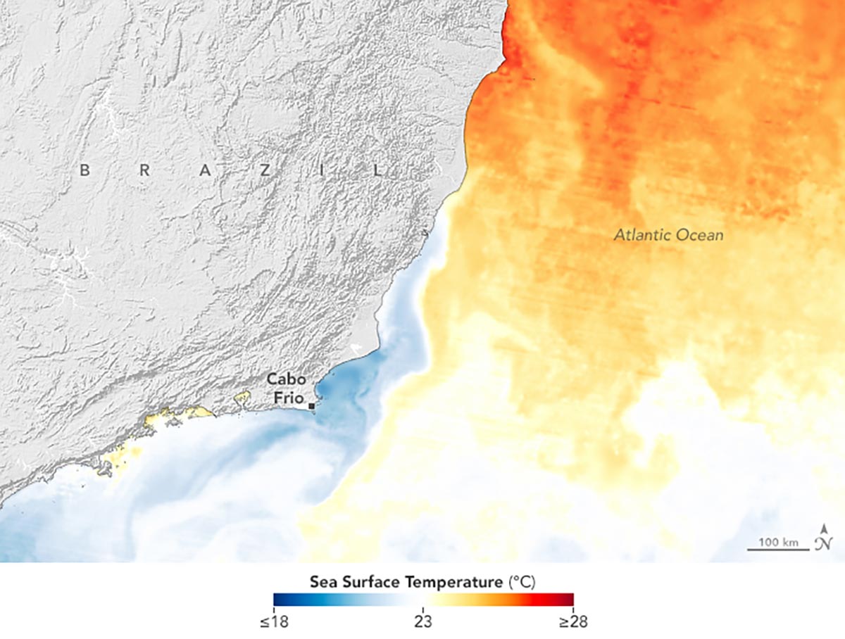
A temperature map (below) created from NASA’s Multiscale Ultrahigh Resolution Sea Surface Temperature (MUR SST) analysis shows cooler waters hugging the coast of Cabo Frio compared to the surrounding ocean. This cooling isn’t just a fluke—it’s a regular phenomenon caused by upwelling, where deeper, colder ocean water rises to the surface, dropping local temperatures by several degrees.
To create the map, scientists blended sea surface temperature data from a range of sources, including NASA, NOAA, international satellites, ships, and buoys. The land terrain was mapped using NASA’s Shuttle Radar Topography Mission, giving a detailed view of the region’s dramatic coastal geography.
The Forces Behind Cabo Frio’s Unique Climate
The upwelling is primarily caused by the prevailing winds. Strong northeasterly winds that blow along the coast for much of the year, especially in the spring and summer, push warm surface waters away from the shore. This allows cool waters from deeper in the ocean to rise to the surface. Upwelled water is typically rich in nutrients that fuel populations of phytoplankton, which in turn nourish marine ecosystems and contribute to Cabo Frio’s productive fisheries.
One model of Cabo Frio upwelling, developed by researchers in Germany and Brazil, indicates that the zone of cool water typically covers an area about 200 kilometers long and 20 kilometers wide (124 miles long and 12 miles wide), and has temperature gradients as large as 8 degrees Celsius (14 degrees Fahrenheit) over less than 10 kilometers. The findings were based in part on wind speed measurements from NASA’s QuikSCAT satellite that were incorporated into the analysis.
The first known use of the name “Cabo Frio” appears on Kunstmann III, the oldest known nautical chart that includes lines of latitude. The map, which dates to 1506 or possibly earlier, is thought to be based partly on expeditions to South America led by the Portuguese explorer Gonçalo Coelho and Italian navigator Amerigo Vespucci.
NASA Earth Observatory images by Lauren Dauphin, using Landsat data from the U.S. Geological Survey and data from the Multiscale Ultrahigh Resolution (MUR) project.
Never miss a breakthrough: Join the SciTechDaily newsletter.
Follow us on Google and Google News.