Close Menu
    Facebook X (Twitter) Instagram
    SciTechDaily
    • Biology
    • Chemistry
    • Earth
    • Health
    • Physics
    • Science
    • Space
    • Technology
    Facebook X (Twitter) Pinterest YouTube RSS
    SciTechDaily
    Home»Earth»Exploring Earth From Space: Mississippi River [Video]
    Earth

    Exploring Earth From Space: Mississippi River [Video]

    By European Space Agency (ESA)November 5, 2022No Comments4 Mins Read
    Facebook Twitter Pinterest Telegram LinkedIn WhatsApp Email Reddit
    Share
    Facebook Twitter LinkedIn Pinterest Telegram Email Reddit
    Mississippi River From Space
    The Mississippi River, one of the longest rivers in North America, is featured in this multi-temporal radar image captured by the Copernicus Sentinel-1 mission. Credit: Contains modified Copernicus Sentinel data (2022), processed by ESA, CC BY-SA 3.0 IGO

    The Mississippi River, a major river in the United States, is featured in this multi-temporal radar image captured by the Copernicus Sentinel-1 mission. It is the second-longest river in the U.S. (and all of North America), edged out by just a tiny bit by the Missouri River. It is the 11th longest river in the world.

    The Mississippi River is one of the world’s major river systems in size, habitat diversity, and biological productivity. The river flows 2,340 miles (3766 km) from its source at Lake Itasca in northern Minnesota through the center of the continental United States to the Gulf of Mexico.

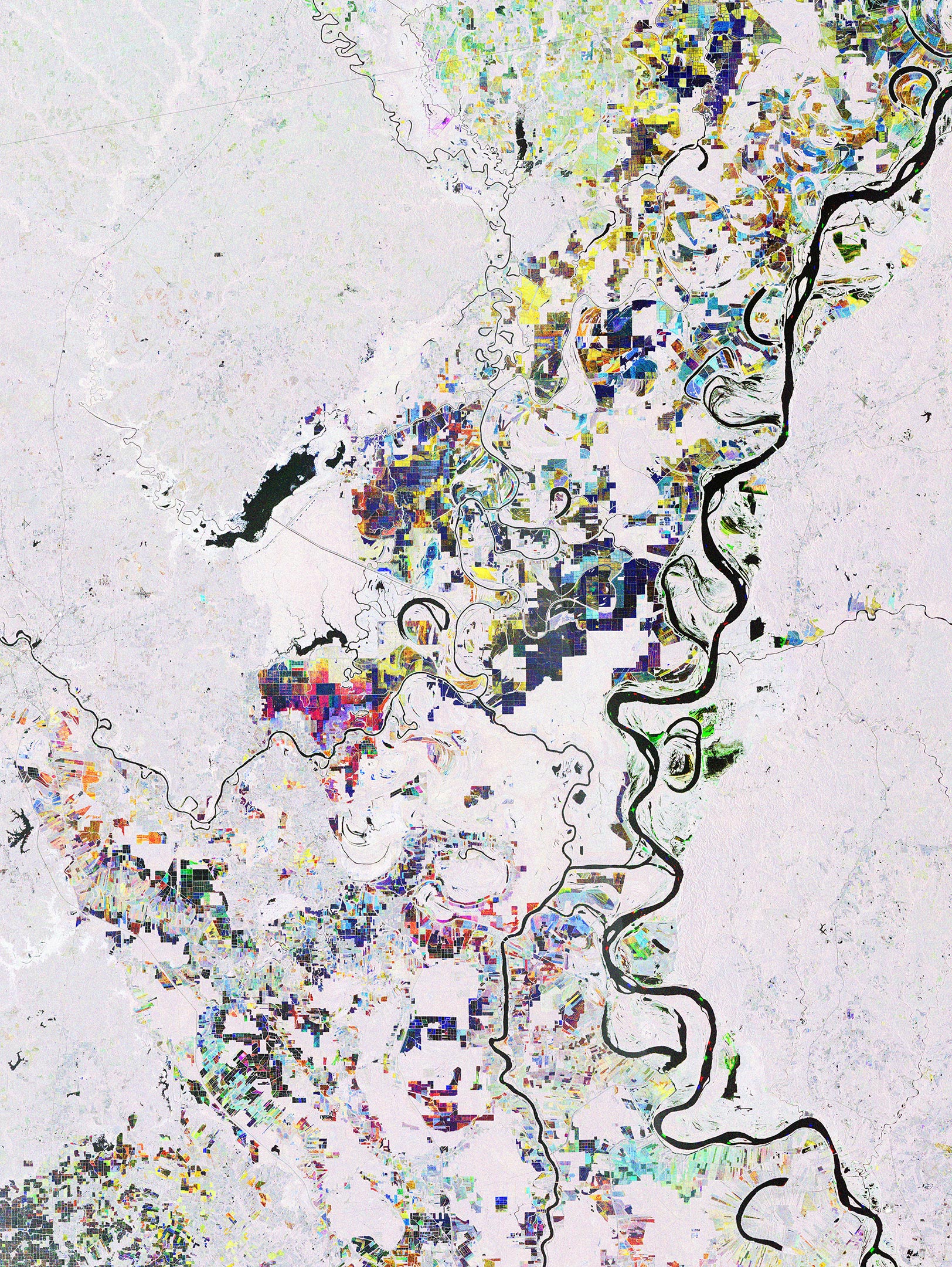
    The area pictured here shows where the Mississippi straddles the states of Louisiana and Mississippi. The image combines three radar acquisitions from the Sentinel-1 mission taken 12 days apart to show changes in crop and land conditions over time. Bright colors in the image come from changes on the ground that have occurred between acquisitions.

    Water bodies, including the Mississippi River, visible on the far right, and Catahoula Lake, on the far left, appear black as water surfaces reflect the radar signal away from the satellite. If we take a closer look, we can see cargo ships traveling along the Mississippi. Ships from April 7, 2022, appear in red, those from April 19 appear in green, and those from May 1 appear in blue.


    This episode of the Earth From Space program features a Copernicus Sentinel-1 radar image of the Mississippi River, one of the longest rivers in North America. Credit: ESA – European Space Agency

    White areas in the image indicate the various types of vegetation that surrounds the river, including the Kisatchie National Forest – the only national forest in Louisiana. The Mississippi is a classic example of a meandering alluvial river with its loops and curls along its path leaving behind meander scars, cutoffs, and free-standing ‘oxbow lakes’.

    The Mississippi River Basin is home to a variety of agricultural activities. Nutrient-rich soil from sediment deposits through the floodplain supports cropland close to the river and its tributaries. Rectangular fields in the image are cultivated land. The farming of cotton and soybean make up a significant portion of the area’s economic production.

    Sentinel-1 Radar Vision
    Copernicus Sentinel-1 carries an advanced synthetic aperture radar that works in several specialized modes to provide detailed imagery for Europe’s Copernicus program. These data will be used for applications such as monitoring the oceans, including shipping lanes, sea ice, and oil spills. It also provides data to map changing land cover, ground deformation, ice shelves, and glaciers, and can be used to help emergency response when disasters such as floods strike and to support humanitarian relief efforts at times of crisis. Credit: ESA/ATG medialab

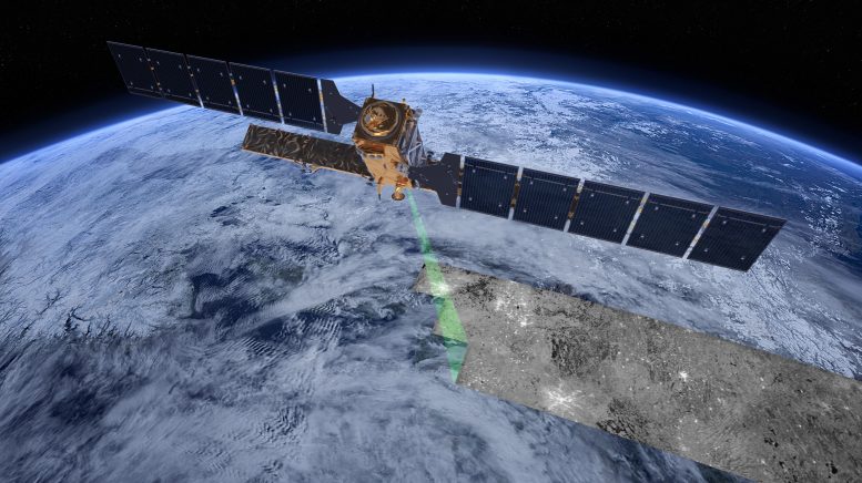
    Sentinel-1A was the first satellite to be launched for Copernicus – the Earth observation component of the European Union’s space program. Looking ahead, the upcoming Sentinel-1C satellite scheduled to lift off on ESA’s Vega-C rocket from Europe’s Spaceport in French Guiana in the first half of 2023, will continue the critical task of delivering key radar imagery for a wide range of services, applications, and science.

    The satellite is now at Thales Alenia Space’s Cannes plant on the French Riviera after it successfully completed all integration tests this summer in Rome, Italy. It will now undergo a final series of tests in Cannes, including radiofrequency performance checks in the facility’s anechoic chamber.

    This image is also featured on the episode of the Earth From Space video program embedded above.

    Never miss a breakthrough: Join the SciTechDaily newsletter.
    Follow us on Google and Google News.

    European Space Agency Geography
    Share. Facebook Twitter Pinterest LinkedIn Email Reddit

    Related Articles

    Breathtaking View of Andros, Bahamas From Space [Video]

    Stunning Views of Houston Texas From Copernicus Sentinel-1 Satellite

    Earth From Space: Bolivian Highland Heart [Video]

    Flevoland, Netherlands From Space: One of the Largest Land Reclamation Projects in the World

    Earth From Space: Lake George, Uganda – A Center for Biological Diversity [Video]

    Deforestation in Bolivia Spied From Space Satellite

    Earth From Space: Japanese Archipelago [Video]

    Earth From Space: Faroe Islands [Video]

    Earth From Space: Tromsø, Norway [Video]

    Leave A Reply Cancel Reply

    • Facebook
    • Twitter
    • Pinterest
    • YouTube

    Don't Miss a Discovery

    Subscribe for the Latest in Science & Tech!

    Trending News

    Popular Sugar-Free Sweetener Linked to Liver Disease, Study Warns

    What Is Hantavirus? The Deadly Disease Raising Alarm Worldwide

    Scientists Just Discovered How the Universe Builds Monster Black Holes

    Scientists Unveil New Treatment Strategy That Could Outsmart Cancer

    A Simple Vitamin May Hold the Key to Treating Rare Genetic Diseases

    Scientists Think the Real Fountain of Youth May Be Hiding in Your Gut

    Ravens Don’t Follow Wolves, They Predict Them

    This Common Knee Surgery May Be Doing More Harm Than Good

    Follow SciTechDaily
    • Facebook
    • Twitter
    • YouTube
    • Pinterest
    • Newsletter
    • RSS
    SciTech News
    • Biology News
    • Chemistry News
    • Earth News
    • Health News
    • Physics News
    • Science News
    • Space News
    • Technology News
    Recent Posts
    • Why Are So Many New Fathers Dying? Scientists Say the U.S. Has a Dangerous Blind Spot
    • Scientists Identify Simple Supplement That Greatly Reduces Alzheimer’s Damage
    • You May Have a Dangerous Type of Cholesterol Even if Your Tests Look Normal
    • Study Reveals Dangerous Flaw in AI Symptom Checkers
    • New MRI Breakthrough Captures Stunningly Clear Images of the Eye and Brain
    Copyright © 1998 - 2026 SciTechDaily. All Rights Reserved.
    • Science News
    • About
    • Contact
    • Editorial Board
    • Privacy Policy
    • Terms of Use

    Type above and press Enter to search. Press Esc to cancel.