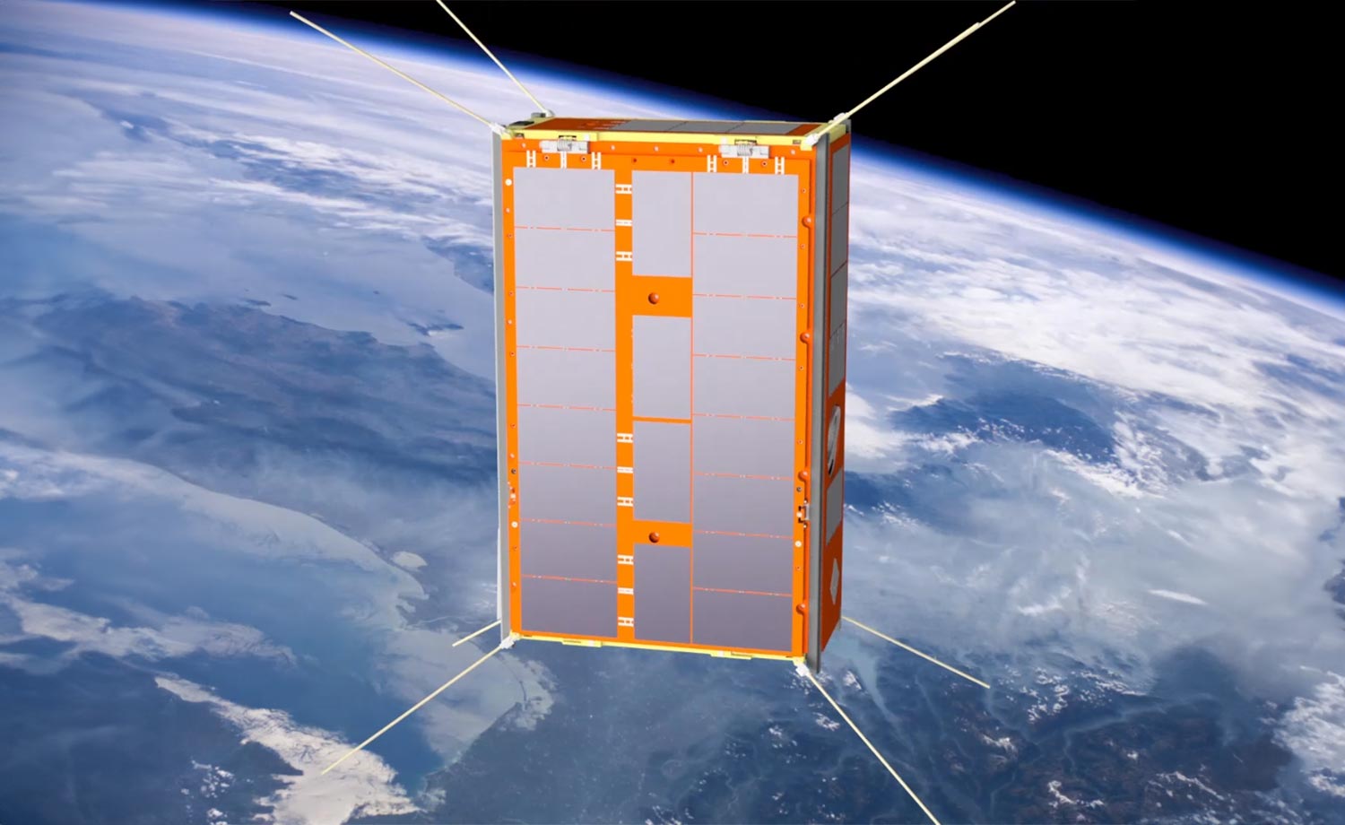
The cube satellite which will process complex imagery on board, enabling much faster detection of fires from space. Credit: SmartSatCRC, edited
Cube satellites with AI are revolutionizing bushfire detection in Australia by processing imagery from space quickly and efficiently. The technology is set to be operational by 2025 and may be commercialized to enhance early fire and disaster response.
Australian scientists are getting closer to detecting bushfires in record time, thanks to cube satellites with onboard AI. They’re now able to detect fires from space 500 times faster than traditional on-ground processing of imagery.
Remote sensing and computer science researchers have overcome the limitations of processing and compressing large amounts of hyperspectral imagery on board the smaller, more cost-effective cube satellites before sending it to the ground for analysis, saving precious time and energy.
AI-Powered Fire Detection
The breakthrough, using artificial intelligence, means that bushfires will be detected earlier from space, even before they take hold and generate large amounts of heat, allowing on-ground crews to respond more quickly and prevent loss of life and property.
A project funded by the SmartSat CRC and led by the University of South Australia (UniSA) has used cutting-edge onboard AI technology to develop an energy-efficient early fire smoke detection system for South Australia’s first cube satellite, Kanyini.
Launching the Kanyini Mission
The Kanyini mission is a collaboration between the SA Government, SmartSat CRC, and industry partners to launch a 6 U CubeSat satellite into low Earth orbit to detect bushfires as well as monitor inland and coastal water quality.
Equipped with a hyperspectral imager, the satellite sensor captures reflected light from Earth in different wavelengths to generate detailed surface maps for various applications, including bushfire monitoring, water quality assessment, and land management.
Enhancing Satellite Imaging and Processing
Lead researcher UniSA geospatial scientist Dr. Stefan Peters says that, traditionally, Earth observation satellites have not had the onboard processing capabilities to analyze complex images of Earth captured from space in real-time.
His team, which includes scientists from UniSA, Swinburne University of Technology, and Geoscience Australia, has overcome this by building a lightweight AI model that can detect smoke within the available onboard processing, power consumption, and data storage constraints of cube satellites.
Efficiency and Speed of AI Models
Compared to the on-ground based processing of hyperspectral satellite imagery to detect fires, the AI onboard model reduced the volume of data downlinked to 16% of its original size, while consuming 69% less energy.
The AI onboard model also detected fire smoke 500 times faster than traditional on-ground processing.
“Smoke is usually the first thing you can see from space before the fire gets hot and big enough for sensors to identify it, so early detection is crucial,” Dr Peters says.
Simulation and Training of AI Models
To demonstrate the AI model, they used simulated satellite imagery of recent Australian bushfires, using machine learning to train the model to detect smoke in an image.
“For most sensor systems, only a fraction of the data collected contains critical information related to the purpose of a mission. Because the data can’t be processed on board large satellites, all of it is downlinked to the ground where it is analyzed, taking up a lot of space and energy. We have overcome this by training the model to differentiate smoke from cloud, which makes it much faster and more efficient.”
Using a past fire event in the Coorong as a case study, the simulated Kanyini AI onboard approach took less than 14 minutes to detect the smoke and send the data to the South Pole ground station.
Future Prospects and Commercialization
“This research shows there are significant benefits of onboard AI compared to traditional on ground processing,” Dr Peters says. “This will not only prove invaluable in the event of bushfires but also serve as an early warning system for other natural disasters.”
The research team hopes to demonstrate the onboard AI fire detection system in orbit in 2025 when the Kanyini mission is operational.
“Once we have ironed out any issues, we hope to commercialize the technology and employ it on a CubeSat constellation, aiming to contribute to early fire detection within an hour.”
The researchers have published details of their experiment in the latest issue of IEEE Journal of Selected Topics in Applied Earth and Remote Sensing.
Reference: “Onboard AI for Fire Smoke Detection Using Hyperspectral Imagery: An Emulation for the Upcoming Kanyini Hyperscout-2 Mission” by Sha Lu, Eriita Jones, Liang Zhao, Yu Sun, Kai Qin, Jixue Liu, Jiuyong Li, Prabath Abeysekara, Norman Mueller, Simon Oliver, Jim O’Hehir and Stefan Peters, 29 April 2024, IEEE Journal of Selected Topics in Applied Earth and Remote Sensing.
DOI: 10.1109/JSTARS.2024.3394574


Be the first to comment on "How AI-Equipped CubeSats Are Outsmarting Wildfires"