Close Menu
    Facebook X (Twitter) Instagram
    SciTechDaily
    • Biology
    • Chemistry
    • Earth
    • Health
    • Physics
    • Science
    • Space
    • Technology
    Facebook X (Twitter) Pinterest YouTube RSS
    SciTechDaily
    Home»Earth»Meet the People Behind NASA’s Incredible New SWOT Water-Tracking Satellite
    Earth

    Meet the People Behind NASA’s Incredible New SWOT Water-Tracking Satellite

    By Jet Propulsion LaboratoryDecember 24, 2022No Comments5 Mins Read
    Facebook Twitter Pinterest Telegram LinkedIn WhatsApp Email Reddit
    Share
    Facebook Twitter LinkedIn Pinterest Telegram Email Reddit
    SWOT Above Earth (Illustration)
    This illustration depicts the Surface Water and Ocean Topography (SWOT) satellite, a mission led by NASA and the French space agency Centre National d’Études Spatiales (CNES). The scientific heart of the SWOT satellite is the Ka-band Radar Interferometer (KaRIn) instrument, which will measure the height of water in Earth’s lakes, rivers, reservoirs, and ocean. To do that, KaRIn will transmit radar pulses to Earth’s surface and use two antennas – seen to the left and right of the spacecraft bus – to triangulate the return signals that bounce back. Mounted at the ends of a boom 33 feet (10 meters) long, the antennas will collect data over two swaths of Earth’s surface at a time, each of them 30 miles (50 kilometers) wide and located on either side of the satellite. KaRIn will operate in two modes: A lower-resolution mode over the ocean will involve significant onboard processing of the data to reduce the volume of information sent during downlinks to Earth; a higher-resolution mode will be used mainly over land. Credit: NASA/JPL-Caltech

    A new video series highlights the hard work and passion of scientists and engineers who helped get this remarkable new satellite off the ground.

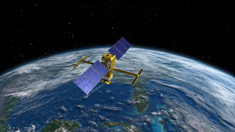
    On December 16, 2022, the international Surface Water and Ocean Topography (SWOT) mission launched aboard a SpaceX Falcon 9 rocket from Space Launch Complex 4E at Vandenberg Space Force Base in California. A new video series focuses on some of the engineers and scientists behind the satellite, which will be the first to observe nearly all water on Earth’s surface.

    Led by NASA and the French space agency Centre National d’Études Spatiales (CNES), SWOT will measure the height of water in lakes, rivers, reservoirs, and the ocean. The SUV-size satellite will improve scientists’ ability to track the movement of water around the world while providing data that will help communities monitor and plan for changing water resources.

    People Behind SWOT
    Clockwise from top left, Tahani Amer, Marc Simard, Christine Gebara, and Cedric David are the subjects of a new video series about the NASA engineers and scientists who work on the Surface Water and Ocean Topography (SWOT) satellite, which will track most of Earth’s water. Credit: NASA/JPL-Caltech

    In addition, the mission will boost scientists’ understanding of how sea level rise will affect coastlines around the world and the people who live near them. SWOT will also see ocean features too small for current space-based instruments to detect, improving researchers’ understanding of their role in climate change.

    Watch the series trailer here:


    Meet some of the scientists and engineers contributing to a new Earth science mission, led by NASA and the French space agency Centre National d’Études Spatiales (CNES). The Surface Water and Ocean Topography (SWOT) satellite will make the first global survey of nearly all water on Earth’s surface. Credit: NASA/JPL-Caltech

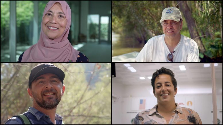
    More than a machine, SWOT is the culmination of years of work by a global team of engineers, scientists, and technicians committed to improving our understanding of our home planet. In this video series, you can meet team members from NASA’s Jet Propulsion Laboratory in Southern California, which manages the U.S. portion of the mission, and from the agency’s headquarters in Washington as they explain why working on SWOT means so much to them:

    Cedric David

    Cedric David, a hydrologist who studies the world’s rivers, shares how water is the only place he feels truly comfortable because of physical challenges. As Cedric notes, SWOT will provide a global picture of freshwater resources and help improve water management, which is why he is so proud to help make a difference in protecting this precious resource.

    Christine Gebara

    Christine Gebara, a mechanical engineer who helped test and integrate the spacecraft, tells the story of how she fell in love with engineering while learning to sail with the Girl Scouts on a lake near her childhood home in Houston. She reveals what inspires her most about building a spacecraft and offers advice for young women interested in engineering.

    Tahani Amer

    Tahani Amer, the mission’s program executive, recalls growing up near Cairo, where her father encouraged her to study math and science – an atypical pursuit for young women in Egypt at the time. Today, she oversees several NASA Earth science missions, including SWOT. In the video, Amer shares how she’s been inspired by her Islamic faith, her family, and her colleagues.

    Marc Simard

    Marc Simard, a scientist who studies river deltas where they meet the ocean, discusses how he developed a passion for the environment in college, switching from a planned career in astrophysics to developing tools to study Earth. One of Simard’s favorite things about SWOT is that its data will help scientists better understand how sea level rise will affect coastal deltas around the world.

    Never miss a breakthrough: Join the SciTechDaily newsletter.
    Follow us on Google and Google News.

    JPL NASA Sea Level SWOT Water
    Share. Facebook Twitter Pinterest LinkedIn Email Reddit

    Related Articles

    Game-Changing Satellite Unlocks Water Secrets in the Ohio River Basin

    SWOT Mission: See an Unprecedented View of Global Sea Levels [Video]

    NASA SWOT Water Mission To Gauge Alaskan Rivers on Front Lines of Climate Change

    How SWOT Will Look at the World’s Water: 5 Things To Know

    Latest International Water Satellite Packs Powerful Engineering Punch

    U.S.-European Sentinel-6 Sea Level Satellite Gears Up for Launch

    Sentinel-6 Michael Freilich Is Set for Launch in Weeks – 5 Things to Know

    New NASA Research Projects Probe COVID-19 Impacts on Environment, Food & Water Supply

    GRACE Data Spreads Awareness of Groundwater Levels

    Leave A Reply Cancel Reply

    • Facebook
    • Twitter
    • Pinterest
    • YouTube

    Don't Miss a Discovery

    Subscribe for the Latest in Science & Tech!

    Trending News

    Breakthrough Bowel Cancer Trial Leaves Patients Cancer-Free for Nearly 3 Years

    Natural Compound Shows Powerful Potential Against Rheumatoid Arthritis

    100,000-Year-Old Neanderthal Fossils in Poland Reveal Unexpected Genetic Connections

    Simple “Gut Reset” May Prevent Weight Gain After Ozempic or Wegovy

    2.8 Days to Disaster: Scientists Warn Low Earth Orbit Could Suddenly Collapse

    Common Food Compound Shows Surprising Power Against Superbugs

    5 Simple Ways To Remember More and Forget Less

    The Atomic Gap That Could Cost the Semiconductor Industry Billions

    Follow SciTechDaily
    • Facebook
    • Twitter
    • YouTube
    • Pinterest
    • Newsletter
    • RSS
    SciTech News
    • Biology News
    • Chemistry News
    • Earth News
    • Health News
    • Physics News
    • Science News
    • Space News
    • Technology News
    Recent Posts
    • Scientists Print Artificial Neurons That Can Talk to the Brain
    • Bowel and Ovarian Cancers Are Dramatically Rising in Young Adults and Scientists Aren’t Sure Why
    • Alzheimer’s May Begin Decades Earlier Than You Think, New Mayo Clinic Study Finds
    • The Hidden Risk of Taking Breaks From Weight-Loss Drugs Like Ozempic
    • Total Solar Eclipse Made Cities Go Eerily Quiet Beneath the Surface
    Copyright © 1998 - 2026 SciTechDaily. All Rights Reserved.
    • Science News
    • About
    • Contact
    • Editorial Board
    • Privacy Policy
    • Terms of Use

    Type above and press Enter to search. Press Esc to cancel.