Close Menu
    Facebook X (Twitter) Instagram
    SciTechDaily
    • Biology
    • Chemistry
    • Earth
    • Health
    • Physics
    • Science
    • Space
    • Technology
    Facebook X (Twitter) Pinterest YouTube RSS
    SciTechDaily
    Home»Space»Moreux Crater: The Dark Dunes of Mars in Stunning Imagery From Mars Express Orbiter
    Space

    Moreux Crater: The Dark Dunes of Mars in Stunning Imagery From Mars Express Orbiter

    By ESA - European Space AgencyMarch 8, 20202 Comments6 Mins Read
    Facebook Twitter Pinterest Telegram LinkedIn WhatsApp Email Reddit
    Share
    Facebook Twitter LinkedIn Pinterest Telegram Email Reddit
    Dark Dunes of Moreux Crater
    This image of the Moreux crater in the Terra Sabaea region of Mars comprises data gathered on October 30, 2019, during orbit 20014. The ground resolution is approximately 16 m/pixel and the images are centered at about 44°E/42°N. This image was created using data from the nadir and color channels of the High Resolution Stereo Camera (HRSC). The nadir channel is aligned perpendicular to the surface of Mars, as if looking straight down at the surface. North is to the right. ESA/DLR/FU Berlin, CC BY-SA 3.0 IGO

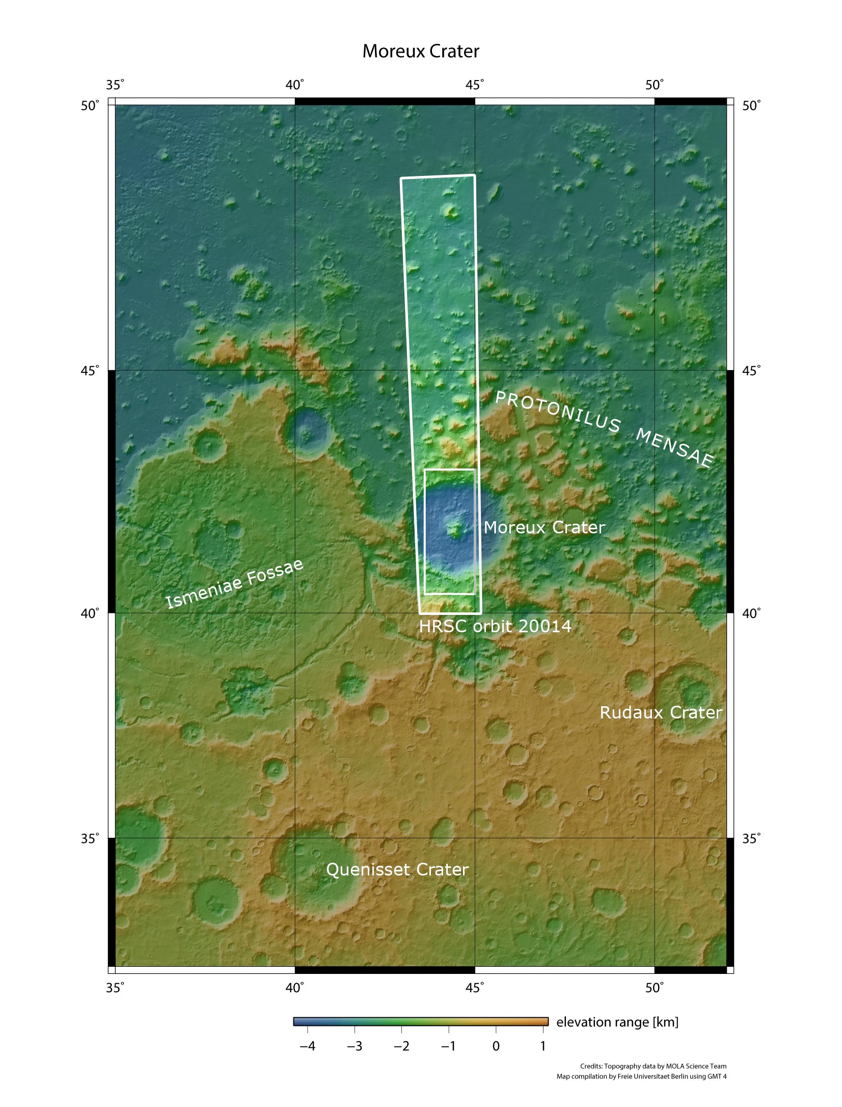
    Known for its wide swathes of rippling, textured, gently sloping dunes, the Terra Sabaea region on Mars is home to many fascinating geological features – including the prominent Moreux crater, the star of a new image from ESA’s Mars Express.

    The Moreux crater on Mars showcases numerous intriguing geological processes and features. It sits at the northern edge of Terra Sabaea, a large area of the Red Planet that is speckled with impact craters and covered in glacial flows, dunes, fretted terrain and intricate ridge networks.

    Moreux Crater Topography
    This color-coded topographic image shows a feature on Mars’ surface named Moreux crater, based on data gathered by the Mars Express High Resolution Stereo Camera on 30 October 2019 during orbit 20014. This view is based on a digital terrain model (DTM) of the region, from which the topography of the landscape can be derived; lower parts of the surface are shown in blues and purples, while higher altitude regions show up in whites, yellows and reds, as indicated on the scale to the bottom left. North is to the right. Credit: ESA/DLR/FU Berlin, CC BY-SA 3.0 IGO

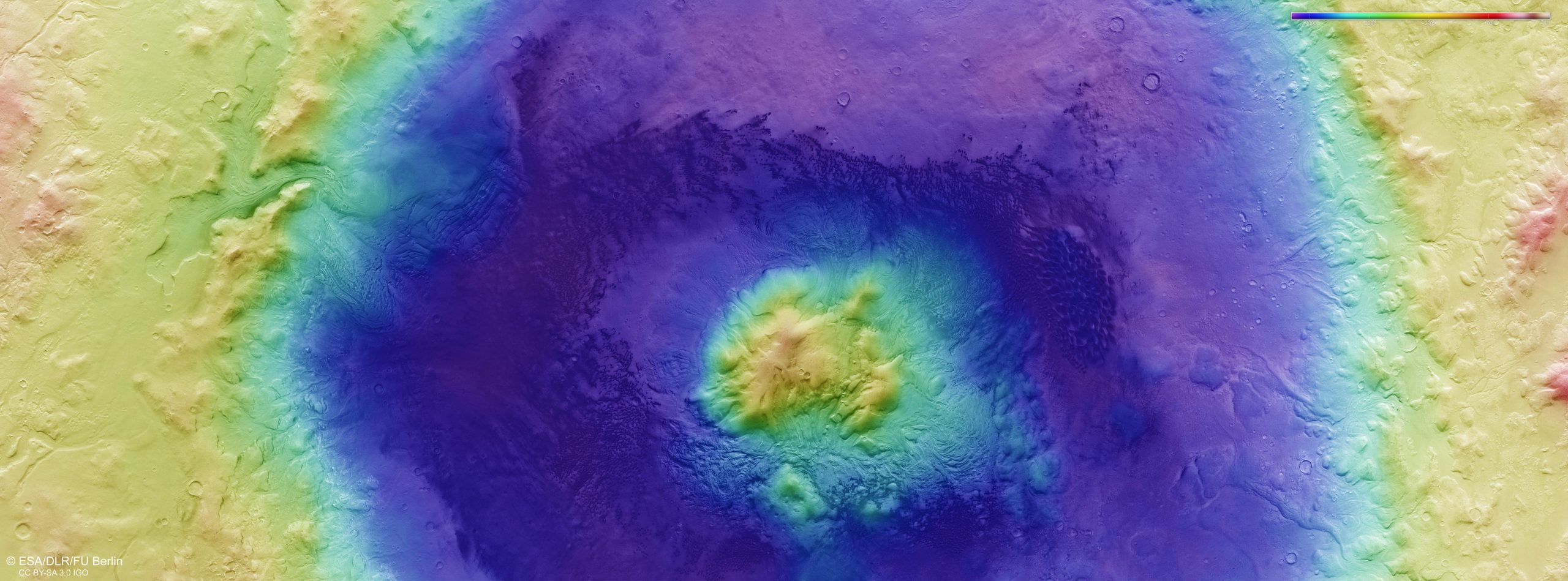
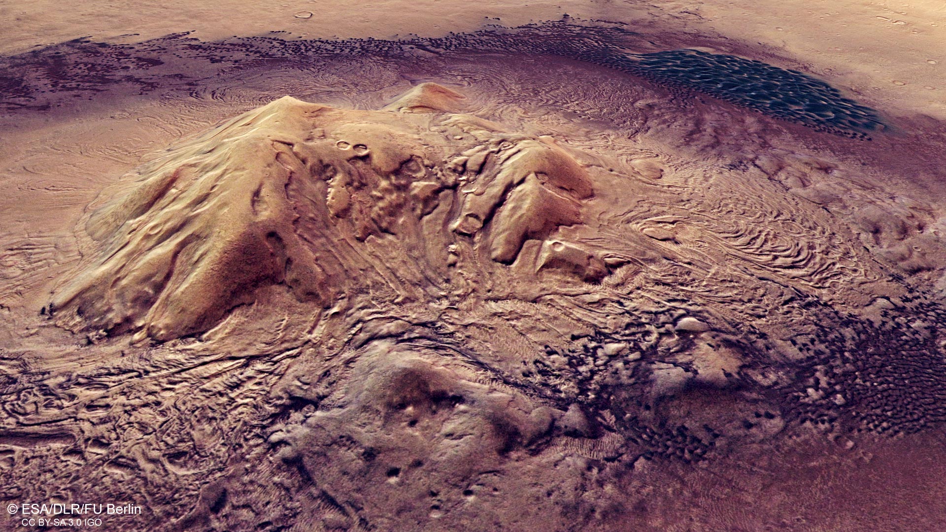
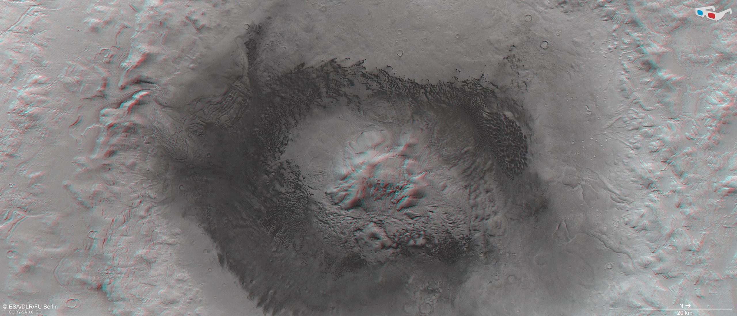
    When compared to other impact craters on both Mars and Earth, Moreux crater appears a little misshapen and messy – the result of ongoing erosion over martian history. Its egg-shaped rim is broken up, its dark walls are ridged, rippled, and mottled, and its center features a prominent clustered ‘peak’, created as material from the crater floor rebounded and rose upwards following the initial impact.

    It is difficult to get a sense of scale when viewing this peak from orbit, but Moreux crater’s central peak is sizeable, reaching around two kilometers in height. The crater itself is roughly three kilometers (2 miles) deep, and spans 135 kilometers (84 miles) from edge to edge.

    Moreux Crater Perspective View
    The perspective view image of Mars’ Moreux crater was created using data from the nadir and color channels of the High Resolution Stereo Camera (HRSC). The nadir channel is aligned perpendicular to the surface of Mars, as if looking straight down at the surface. Credit: ESA/DLR/FU Berlin, CC BY-SA 3.0 IGO

    The range of colors featured in images like this one, taken by the High Resolution Stereo Camera on Mars Express, reveals much about the composition of a particular region, material, or feature.

    In the case of Moreux crater, the color differences are stark: while the surrounding material is visible in hues of butterscotch and caramel, the crater’s walls are dark, resembling a smudged ring of ash or charcoal. Dark brown and black dunes cover the crater floor, while the peak remains a pale yellow-orange. Dark, prominent ejecta, comprising material flung outwards during the crater-forming collision, spread outwards from the crater rim, discoloring and encroaching upon the lighter surrounding terrain.

    Perspective View Moreux Crater
    The image was created using data from the nadir and color channels of the High Resolution Stereo Camera (HRSC). The nadir channel is aligned perpendicular to the surface of Mars, as if looking straight down at the surface. Credit:
    ESA/DLR/FU Berlin, CC BY-SA 3.0 IGO

    This varied color palette reflects an equally varied geological composition. The dunes within and around the crater are thought to contain sandy material rich in pyroxene and olivine: rock-forming minerals that are mafic (containing magnesium and iron) and characterized by their typically dark appearance.

    Martian winds are also thought to have swept and gathered fine, basaltic, volcanic sand and ash into and around the crater. Basaltic rock is commonplace on both Mars and other celestial bodies. It is a key component of the maria, or seas, on the Moon, for instance, and causes them to appear visibly and notably darker than the lunar highlands.

    Moreux Crater Context
    This image shows a feature on Mars’ surface named Moreux crater in wider context. The area outlined by the bold white box indicates the area imaged by the Mars Express High Resolution Stereo Camera on 30 October 2019 during orbit 20014. Credit: NASA MGS MOLA Science Team

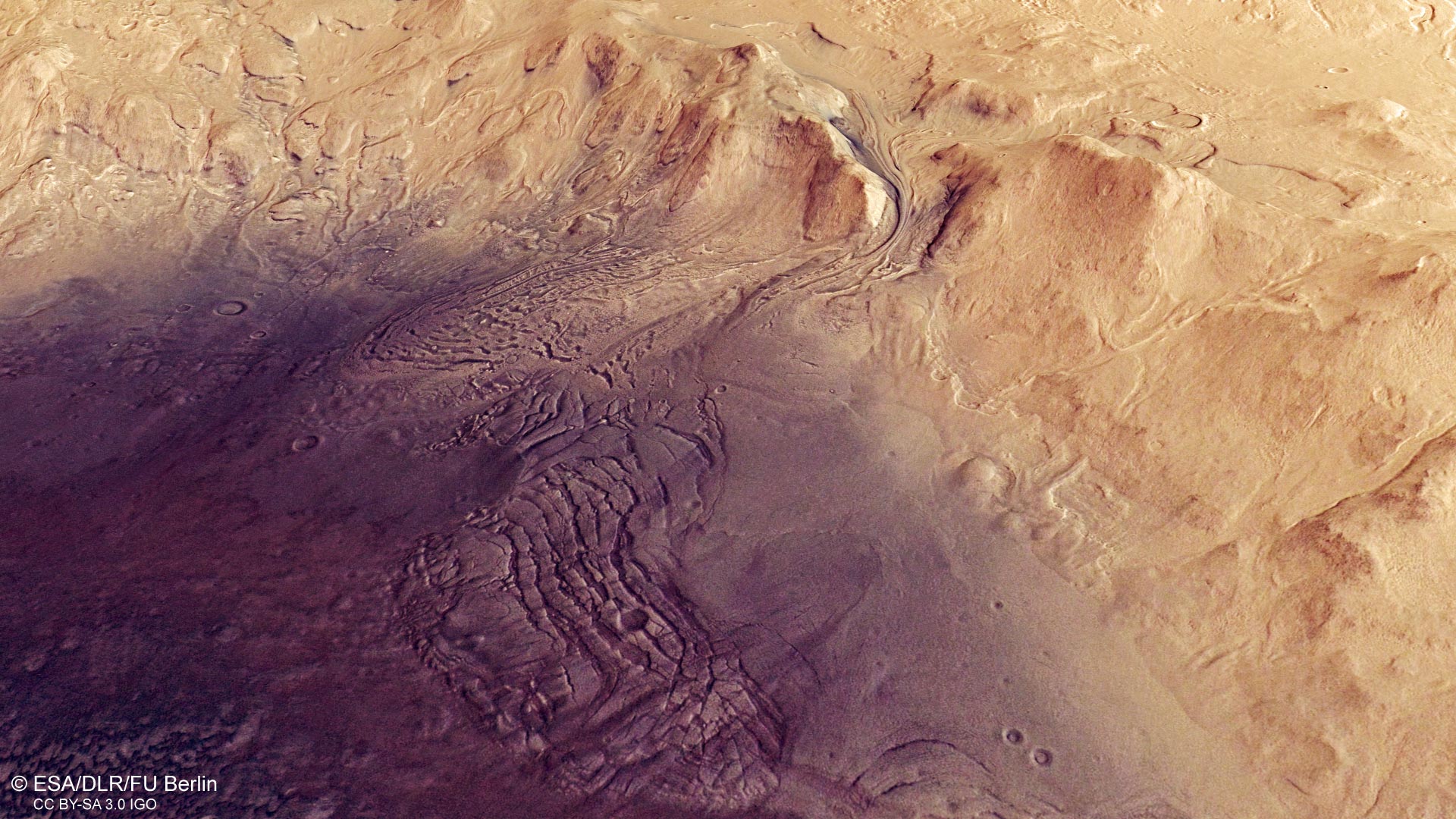
    Many of the features, such as dunes and flows, surrounding the central peak and southern region of Moreux crater (to the left of the image) appear to have been formed by ice. This is thought to have occurred in the form of substantial episodes of glacial activity over the past few million years.

    Many other features show signs of wind erosion, or having been formed via wind-related processes – most notably, the dunes covering the crater floor. These dunes are largely sickle-shaped (barchanoid), and reveal much about wind direction within and across the crater.

    Moreux Crater 3D
    This image shows a feature on Mars’ surface named Moreux crater in 3D when viewed using red-green or red-blue glasses. This anaglyph was derived from data obtained by the nadir and stereo channels of the High Resolution Stereo Camera (HRSC) on ESA’s Mars Express during spacecraft orbit 20014. It covers a part of the martian surface centered at about 44°E/42°N. North is to the right. Credit: ESA/DLR/FU Berlin, CC BY-SA 3.0 IGO

    From the orientation of the dunes, scientists have inferred a complex system of prevailing winds, likely influenced by the topography of the crater itself. Dunes to the north and east of the central peak are largely influenced by winds coming from the northeast, while dunes sitting west of the park are controlled by winds from the northwest.

    These cross-cutting winds create an interesting and unique dune morphology within Moreux crater, adding to the feature’s intrigue.

    Never miss a breakthrough: Join the SciTechDaily newsletter.
    Follow us on Google and Google News.

    European Space Agency Geology Mars Mars Express Popular
    Share. Facebook Twitter Pinterest LinkedIn Email Reddit

    Related Articles

    Solving a Martian Mystery: Mars Express Unlocks the Secrets of Strange Recurring Cloud

    NASA’s Mars 2020 Perseverance Rover Is About to Land on the Red Planet – It Will Have Some Help From These Mars Orbiters

    Creating Chaos: Craters, Cracks, and Collapse on Mars

    Dreaming of a Red Christmas: Festive Silhouettes Spotted Near Mars’ South Pole

    Intriguing Martian Scars: An Ancient Crater Triplet on Mars

    Mars Express Spacecraft Has Discovered Liquid Water Ponds Buried Under the Martian Surface

    Mysteriously Long, Thin Cloud Returns on Mars – Not Linked to Volcanic Activity

    View a Stunning Flight Over Korolev Crater on Mars via Mars Express

    Nilosyrtis Mensae, Mars: Dramatically Different Regions of the Red Planet Come Together as One

    2 Comments

    1. Durward on March 9, 2020 5:58 am

      It would be funny except for the massive theft that goes with these frauds.

      Reply
      • Bruzote on August 14, 2020 5:37 pm

        No fraud. Just a lot money that maybe the taxpayer had no real support for paying. The images are as real as the images from the first weather satellites. Back then, losers would claim space satellites were a hoax as well.

        Reply
    Leave A Reply Cancel Reply

    • Facebook
    • Twitter
    • Pinterest
    • YouTube

    Don't Miss a Discovery

    Subscribe for the Latest in Science & Tech!

    Trending News

    Millions of People Have Osteopenia Without Realizing It – Here’s What You Need To Know

    Researchers Discover Boosting a Single Protein Helps the Brain Fight Alzheimer’s

    World-First Study Reveals Human Hearts Can Regenerate After a Heart Attack

    Why Your Dreams Feel So Real Sometimes and So Strange Other Times

    This Simple Home Device May Boost Brain Power in Adults Over 40

    Enormous Prehistoric Insects Puzzle Scientists

    Scientists Develop Bioengineered Chewing Gum That Could Help Fight Oral Cancer

    After 37 Years, the World’s Longest-Running Soil Warming Experiment Uncovers a Startling Climate Secret

    Follow SciTechDaily
    • Facebook
    • Twitter
    • YouTube
    • Pinterest
    • Newsletter
    • RSS
    SciTech News
    • Biology News
    • Chemistry News
    • Earth News
    • Health News
    • Physics News
    • Science News
    • Space News
    • Technology News
    Recent Posts
    • Scientists Stunned by New Organic Molecules Found on Mars
    • Scientists Discover Evolution’s 120-Million-Year-Old “Cheat Sheet”
    • This New “Sound Laser” Could Measure Gravity With Stunning Precision
    • Quantum Breakthrough: New Algorithm Solves “Impossible” Materials in Seconds
    • Could the Universe’s Hidden Shape Solve One of Physics’ Biggest Mysteries?
    Copyright © 1998 - 2026 SciTechDaily. All Rights Reserved.
    • Science News
    • About
    • Contact
    • Editorial Board
    • Privacy Policy
    • Terms of Use

    Type above and press Enter to search. Press Esc to cancel.