Powerful Earth-observing instruments aboard NASA’s Terra and Aqua satellites, launched in 1999 and 2002, respectively, have observed nearly two decades of planetary change. Now, for the first time, all that imagery — from the first operational image to imagery acquired today — is available for exploration in Worldview.
Thanks to the efforts of several NASA teams, the public can now interactively browse all global imagery from the Moderate Resolution Imaging Spectroradiometer (MODIS) instrument quickly and easily from the comfort of a home computer. All global MODIS imagery dating back to the operational start of MODIS in 2000 is available through NASA’s Global Imagery Browse Services (GIBS) for viewing using NASA’s Worldview application. And there’s a lot to see.
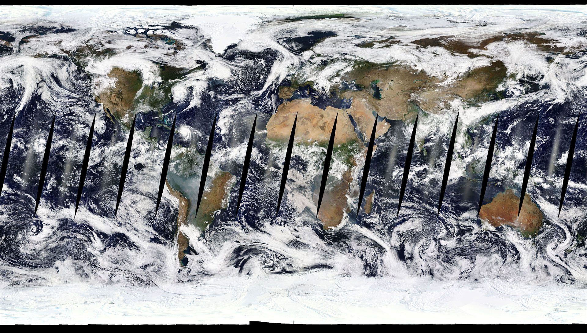
Two decades of planetary change are available to explore in NASA’s Worldview. Detailed views of volcanoes fuming, hurricanes flooding, dams being built and wildfires sweeping across landscapes are just some of the data accessible. Credit: NASA’s Goddard Space Flight Center/ LK Ward
This achievement is the result of more than a half-decade of work and represents the longest continuous daily global satellite observation record of Earth ever compiled. For researchers, the ability to rapidly access and explore all MODIS global imagery greatly improves their use of these data.
“In the ’80s and ’90s, if you wanted to look at, say, clouds off the coast of California, you had to figure out the time of year when it was best to look at these clouds, then place a data request for a specific window of days when you thought the satellite overflew the area,” says Santiago Gassó, an associate research scientist with NASA’s Goddard Earth Sciences Technology And Research program at Morgan State University, Baltimore. “You would get a physical tape with these images and have to put this into the processing system. Only then would you know if the image was usable. This process used to take from days to weeks. Now, you can look at images for days, weeks, and even years in a matter of minutes in Worldview, immediately find the images you need, and download them for use. It’s fantastic!”
Daily MODIS global images have been produced since the public debut of Worldview in 2012. But data users wanted more. “Users said to us, ‘We know you have the source data available, and we’d like to see it as imagery in Worldview,’” says Ryan Boller, the EOSDIS data visualization lead and Worldview Project owner.
GIBS provides access to more than 600 satellite imagery products covering every part of the world. Worldview pulls imagery from GIBS and allows users to interactively overlay all of these data products on top of a MODIS global base map from Terra or Aqua. Worldview users can even create data animations at the touch of a button and easily share imagery. Both GIBS and Worldview are part of NASA’s Earth Observing System Data and Information System (EOSDIS), which provides end-to-end capabilities for managing NASA Earth-observing data.
The completion of this effort gives NASA’s worldwide audience the ability to interactively view their world their way and interactively explore almost 20 years of planetary change. As Boller observes, “To be able to go from the very start, from the very first image, to the present and move forward provides not only a sense of completeness, but also the potential for new discoveries.”
Never miss a breakthrough: Join the SciTechDaily newsletter.
Follow us on Google and Google News.