The Moon’s contraction causes fault scarps and moonquakes in the south pole, posing risks for lunar outposts.
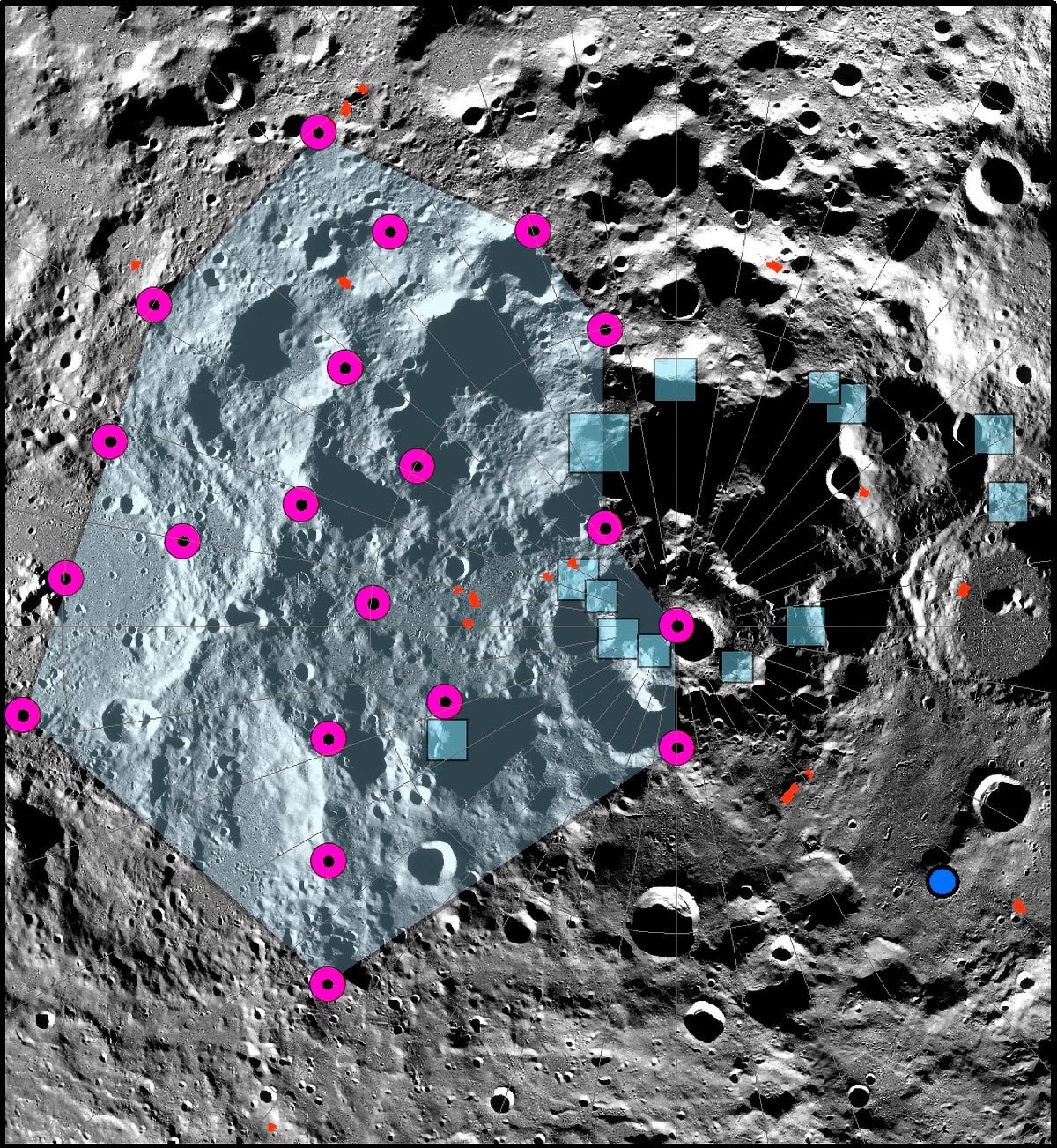
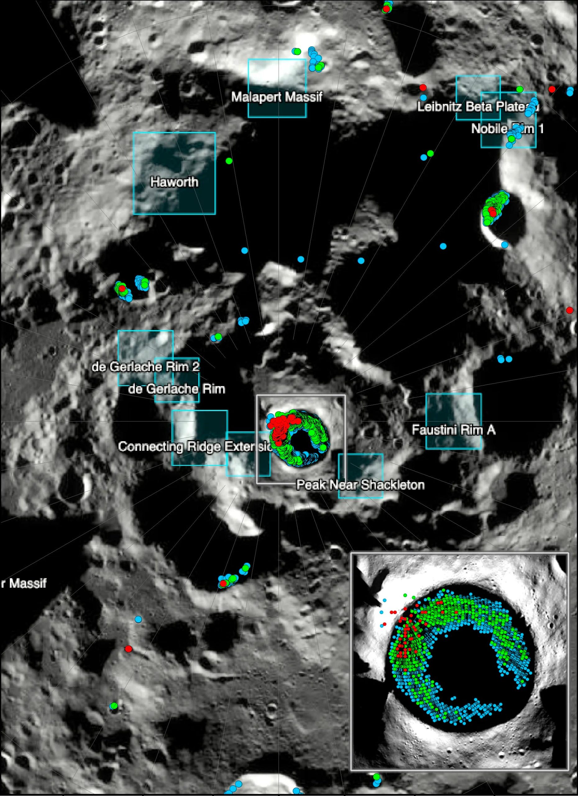
Findings from a recently published paper led by Smithsonian senior scientist emeritus Thomas R. Watters reveal evidence that the south polar region of Earth’s moon has experienced the effects of the shrinking moon. Global contraction of the moon has caused young lobate thrust fault scarps near and within some regions NASA has proposed for the crewed Artemis III moon landing.
The paper, “Tectonics and Seismicity of the Lunar South Polar Region,” published recently in the Planetary Science Journal, associates one of the most powerful moonquakes recorded by Apollo seismometers with a young polar thrust fault scarp, and it presents new models on the strength of shaking from its formation. Models of the stability of sloping surfaces in the lunar south polar region suggest that some areas are vulnerable to landslides from regional seismic shaking. The possibility of strong seismic shaking should be considered in plans for locating and building permanent lunar outposts.
Lunar Crust’s Contraction and Fault Formation
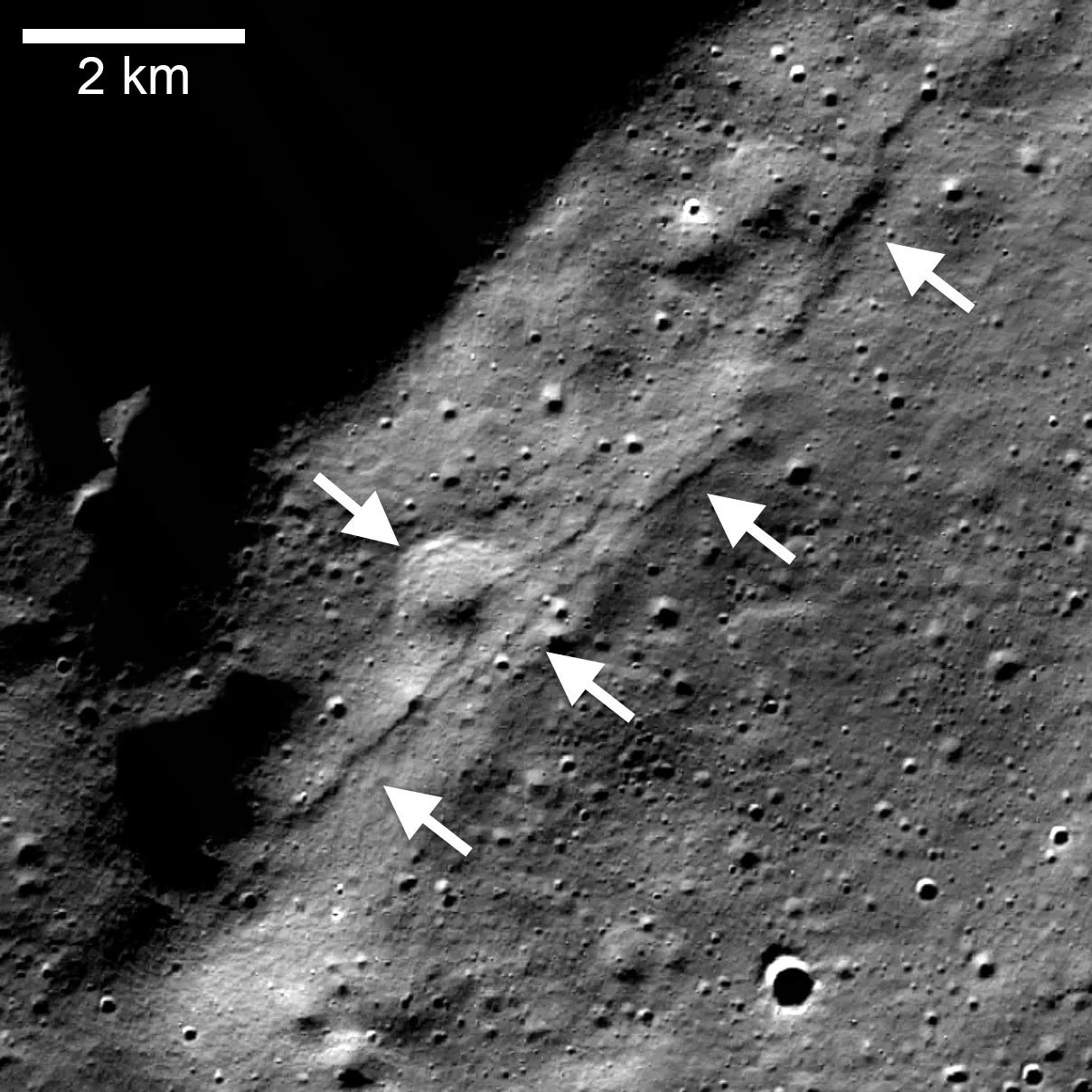
The Lunar Reconnaissance Orbiter Camera onboard the Lunar Reconnaissance Orbiter has detected thousands of relatively small, young thrust faults widely distributed in the lunar crust. The scarps are cliff-like landforms that resemble small stairsteps on the lunar surface. They form where contractional forces break the crust and push or thrust it on one side of the fault up and over the other side. The contraction is caused by cooling of the moon’s still-hot interior and tidal forces exerted by Earth, resulting in global shrinking.
The formation of the faults is accompanied by seismic activity in the form of shallow-depth moonquakes. Such shallow moonquakes were recorded by the Apollo Passive Seismic Network, a series of seismometers deployed by the Apollo astronauts over 50 years ago. The strongest recorded shallow moonquakes had an epicenter in the south-polar region.
One young thrust fault scarp, located within the de Gerlache Rim 2 Artemis III candidate landing region, is modeled and shows that the formation of this fault scarp could have been associated with a moonquake of the recorded magnitude (Richter equivalent magnitude of about 5).
Implications for Lunar Settlements
Modeling the stability of surface slopes in the lunar south polar region indicates that some areas are susceptible to regolith (loose rock) landslides from even light seismic shaking, including areas in some permanently shadowed regions.
“Our modeling suggests that shallow moonquakes capable of producing strong ground shaking in the south polar region are possible from slip events on existing faults or the formation of new thrust faults,” said Watters, a senior scientist emeritus in the National Air and Space Museum’s Center for Earth and Planetary Studies.
“The global distribution of young thrust faults, their potential to be active, and the potential to form new thrust faults from ongoing global contraction should be considered when planning the location and stability of permanent outposts on the moon.”
For more on this study:
Reference: “Tectonics and Seismicity of the Lunar South Polar Region” by T. R. Watters, N. C. Schmerr, R. C. Weber, C. L. Johnson, E. J. Speyerer, M. S. Robinson and M. E. Banks, 25 January 2024, The Planetary Science Journal.
DOI: 10.3847/PSJ/ad1332
Watters is a co-investigator on the Lunar Reconnaissance Orbiter Camera (Mark S. Robinson, Arizona State University, is the principal investigator). This research was funded by NASA’s Lunar Reconnaissance Orbiter mission, launched June 18, 2009. The Lunar Reconnaissance Orbiter is managed by NASA’s Goddard Space Flight Center for the Science Mission Directorate at NASA Headquarters in Washington, D.C.
Never miss a breakthrough: Join the SciTechDaily newsletter.
Follow us on Google and Google News.