Online bathymetric dataset will help decision-makers manage water resources.
Lakes and reservoirs have a profound influence on ecosystem functions, local streamflow levels, and the movement of water across landscapes. But water managers often are in the dark when it comes to subsurface topography, which affects the ecology, volume, temperature, and rate of evaporation of a waterbody, as well as inflows and outflows.
Now a team of scientists has developed artificial intelligence techniques to create a publicly available dataset of the underwater topography, or bathymetry, of more than 1.4 million inland lakes and reservoirs around the world. This information can enable water managers and other decision-makers to better anticipate issues ranging from the availability of water for cities and farms to ecological changes in wetlands.
“This dataset gives lake modelers and ecologists a more realistic depiction of a waterbody,” said Bahram Khazaei, who led the creation of the database as a postdoctoral researcher at the National Center for Atmospheric Research (NCAR). “In order to better understand the aquatic systems dynamics and properties of freshwater resources, we need to know more about the geophysical characteristics of what lies beneath the surface.”
The Global Lakes Bathymetry Dataset, or GLOBathy, can be accessed online.
Estimating Bathymetry With Machine Learning
Most of Earth’s accessible surface freshwater is stored in more than 100 million lakes and reservoirs. Any changes to their volumes or discharges can affect both the availability and quality of water, with far-reaching impacts on people and ecosystems. In order to better understand potential changes to the waterbodies, scientists need computer models that can accurately represent their physical characteristics.
Khazaei, who now works for NOAA’s National Ocean Service, became interested in creating a bathymetry dataset when working on NOAA’s National Water Model, which provides detailed predictions of streamflow across the United States. As he focused on improving simulations of water levels in rivers and streams, he needed more information about the geophysical characteristics of lakes and reservoirs. Researchers have used advances in Geographic Information Systems (GIS), airborne LiDAR, and other technologies to map the underwater topography of thousands of lakes and reservoirs, but they lack the capability to determine the bathymetry of millions of others.
To estimate the bathymetry of additional lakes and reservoirs, Khazaei and his collaborators turned to a comprehensive dataset known as HydroLAKES. This provided them with an extensive list of the geophysical characteristics of more than 1.4 million waterbodies worldwide, including shoreline length, surface area, volume, watershed area, elevation, and more.
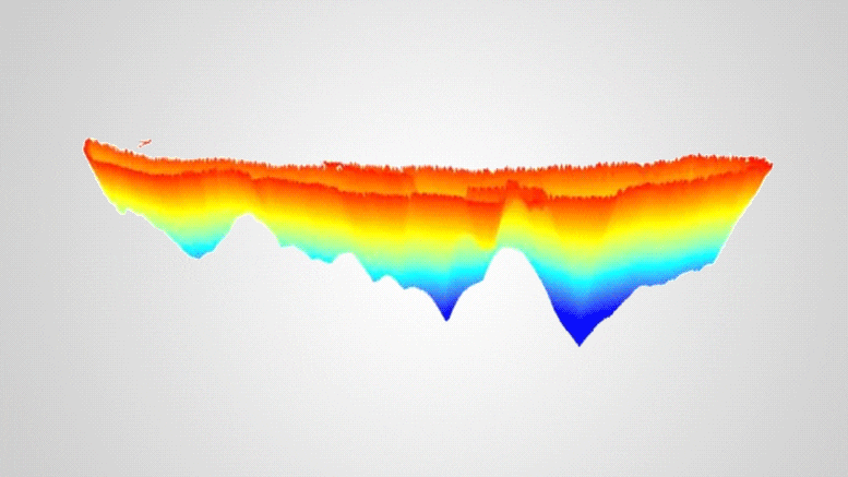
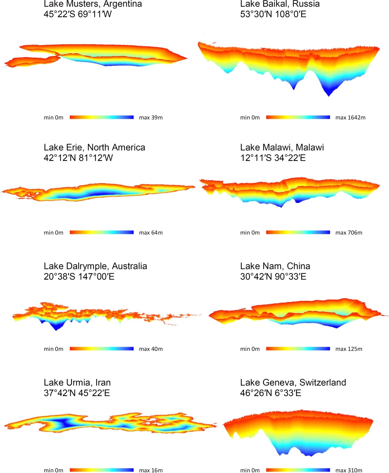
They then developed a machine learning technique, called random forest, that is effective for classifying data to build relationships among those geophysical characteristics of the waterbodies. They estimated maximum depth and bathymetry for all lakes and reservoirs in the dataset using these relationships, accompanied with GIS techniques.
To validate the dataset, the scientists turned to datasets of lakes in which the maximum depth had been measured, as well as to ground-based bathymetry observations of waterbodies in different regions and with a wide range of physical characteristics. The results showed that GLOBathy succeeded in estimating bathymetry and reproducing the patterns of depth variability “reasonably well,” according to the paper.
GLOBathy also provides estimates of head-area-volume relationships, derived from its bathymetric maps. These relationships, which indicate water availability and surface area in different waterbody depth levels, provide essential information that can be used for improved water budget analyses and better understanding of hydrological cycles in local, regional, and global scales. GLOBathy also gives geophysical scientists more flexibility in modeling aquatic systems as it complements several existing datasets of inland waterbodies.
“For the first time, we have detailed depth and bathymetric information for all these waterbodies around the world,” Khazaei said. “This doesn’t replace ground-based measurements, but it gives us critical insights into numerous lakes and reservoirs whose underwater topography has never been mapped to such extent.”
Reference: “GLOBathy, the global lakes bathymetry dataset” by Bahram Khazaei, Laura K. Read, Matthew Casali, Kevin M. Sampson and David N. Yates, 3 February 2022, Scientific Data.
DOI: 10.1038/s41597-022-01132-9
The work was funded by NOAA, and the findings were published in a recent issue of Scientific Data. NCAR is sponsored by the National Science Foundation.
Never miss a breakthrough: Join the SciTechDaily newsletter.
Follow us on Google and Google News.