Unexpected mantle structures hint at ancient or unknown materials, challenging current tectonic theories and prompting deeper research.
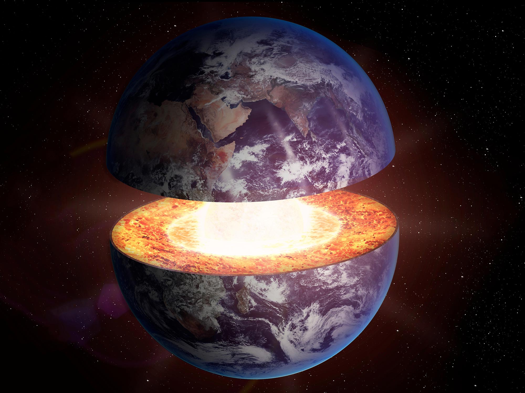
No one can see inside the Earth or drill deep enough to collect rock samples from the mantle—the layer between Earth’s core and its outermost rigid layer, the lithosphere. Measuring temperature and pressure at those depths is also impossible. To overcome these challenges, geophysicists rely on indirect methods to study what lies deep beneath our feet.
One key method involves analyzing seismograms, which are recordings of earthquake waves. By measuring how fast these waves travel through the Earth, scientists can infer details about its internal structure. This process is similar to how doctors use ultrasound to create images of organs, muscles, or veins inside the body without surgery.
Seismic waves provide information
Here’s how it works: when an earthquake occurs, seismic waves radiate outward from the epicenter in all directions. As they travel through the Earth, these waves can be refracted (bent), diffracted (spread around obstacles), or reflected (bounced back). The speed of these waves depends not only on the type of wave but also on the density and elasticity of the materials they pass through. Seismographic stations around the world record these waves, allowing geophysicists to analyze the data. From these recordings, scientists can infer the Earth’s internal structure, its composition, and the dynamic processes occurring deep within the planet.

Using seismic recordings, Earth scientists determined the position of submerged tectonic plates throughout the Earth’s mantle. They always found them where they expected them to be: in an area known as subduction zones, where two plates meet and one subducts beneath the other into the Earth’s interior. This has helped scientists investigate the plate tectonic cycle, i.e., the emergence and destruction of plates at Earth’s surface, through our planet’s history.
Plate remnants where there shouldn’t be any
Now, however, a team of geophysicists from ETH Zurich and the California Institute of Technology has made a surprising discovery: using a new high-resolution model, they have discovered further areas in the Earth’s interior that look like the remains of submerged plates. Yet, these are not located where they were expected; instead, they are under large oceans or in the interior of continents – far away from plate boundaries. There is also no geological evidence of past subduction there. This study was recently published in the journal Scientific Reports.
What is new about their modeling approach is that the ETH researchers are not just using one type of earthquake wave to study the structure of the Earth’s interior, but all of them. Experts call the procedure full-waveform inversion. This makes the model very computationally intensive, which is why the researchers used the Piz Daint supercomputer at the CSCS in Lugano. Is there a lost world beneath the Pacific Ocean?
“Apparently, such zones in the Earth’s mantle are much more widespread than previously thought,” says Thomas Schouten, first author and doctoral student at the Geological Institute of ETH Zurich.
One of the newly discovered zones is under the western Pacific. However, according to current plate tectonic theories and knowledge, there should be no material from subducted plates there, because it is impossible that there were subduction zones nearby in the recent geological history. The researchers do not know for certain what material is involved instead, and what that would mean for Earth’s internal dynamics. “That’s our dilemma. With the new high-resolution model, we can see such anomalies everywhere in the Earth’s mantle. But we don’t know exactly what they are or what material is creating the patterns we have uncovered.”
It’s like a doctor who has been examining blood circulation with ultrasound for decades and finds arteries exactly where he expects them, says ETH professor Andreas Fichtner. “Then if you give him a new, better examination tool, he suddenly sees an artery in the buttock that doesn’t really belong there. That’s exactly how we feel about the new findings,” explains the wave physicist. He developed the model in his group and wrote the code.
Extracting more information from waves
So far, the researchers can only speculate. “We think that the anomalies in the lower mantle have a variety of origins,” says Schouten. He believes it is possible that they are not just cold plate material that has subducted in the last 200 million years, as previously assumed. “It could be either ancient, silica-rich material that has been there since the formation of the mantle about 4 billion years ago and has survived despite the convective movements in the mantle, or zones where iron-rich rocks accumulate as a consequence of these mantle movements over billions of years” he notes.
For the doctoral student, this means above all that more research with even better models is needed to see further details of Earth’s interior. “The waves we use for the model essentially only represent one property, namely the speed at which they travel through the Earth’s interior,” says the Earth scientist. However, this does not do justice to the Earth’s complex interior. “We have to calculate the different material parameters that could generate the observed speeds of the different wave types. Essentially, we have to dive deeper into the material properties behind the wave speed,” says Schouten.
Reference: “Full-waveform inversion reveals diverse origins of lower mantle positive wave speed anomalies” by Thomas L. A. Schouten, Lars Gebraad, Sebastian Noe, Anna J. P. Gülcher, Solvi Thrastarson, Dirk-Philip van Herwaarden and Andreas Fichtner, 4 November 2024, Scientific Reports.
DOI: 10.1038/s41598-024-77399-2
Never miss a breakthrough: Join the SciTechDaily newsletter.
Follow us on Google and Google News.
7 Comments
Petrologists and geochemists?
Perhaps this may make ideas about predicting past tectonic settings from geochemistry a little more complex?
What if this was where the water was?
There is lots of water deep below the lithosphere. I don’t remember when someone won the Nobel Prize for discovering that deep underground where pressure is very high a rock the size of a marble holds a pint of water in it. So my point is imagine how much water could be down there is mind blowing!
Aloha from Hawai’i. In Marine Science Class we learned about the Magnetic Straitions that showed by fact, there was a great polar shift in the earth approximately every 26,000 years. The Magnetic Straitions were definite indicators. I believe these unusual Tetonic Plates in unusual areas could very well be additional proof of this; depending on layout, location, and material type matching. When I was 7, National Geographic came to speak with my Daddy, a professor at Tulane University, about this ancient People of the Sea (not Vikings) searching
for the Ha’I~Indigenous people who date back before the Ice Age. Years later, their written language was found 200 meters down, and dated 26,000 years old. For 200 meters of water to happen in an apparently sudden (or?) event, can affect pressure and changeable flow from polar ice now melting at the Equator. The last shift of earth’s Poles rendered that which was the Equator with tropical species and ecosystems to become the new Magnetic North and South Poles. Evidence of species found by explorers were tropical in nature. The fact that Humans survived through such an event is incredible! Scientologycan now detect that the Earth’s Core is in process of being “Reversed”; a part of a natural process correlating with events on the surface, my Daddy spoke of this Ice Age Glacier called the “Great Apo” or perhaps in ancient language “Apo Nui”…which was described in English Version of Ha’I Oral Traditions:
“The Great Apo came from the North, a giant Glacier that came across the Pacific Ocean where the Ocean lapped upon it; making the Edge as sharp as a knife. As it pushed across the Ocean it cut away the tops of the islands and dumped them into the Sea.” My Professor Craig Severance of Hilo college who taught in Pacific Cultures went with team on a boat to check it out! Prof. Severance stated, “Your Father was right! How did he know! An old family story going back to the Ice Age?!! All this time we thought they were Atolls, but they weren’t Atolls at All!!” Point here is, there is much more to learn from what is right in front of us; maybe even a clue to the answer of these unusual Tetonic Plates! Aloha and Mahalo (thank you) from Shelley of the 12 pt. Star People of Ha’I
Aloha, another oral tradition; like a Ha’I Bedtime Story where:
“…there was an explosion in space and a planet blew up, the Sky turned Red and something hit the Earth causing a slight wobble. No more Eternal Spring….” I was thinking that for something to smack the Earth enough to make a slight wobble and change the Earth Weather Clycles and transform the Water into freezing/Seasonal cycles and species evolutionary changes…this Humongous Impact would have left, perhaps, some type of geological evidence, possibly Tetonic Plate shattering evidence?
Aloha. Shelley Ha’I
Aloha from Hawai’i. I am a descendant of an ancient seafaring peoples known as the Ha’I (Hah-EE) In Oral Traditions handed down through my grandfather, we sailed near “The Great Apo; a huge sharp edged glacier dating back to the Prehistoric Ice Age. We fished under the glaciers edge to catch a sturgeon like fish; and a mammal that was “dapple Grey fur and four paddle feet…” We used the fur “to make round shields as we sailed on the 16 pointed star map.” When I was 7 years old National Geographic came to speak with my Daddy about this ancient 16 pointed star seafaring map. Before my Daddy passed on, he told me all about the Great Apo, that “because of the waves of the Pacific Ocean, lapping at it’s edge, The Great Apo was very sharp, and sliced off the tops of islands in it’s path, dumping them into the sea.” When I told my Pacific Culture College Professor Craig Severance about it, he took a team of scientists on a boat and found it was true. He said, “All that time we thought they were Atolls, but they weren’t Atolls at all !!” There are many Ha’I Legends to do with the 16 & 12 pointed star maps. Today, they are reflected in the modern day “Hale Mua” about Mau of Satawal [The Men’s Navigational House].However, I have never seen the plotted Map of The Great Apo. At the Papahanaumoku Center in Hilo, it shows that from above Kauai is the “Po”; and Kauai and below is the “A”=signifying the designation of the very ancient. My father taught me the Ha’I “unspoken language” -a quickly drawn petroglyph found 200 meters down in the ocean-over 26,000 years old. These symbols are continued throughout Pacific in Ta’au; and other locations around the planet, even today. Please contact me; especially if your family (Ohana) has Ha’I legends; or have interest in ancient seafaring oral traditions.
This may be evidence of major crust disturbances caused periodically by outside forces, such as solar flare activity or collisions with meteors.