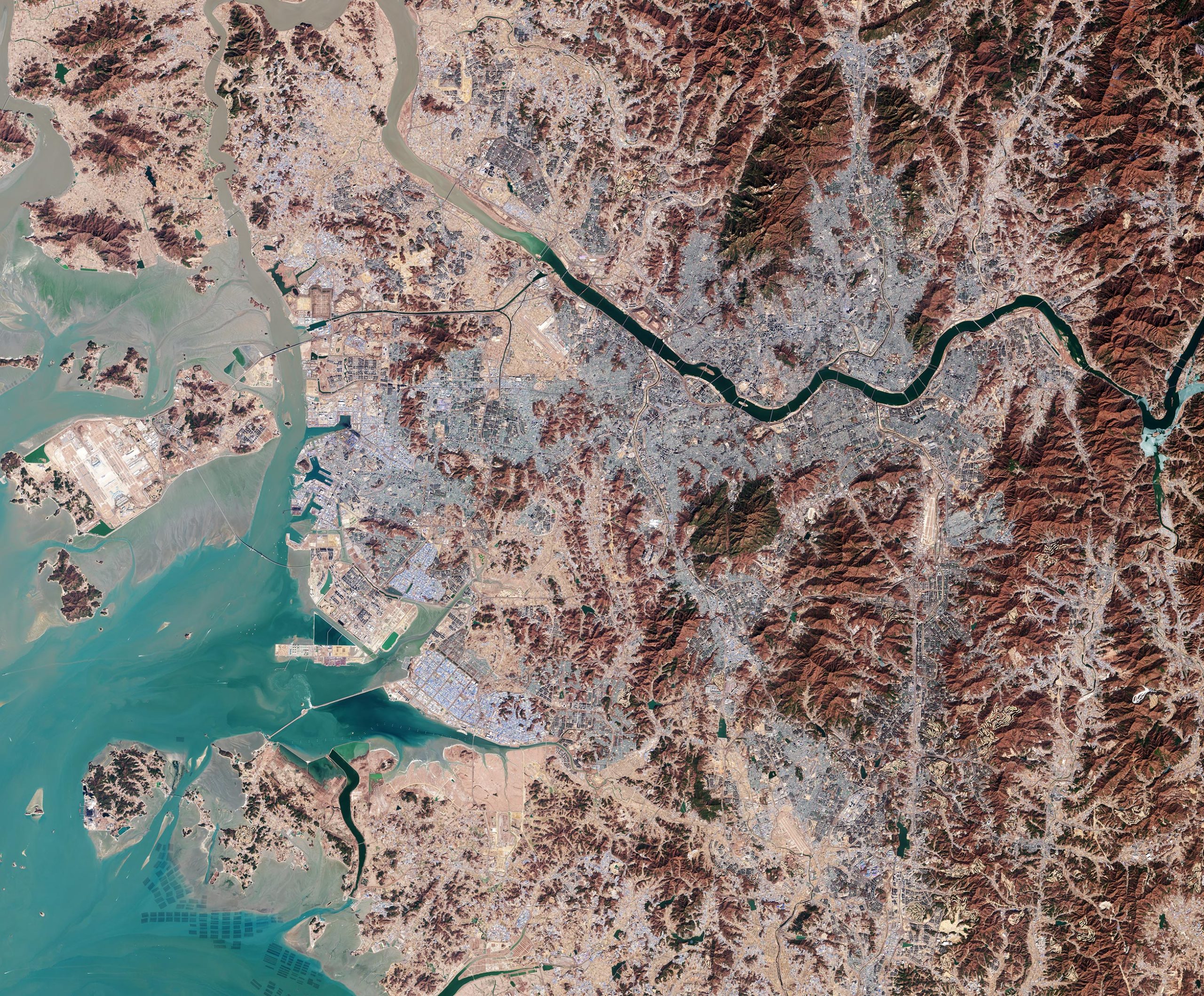
South Korea’s capital city, Seoul, and its surroundings are featured in this satellite image, captured by the Copernicus Sentinel-2 mission on February 21, 2023.
Situated some 50 km (30 miles) south of the North Korean border, the metropolitan area of Seoul appears as the grey area in the center of the image.
The Han River runs through the city, and to the right of the image, it can be seen partly covered by ice. It is one of the biggest rivers in the Korean peninsula. It flows westward through Seoul into the Yellow Sea, named so because of the yellowish sand that colors its water.
Seoul is surrounded by forested mountains, which appear brown in this wintery image. Bukhansan National Park lies just north of the city. The park is like an island, acting as a big green lung for the surrounding urban environment.
West of Seoul lies the coastal city of Incheon, which serves as Seoul’s chief port. The Incheon International Airport, South Korea’s main airport, is clearly visible in the image to the west of the large artificial island.
The artificial seawall of the Sihwa Lake tidal power station, which creates a basin along the coast, can be spotted as a light brown line towards the bottom of the image. It is the world’s largest tidal power station and it makes use of strong tides that can lead to water level differences of more than six meters. Signs of these tidal forces can be seen in the image, mainly in the form of extensive sandy banks along the coast.
There are also numerous oyster farms that also benefit from the strong tides. They are visible as blue rectangles at the very bottom of the image, in the Yellow Sea.
Never miss a breakthrough: Join the SciTechDaily newsletter.
Follow us on Google and Google News.