
Hidden landscapes under Antarctic ice may slow glacier flow. These ancient surfaces could change how we predict sea-level rise.
Scientists have identified remnants of ancient landscapes in East Antarctica that are believed to have been shaped by rivers and may offer new insight into predicting future ice loss.
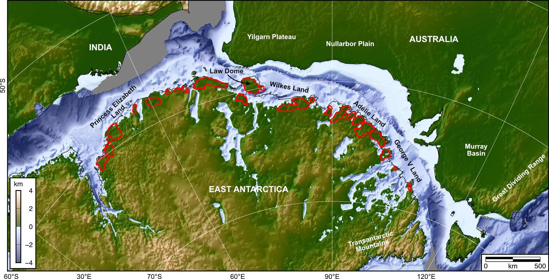
A research team led by Durham University in the UK analyzed radar data showing ice thickness and uncovered vast, flat surfaces that had not been previously mapped. These buried features extend across a 3,500-kilometer section of the East Antarctic coast.
The researchers believe these surfaces were originally linked and formed by major river systems following the separation of East Antarctica and Australia around 80 million years ago, but before the continent became ice-covered roughly 34 million years ago.
River-carved surfaces now shape glacier flow
According to the researchers, these flat surfaces lie buried beneath the ice sheet and are separated by deep troughs that guide the movement of fast-flowing glaciers. In contrast, the ice sitting above the flat areas moves at a significantly slower pace.
Although Antarctica is experiencing increasing ice loss, the flat surfaces appear to act as natural barriers, helping to limit the flow of ice in some regions.
If the East Antarctic Ice Sheet were to melt entirely, it could raise global sea levels by up to 52 meters.
Incorporating the influence of these newly identified surfaces into predictive models could improve forecasts of how the East Antarctic Ice Sheet may respond to climate change and the potential consequences for global sea levels
A remarkably preserved hidden landscape
The findings are published in the journal Nature Geoscience.
Dr Guy Paxman, lead author of the study and Royal Society University Research Fellow in the Department of Geography at Durham University, explained: “The landscape beneath the East Antarctic Ice Sheet is among the most enigmatic not only on Earth, but across any rocky planet in the solar system.”
He continues, “When we reviewed radar imagery of the sub-ice terrain in this area, we began to see these strikingly flat surfaces appear almost everywhere we looked. What’s remarkable is that these surfaces have remained largely undisturbed for over 30 million years, suggesting that portions of the ice sheet have acted to preserve, rather than erode, the landscape beneath.
He says, “Details like the shape and geological features of these newly charted surfaces are key to improving our understanding of ice flow dynamics at the edge of East Antarctica. This, in turn, will enhance our ability to forecast how the East Antarctic Ice Sheet might influence future sea levels under varying climate warming scenarios.”
The researchers found that these expansive flat surfaces lie beneath roughly 40 percent of the East Antarctic Ice Sheet’s 3,500-kilometre-long coastal region, stretching from Princess Elizabeth Land to George V Land.
Their long-term preservation suggests that these areas have avoided major glacial erosion throughout much of Antarctica’s frozen history.
An international team reveals the bigger picture
The research team also included the universities of Newcastle, Edinburgh, and Exeter, UK, the British Antarctic Survey, the Alfred Wegener Institute, Germany, the Polar Research Institute of China, and Beijing University of Technology.
Research co-author Professor Neil Ross, Professor of Polar Science and Environmental Geophysics, Newcastle University, said: “We’ve long been intrigued and puzzled about fragments of evidence for ‘flat’ landscapes beneath the Antarctic ice sheets.
“This study brings the jigsaw pieces of data together to reveal the big picture: how these ancient surfaces formed, their role in determining the present-day flow of the ice, and their possible influence on how the East Antarctic Ice Sheet will evolve in a warming world.”
The researchers emphasize the need to further explore the influence of these flat surfaces on ice sheet movement during past warmer climates.
This would include drilling through the ice to retrieve rock from the flat surfaces to understand when they were last free from ice cover. This will help improve predictions for how the ice around this large section of the East Antarctic margin will respond as the climate and ocean warm.
Reference: “Extensive fluvial surfaces at the East Antarctic margin have modulated ice-sheet evolution” by Guy J. G. Paxman, Stewart S. R. Jamieson, Neil Ross, Michael J. Bentley, Charlotte M. Carter, Tom A. Jordan, Xiangbin Cui, Shinan Lang, David E. Sugden and Martin J. Siegert, 11 July 2025, Nature Geoscience.
DOI: 10.1038/s41561-025-01734-z
The research was funded by the UK’s Natural Environment Research Council, a Leverhulme Trust Early Career Fellowship, the European Research Council, the AWI INSPIRES III programme, and the Natural Science Foundation of China.
Never miss a breakthrough: Join the SciTechDaily newsletter.
Follow us on Google and Google News.
3 Comments
perhaps the Deception Island volcano will explode again soon & cover the region with ash once again,
melting the snow naturally. ( 1907 ) Then amble on this” enigma landscape” surface and do your thing.
overdue for another big one ?
Geologists didn’t “stumble” on the buried land surface. They purposely set out to determine what is was like and confirmed their suspicions. To ‘stumble’ on something implies that they were doing something else when they discovered something they didn’t realize was there. They have long known that there was land under the ice and realized that West Antarctica was lower, warmer, and melting faster than East Antarctica, probably because of greater volcanic activity.
“This study brings the jigsaw pieces of data together to reveal the big picture: how these ancient surfaces formed, their role in determining the present-day flow of the ice, and their possible influence on how the East Antarctic Ice Sheet will evolve in a warming world.”
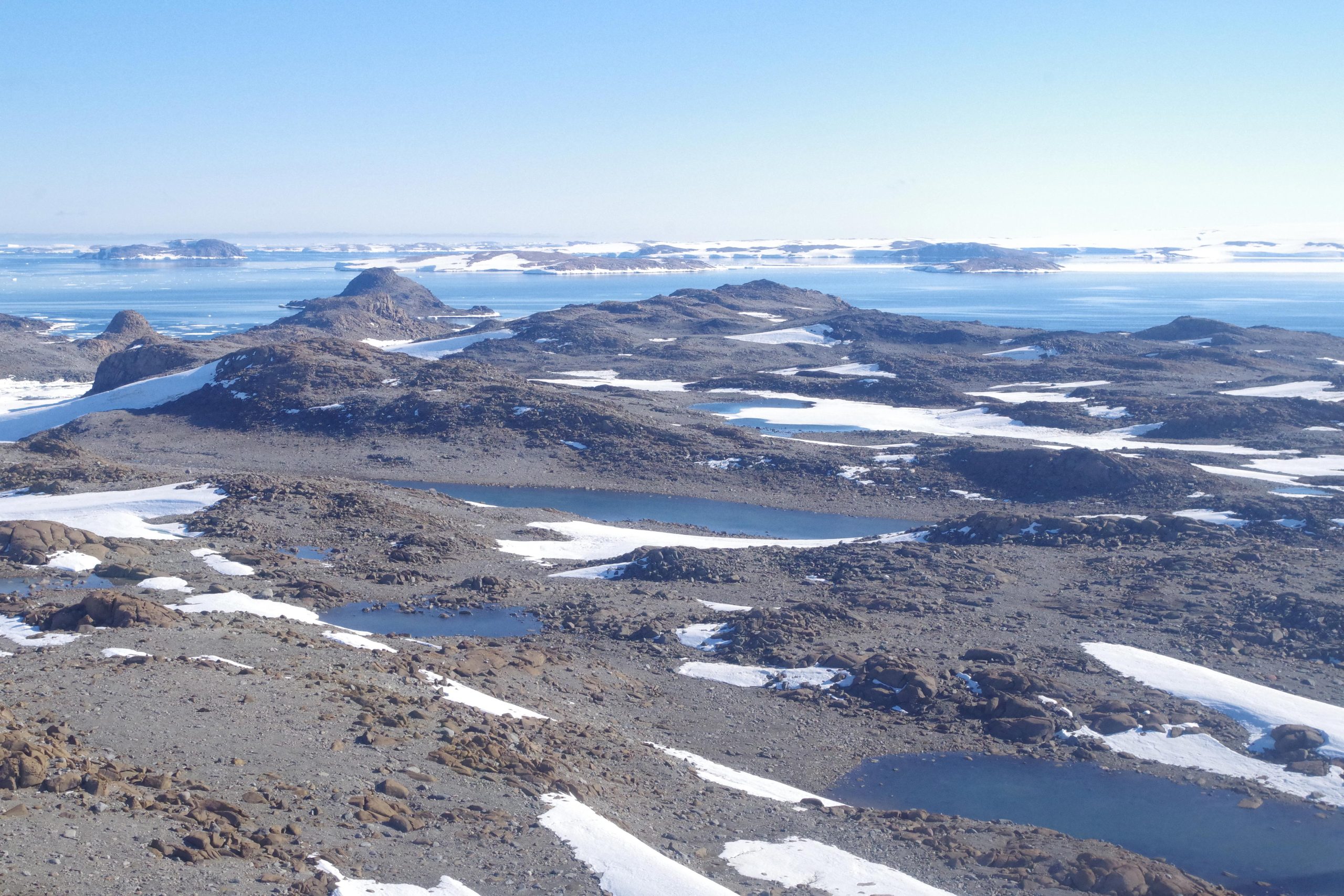
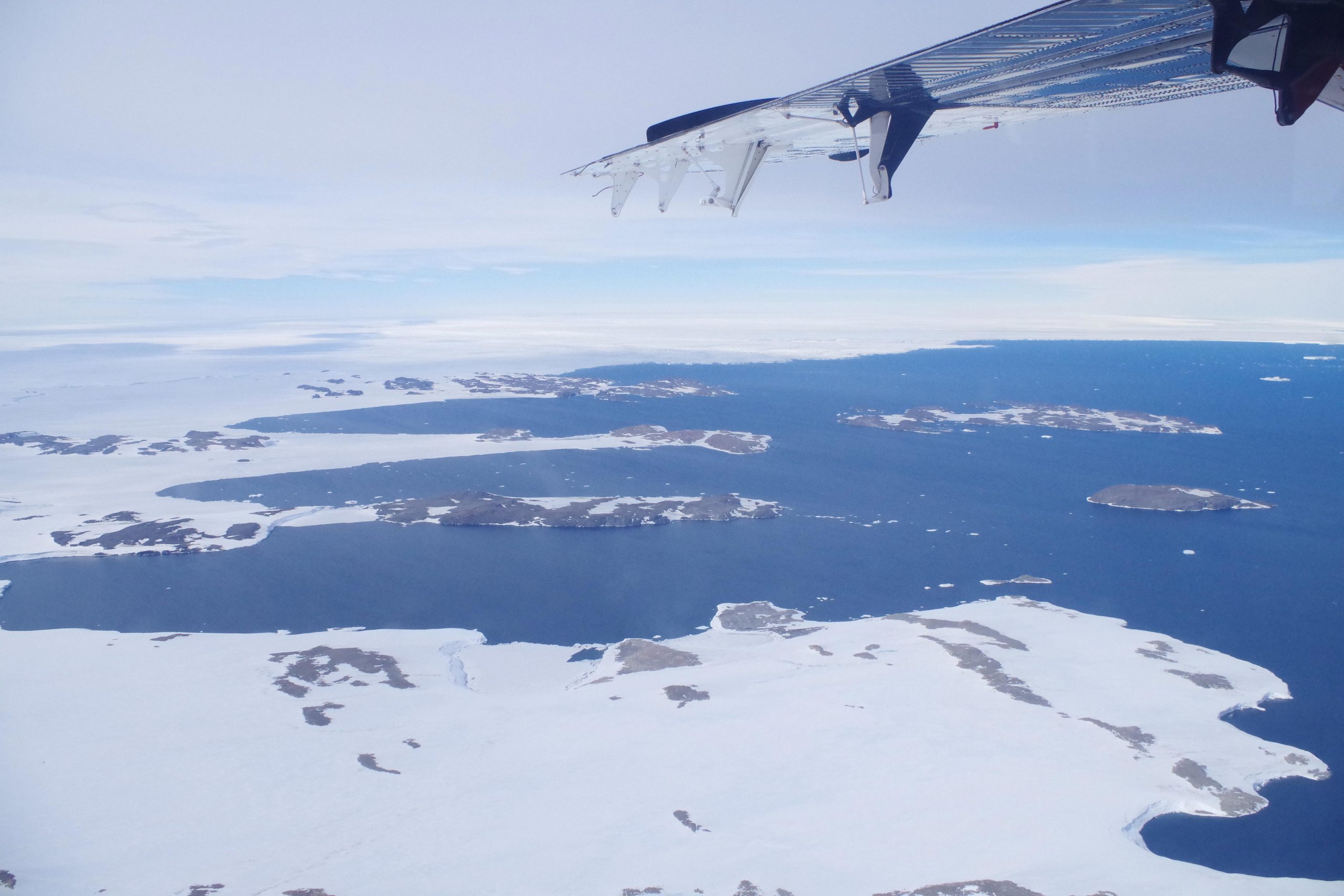
Aerial View of Windmill Islands Near Vanderford Glacier.”
How WERE the flat surfaces formed?