Outbursts from Glacial Lake Missoula carved the Channeled Scablands in Washington state.
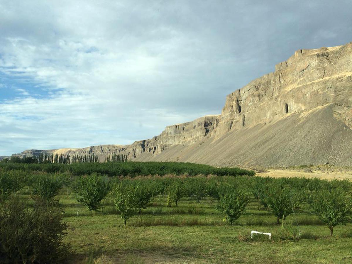
In southeastern Washington state, neat grids of farmland stretch for miles across gently rolling hills. Dozens of different crops are grown on the valuable agricultural land of the Columbia Plateau. In some places, however, undulating streaks of scoured earth interrupt the array of angular plots and center-pivot irrigated fields.
These rocky scars are known as the Channeled Scablands, and they formed 10,000 to 20,000 years ago in a series of dramatic floods. Landsat 8’s OLI (Operational Land Imager) captured this image of a portion of the scablands about 120 kilometers (75 miles) west of Spokane on May 14, 2023.
The source of water that carved these unusual features remained a mystery to geologists for decades. They have since come to understand that as the Cordilleran ice sheet advanced southward during the last ice age, it formed a dam along the Clark Fork River. Glacial Lake Missoula grew behind this ice dam in what is now western Montana, ultimately holding as much water as Lake Erie and Lake Ontario combined. Geologists estimate that the dam formed and broke dozens of times over several thousand years, sending as much as 600 cubic miles of water tearing across the region with each failure.
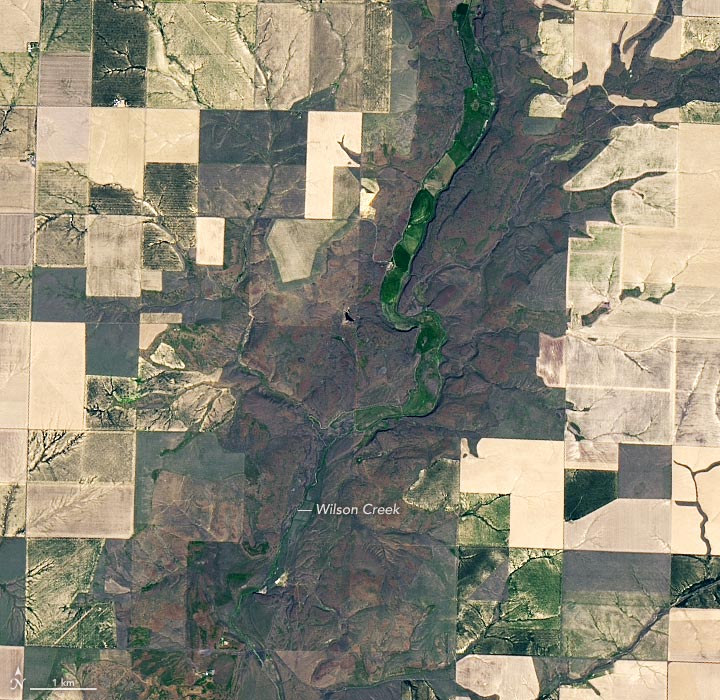
Floodwaters coursed to the south and southwest, eventually funneling into the Columbia River. Along the way, they carved grooves, potholes, and long channels known as “coulees” into the volcanic basalt bedrock. The detailed view (above) shows one of these channels and reveals the striking contrast between the flood-scoured area and farmable land.
The canyons shown here are tiny compared with Grand Coulee, the largest in the Channeled Scablands, north of this scene. Completed in 1942, the Grand Coulee Dam was the largest concrete structure in the world before being surpassed by South America’s Itaipú Dam in 1984 and China’s Three Gorges Dam in 2006. It is currently the largest U.S. hydropower facility and provides irrigation water for the Columbia Plateau.
NASA Earth Observatory images by Lauren Dauphin, using Landsat data from the U.S. Geological Survey.
Never miss a breakthrough: Join the SciTechDaily newsletter.
Follow us on Google and Google News.