
A brush-and-sample mission had to be skipped as NASA’s Curiosity Mars rover found itself on unstable ground, but this opened up a unique opportunity to conserve energy for an exciting week ahead.
Scientists are targeting fascinating Martian features called boxwork formations—fractured ridges likely shaped by ancient fluid activity.
Power Trade-Off: No Arm Deployment Today
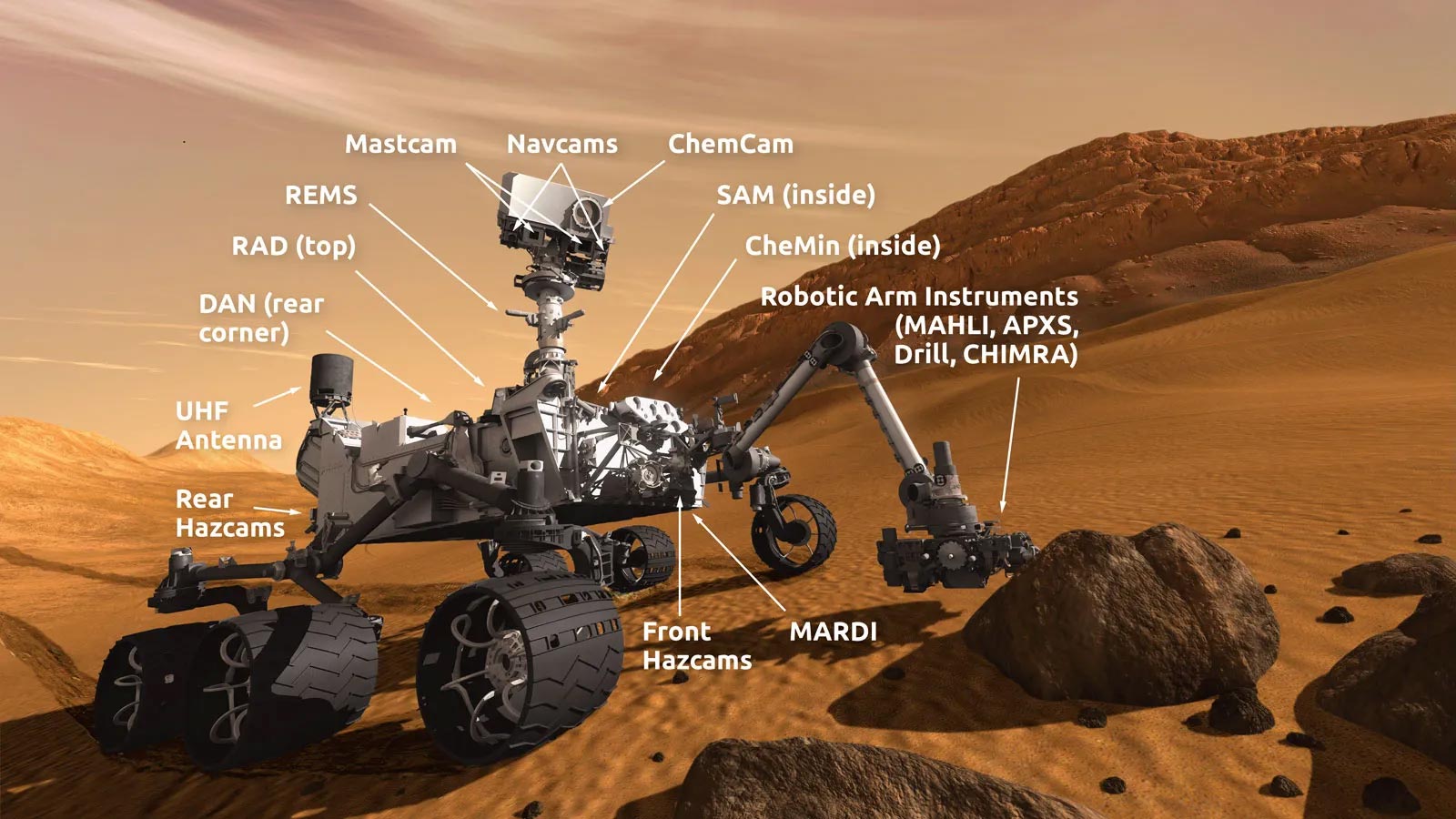
As the Alpha Particle X-Ray Spectrometer (APXS) operations lead today, I had hoped we could carry out a compositional analysis by brushing one of the bedrock blocks in front of the rover. However, we quickly realized that the rover wasn’t on stable enough ground to safely deploy its arm to place the APXS or MAHLI instruments. There was a silver lining: since arm movements require a significant amount of power, leaving them out of the plan allowed us to conserve energy. That saved energy will support what we anticipate to be a busy upcoming week of science activities as we continue our drive toward a high-priority target—an area known as the boxwork formations.
These formations appear as large, resistant ridges that were first identified from orbit. They may have formed through fracturing, fluid flow, and chemical alteration processes within the sulfate-rich rock unit we’re currently traversing. We plan to capture detailed images of these formations as we approach to better understand their geological context.

Laser Targets and Imaging Galore
Despite the loss of arm activities, we still have plenty of interesting observations planned for this 3-sol weekend. ChemCam will fire its laser at two separate rock targets, “Santa Ynez” and “Cahuilla,” which will also be captured with Mastcam documentation images. The targets are on two different bedrock blocks, with the “Cahuilla” raster focused on a thin resistant layer.
ChemCam will also use its remote imaging capabilities to obtain mosaics of the “Texoli” butte and another interesting feature, “Torote Bowl.” Mastcam will capture mosaics of “San Gabriel River” (an apparent angular contact) and of some sand troughs surrounding many of the bedrock blocks in this region. An image of a small, grey float pebble, “Piru Creek,” will also be acquired.
Sky Watching Resumes After Power Constraints
The environmental science group was also able to plan a number of activities to catch up on their regular cadence, which has been impacted by the recent power constraints. We are acquiring Navcam line of sight observations (x2), suprahorizon movies (x2), a zenith movie and a 360-degree sky survey, as well as a Mastcam sky survey. Coordinated ChemCam passive sky and APXS atmospheric observations are also planned.
Onward Through Tricky Terrain
There is a ~19 m drive planned through this tricky terrain that will hopefully set us up for arm activities (APXS and MAHLI) in our new workspace next week. The plan is completed with standard RAD, DAN, and REMS activities, as well as two MARDI images to record the terrain beneath the rover in the current and new workspace.
Written by Lucy Thompson, Planetary Geologist at the University of New Brunswick.
Never miss a breakthrough: Join the SciTechDaily newsletter.
Follow us on Google and Google News.
1 Comment
I wish they’d stop naming every rock and crevice the rover comes across. Think what a headache this will create for astronauts on Mars. A simple, unified numbering system would’ve been an obvious way to go.