The oblique perspective view was generated using data from the Mars Express high-resolution stereo camera stereo channels. This scene is part of the region imaged on March 13, 2007, and February 22, 2017, during orbits 4090 and 16648. The image mosaic is centered on 346°E/23°S, with a ground resolution of 15–17 m/pixel. Credit: ESA/DLR/FU Berlin, CC BY-SA 3.0 IGO
New composite images captured by ESA’s Mars Express offer a window into the watery past of the Red Planet.
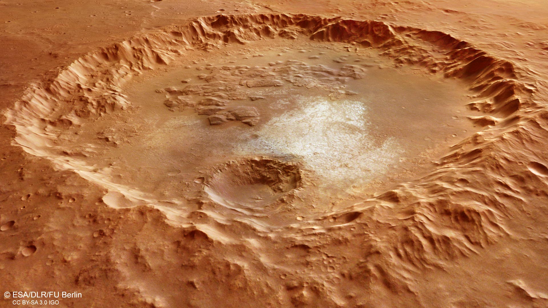
This 70 km-wide (43 mile-wide) crater and its surrounds, captured by ESA’s Mars Express, is a composite of two images taken in March 2007 and February 2017.
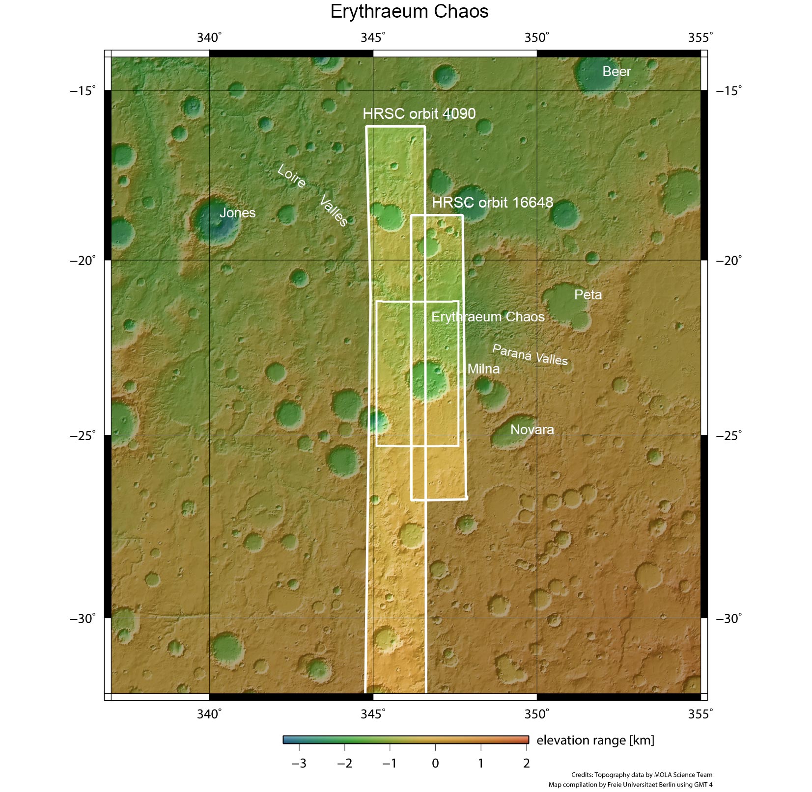
The region outlined by the left-hand white box indicates the area imaged during Mars Express orbit 4090 on March 13, 2007; the right-hand box shows the region imaged during orbit 16648 on February 22, 2017. The small box in the center highlights the focus of the associated image release. In this context image, north is up. Credit: NASA MGS MOLA Science Team
It focuses on a large crater in the Margaritifer Terra region in the southern hemisphere of Mars, and includes a portion of Erythraeum Chaos to the north (right in the main color image below).
The region is located at the northern edge of Noachis Terra, which at 3.7–4 billion years old, represents some of the oldest and most heavily cratered terrain on Mars.
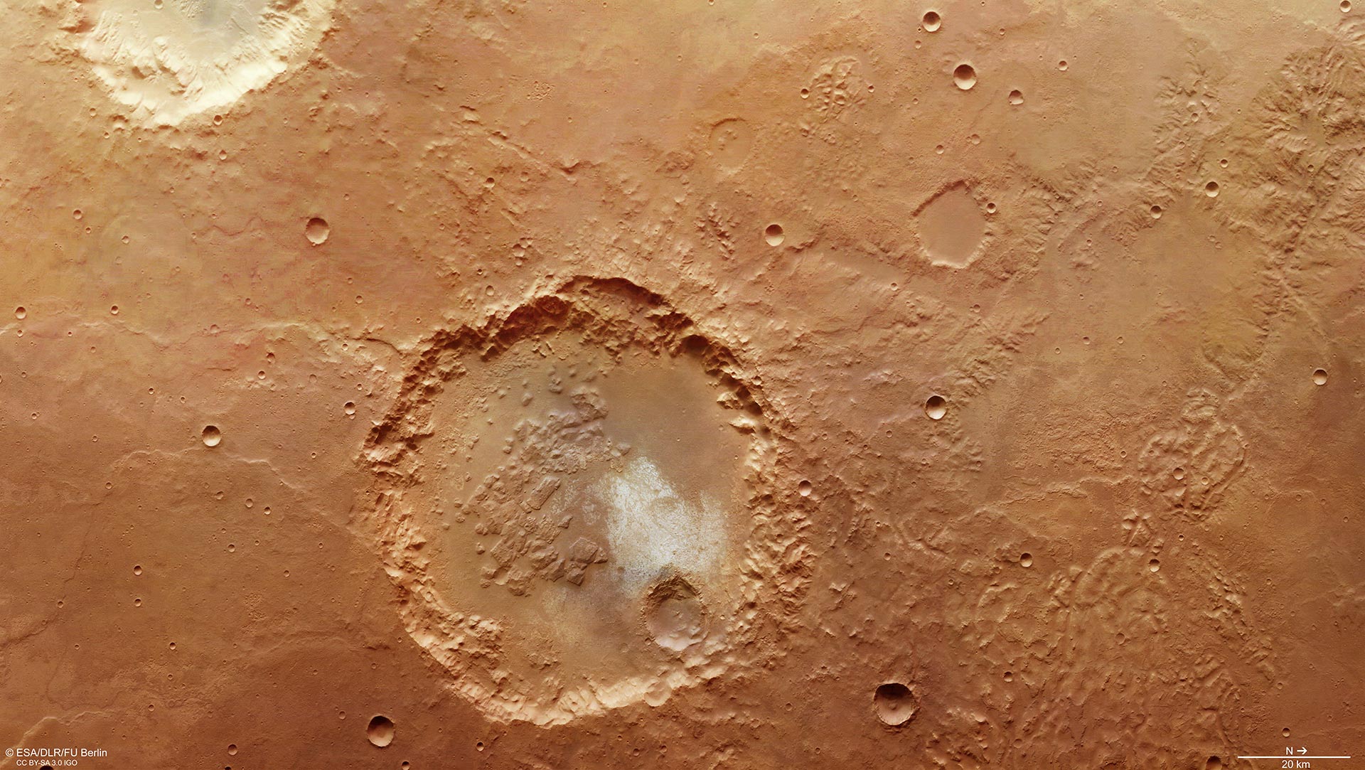
The image mosaic is composed of Mars Express High Resolution Stereo Camera images from orbit 16648 (February 22, 2017), with a ground resolution of 15 m per pixel, and orbit 4090 (March 13, 2007), with a ground resolution of 17 m per pixel. The images are centered on 346°E/23°S.
The color image was created using data from the nadir channel, the field of view which is aligned perpendicular to the surface of Mars, and the HRSC color channels. Credit: ESA/DLR/FU Berlin, CC BY-SA 3.0 IGO
Remnants of valley networks across the scene indicate that water once flowed through this region, shaping the features seen today. Indeed, as shown by the context image, Parana Valles lies to the east, while Loire Valles lies to the northwest.
There are a number of distinctive features inside the 70 km (43 mi) crater, such as the striking light-toned material that is interpreted as exposed bedrock.

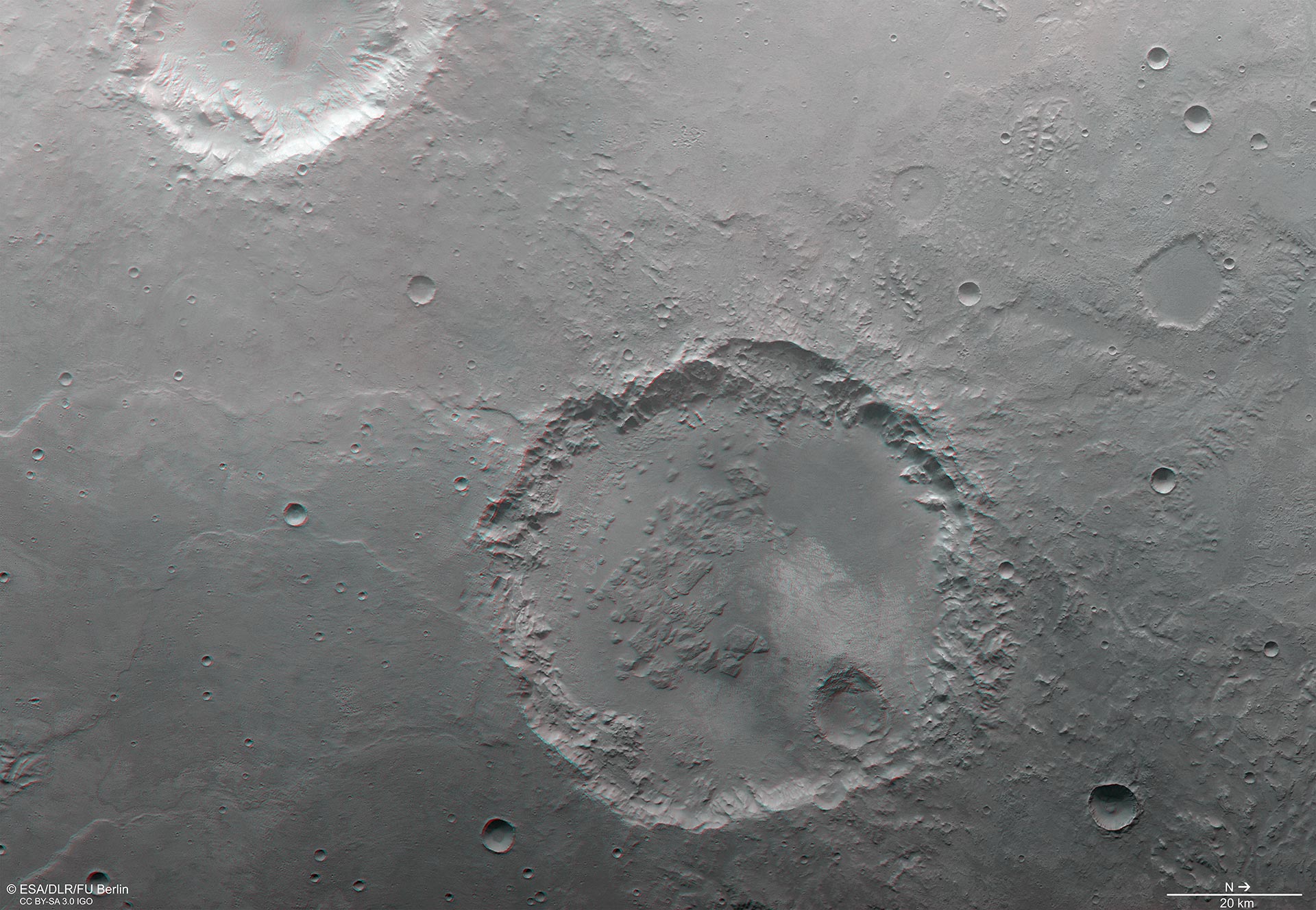
The color-coded topographic view is based on a digital terrain model of the region, from which the topography of the landscape can be derived.
The region was imaged on March 13, 2007, and February 22, 2017, during orbits 4090 and 16648. The image mosaic is centered on 346°E/23°S, with a ground resolution of 15–17 m/pixel. Credit: ESA/DLR/FU Berlin, CC BY-SA 3.0 IGO
‘Chaotic terrain’ is visible both inside and outside the crater, marked by randomly oriented blocks separated by troughs.
In general, chaotic terrain is associated with the collapse of the surface above regions where large amounts of subsurface water have been released, for example by the sudden melting of ice. As such, outflow channels often begin in chaotic terrains.
Chaotic terrain may also mark the sites of ancient lakes, such as in Erythraeum Chaos to the north (right) of the crater in the included images, between Loire and Parana Valles.
Never miss a breakthrough: Join the SciTechDaily newsletter.
Follow us on Google and Google News.