
NISAR, an upcoming Earth satellite mission by NASA and ISRO, promises to revolutionize how we monitor Earth’s surface.
Using cutting-edge synthetic aperture radar (SAR), it will capture highly detailed images, tracking changes in ice sheets, forests, and even small shifts in land from earthquakes.
NISAR: A Revolutionary Earth-Observing Satellite
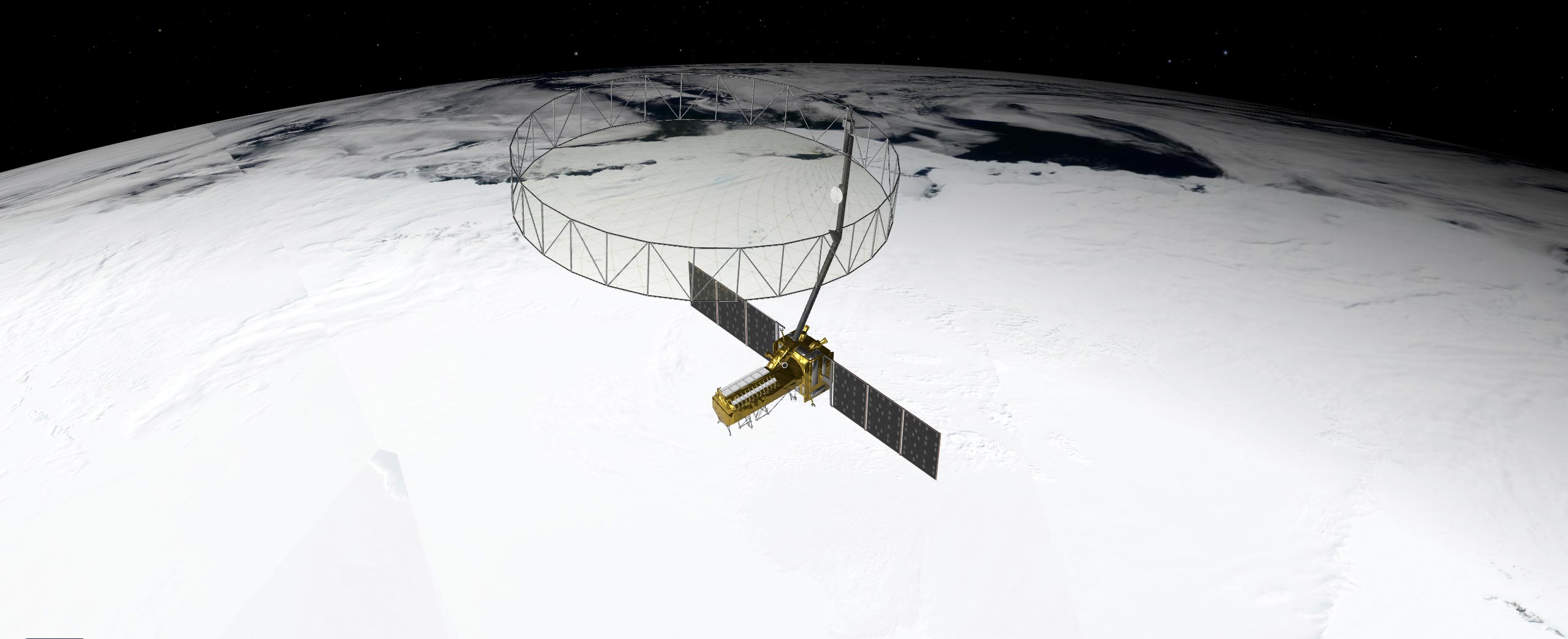
NASA and the Indian Space Research Organization (ISRO) are set to launch their groundbreaking Earth-observing satellite, NISAR (NASA-ISRO Synthetic Aperture Radar), in the coming months. This advanced satellite will capture incredibly detailed images of Earth’s surface, capable of detecting movements in small areas of land and ice down to fractions of an inch. NISAR will scan nearly all of Earth’s solid surfaces twice every 12 days, providing valuable insights into how the planet changes over time. It will track the shifting of Earth’s crust before and after natural disasters like earthquakes, monitor the movement of glaciers and ice sheets, and observe ecosystem changes, including forest growth and deforestation.
NISAR’s exceptional capabilities come from its use of synthetic aperture radar (SAR), a sophisticated technology pioneered by NASA for space applications. SAR works by combining multiple radar measurements taken as the satellite orbits overhead, creating highly detailed images of the Earth’s surface. Unlike traditional radar, which uses microwaves to detect distant objects, SAR enhances data processing to provide sharper, more precise images that reveal surface characteristics in remarkable detail.
Innovative Radar Design for Precision Imaging
To get such detail without SAR, radar satellites would need antennas too enormous to launch, much less operate. At 39 feet (12 meters) wide when deployed, NISAR’s radar antenna reflector is as wide as a city bus is long. Yet it would have to be 12 miles (19 kilometers) in diameter for the mission’s L-band instrument, using traditional radar techniques, to image pixels of Earth down to 30 feet (10 meters) across.
Synthetic aperture radar “allows us to refine things very accurately,” said Charles Elachi, who led NASA spaceborne SAR missions before serving as director of NASA’s Jet Propulsion Laboratory (JPL) in Southern California from 2001 to 2016. “The NISAR mission will open a whole new realm to learn about our planet as a dynamic system.”
How SAR Works
Elachi arrived at JPL in 1971 after graduating from Caltech, joining a group of engineers developing a radar to study Venus’ surface. Then, as now, radar’s allure was simple: It could collect measurements day and night and see through clouds. The team’s work led to the Magellan mission to Venus in 1989 and several NASA space shuttle radar missions.
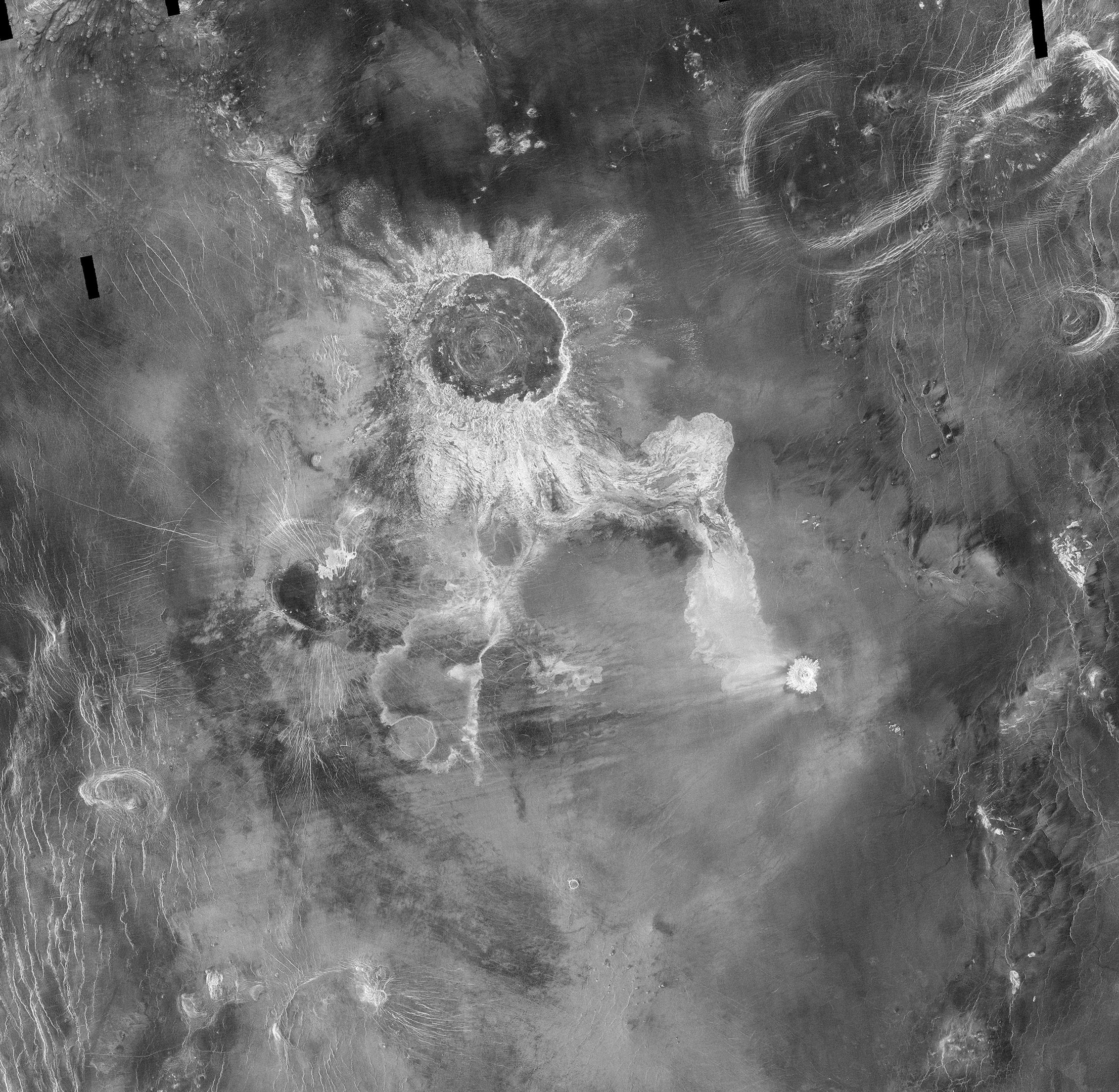
An orbiting radar operates on the same principles as one tracking planes at an airport. The spaceborne antenna emits microwave pulses toward Earth. When the pulses hit something — a volcanic cone, for example — they scatter. The antenna receives those signals that echo back to the instrument, which measures their strength, change in frequency, how long they took to return, and if they bounced off of multiple surfaces, such as buildings.
This information can help detect the presence of an object or surface, its distance away, and its speed, but the resolution is too low to generate a clear picture. First conceived at Goodyear Aircraft Corp. in 1952, SAR addresses that issue.
“It’s a technique to create high-resolution images from a low-resolution system,” said Paul Rosen, NISAR’s project scientist at JPL.
As the radar travels, its antenna continuously transmits microwaves and receives echoes from the surface. Because the instrument is moving relative to Earth, there are slight changes in frequency in the return signals. Called the Doppler shift, it’s the same effect that causes a siren’s pitch to rise as a fire engine approaches then fall as it departs.
Computer processing of those signals is like a camera lens redirecting and focusing light to produce a sharp photograph. With SAR, the spacecraft’s path forms the “lens,” and the processing adjusts for the Doppler shifts, allowing the echoes to be aggregated into a single, focused image.
Analyzing Earth’s Surface with SAR
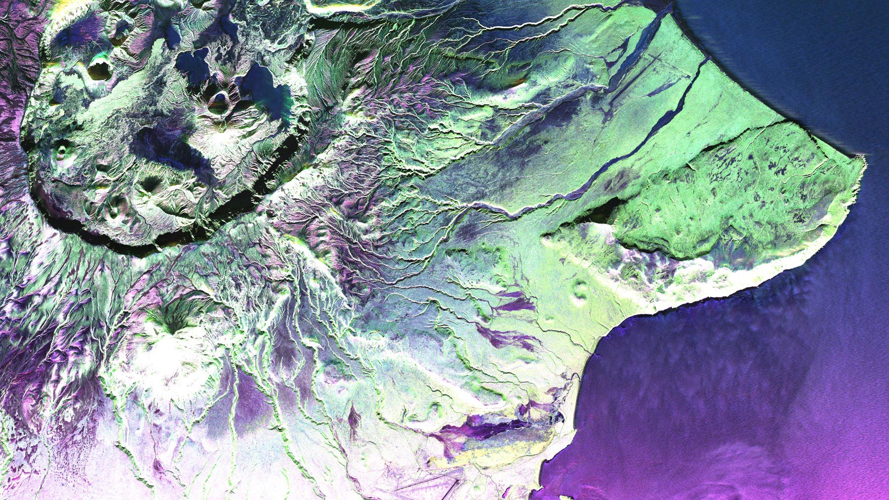
One type of SAR-based visualization is an interferogram, a composite of two images taken at separate times that reveals the differences by measuring the change in the delay of echoes. Though they may look like modern art to the untrained eye, the multicolor concentric bands of interferograms show how far land surfaces have moved: The closer the bands, the greater the motion. Seismologists use these visualizations to measure land deformation from earthquakes.
Another type of SAR analysis, called polarimetry, measures the vertical or horizontal orientation of return waves relative to that of transmitted signals. Waves bouncing off linear structures like buildings tend to return in the same orientation, while those bouncing off irregular features, like tree canopies, return in another orientation. By mapping the differences and the strength of the return signals, researchers can identify an area’s land cover, which is useful for studying deforestation and flooding.
The Impact of NISAR on Science and Society
Such analyses are examples of ways NISAR will help researchers better understand processes that affect billions of lives.
“This mission packs in a wide range of science toward a common goal of studying our changing planet and the impacts of natural hazards,” said Deepak Putrevu, co-lead of the ISRO science team at the Space Applications Centre in Ahmedabad, India.
Never miss a breakthrough: Join the SciTechDaily newsletter.
Follow us on Google and Google News.