
NASA and India’s ISRO have launched a cutting-edge Earth-observing satellite called NISAR, equipped with the most advanced radar systems ever flown.
This historic collaboration will scan nearly the entire planet every 12 days, providing critical insights into natural disasters, climate change, and ecosystem health. From tracking volcanic eruptions to detecting glacier shifts in Antarctica, NISAR’s dual-band radar will deliver a torrent of high-resolution data that could transform how we monitor Earth’s dynamic surface.
Historic Launch From India
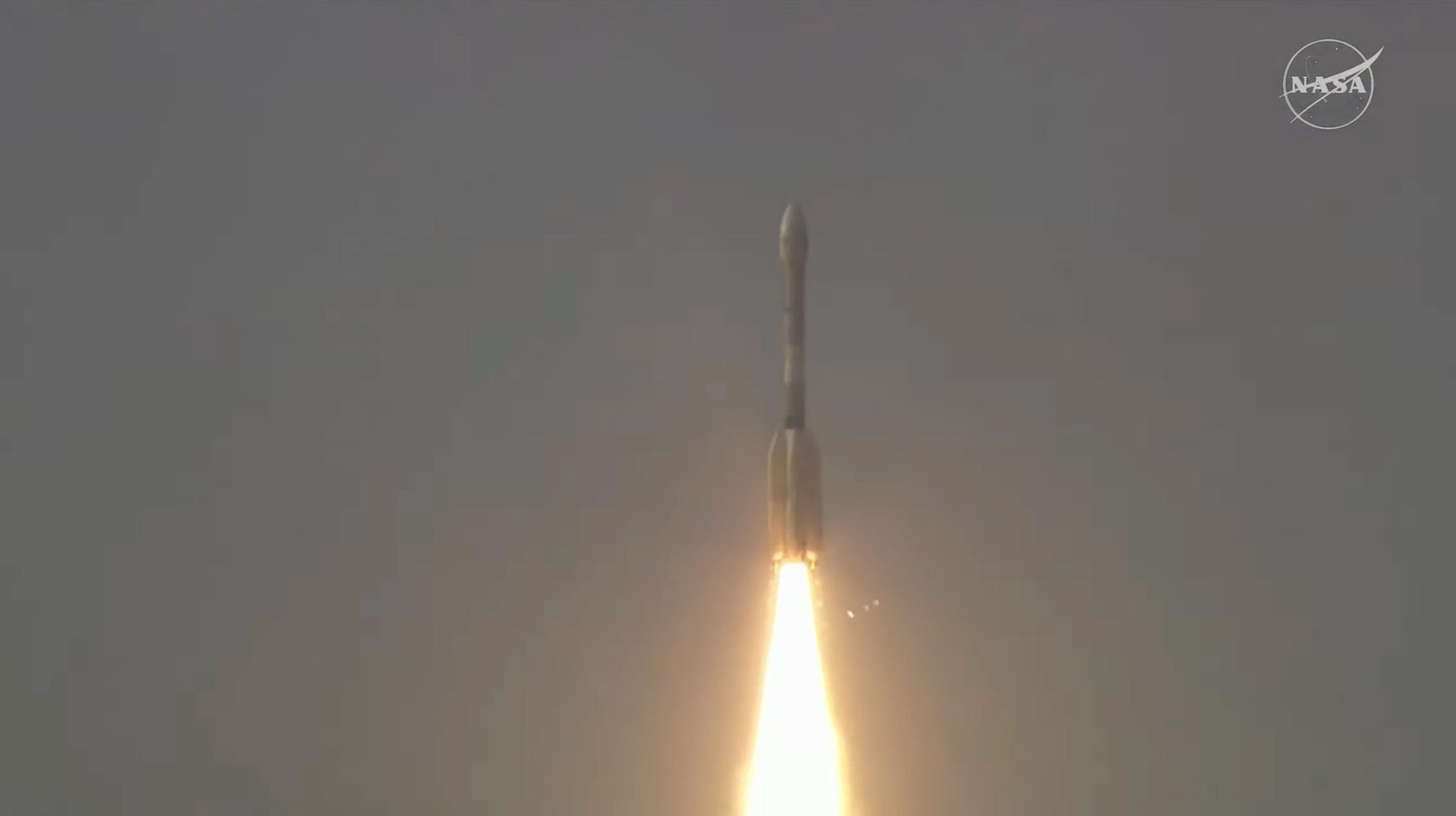
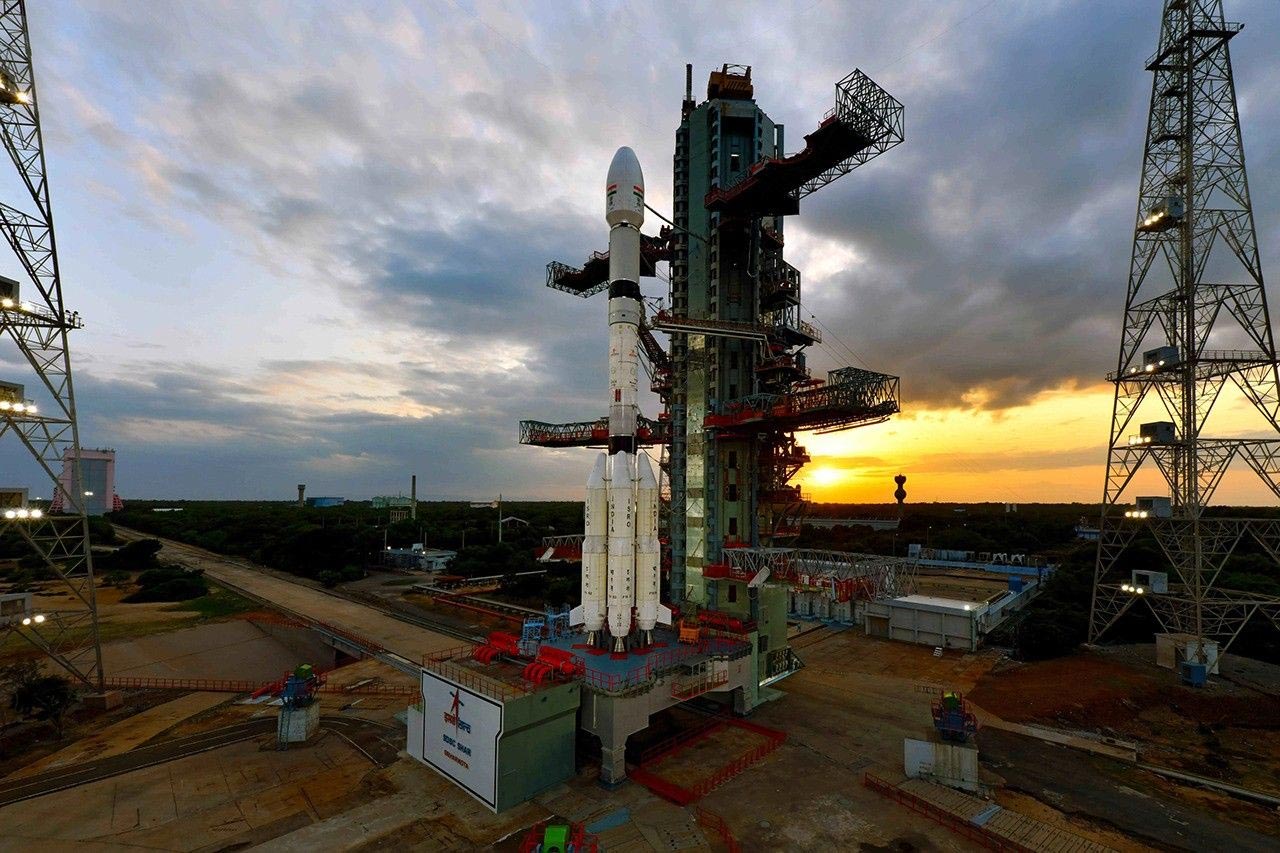
At 8:10 a.m. EDT (5:40 a.m. IST) on Wednesday, July 30, the NASA-ISRO NISAR (NASA-ISRO Synthetic Aperture Radar) satellite launched from the Satish Dhawan Space Centre, located on the southeastern coast of India. The spacecraft was carried into orbit by an ISRO Geosynchronous Satellite Launch Vehicle rocket.
The NISAR satellite is designed to remain in orbit for a minimum of three years. During this time, it will use its advanced radar technology to scan nearly all of Earth’s land and ice surfaces every 12 days, conducting two passes per cycle. The mission is a joint effort between NASA and the Indian Space Research Organisation (ISRO), and it aims to gather valuable data that is critically important to both countries.
Monitoring Earth’s Most Dangerous Forces
NISAR, which stands for NASA-ISRO Synthetic Aperture Radar, will enhance scientific understanding of natural disasters and environmental threats. It will allow researchers to study the mechanics behind earthquakes, volcanic activity, and landslides. Beyond monitoring natural hazards, the satellite will also be used to observe critical infrastructure, including bridges, roads, and dams.
Thanks to its ability to penetrate clouds, NISAR will be especially useful for emergency response teams during severe weather events, including hurricanes, storm surges, and floods. It will also collect data on melting glaciers, shifting ice sheets, and thinning sea ice, all of which play key roles in understanding global climate change. Additionally, the satellite will help scientists examine how environmental changes like deforestation, wildfires, and permafrost thaw are influencing the carbon cycle.
This mission also marks a milestone in international space collaboration. Teams of engineers and researchers, working across more than 9,000 miles and 13 time zones, have come together to deliver one of the most ambitious Earth-monitoring efforts ever undertaken.
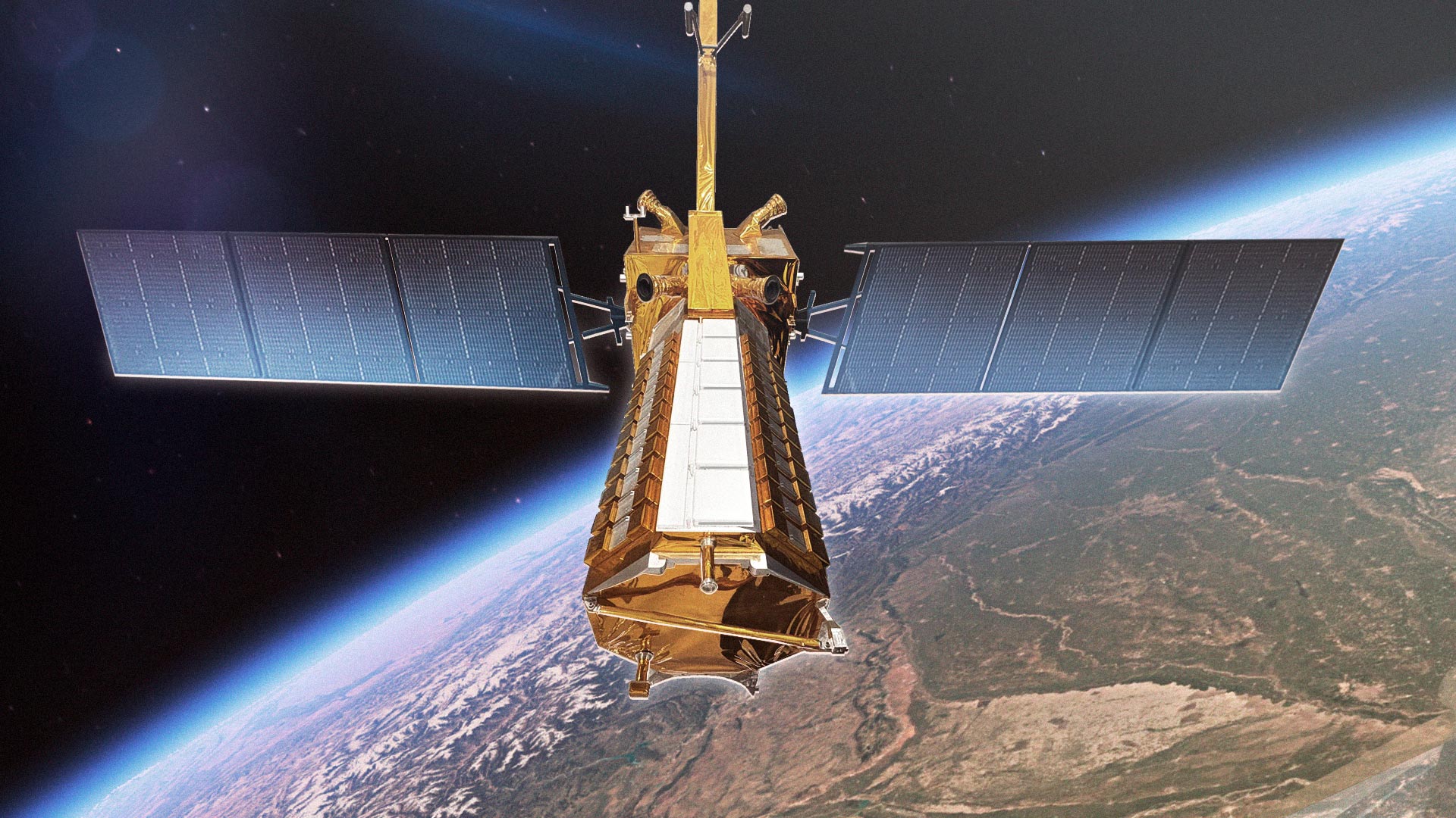
The Most Advanced Radar System Ever Flown
The first-ever hardware collaboration between NASA and ISRO on an Earth-observing mission, NISAR will carry the most advanced radar system ever launched as part of a NASA or ISRO mission.
About the length of a pickup truck, the satellite’s main body contains engineering systems and a first-of-its-kind dual-radar payload — an L-band system with a 10-inch (25-centimeter) wavelength and an S-band system with a 4-inch (10-centimeter) wavelength. Each system’s signal is sensitive to different sizes of features on Earth’s surface, and each specializes in measuring different attributes, such as moisture content, surface roughness, and motion. These characteristics are important for studying a variety of natural surface conditions, such as the amount of soil moisture available for vegetation to thrive or if land has subsided over time.
From Shrubs to Trees: Vegetation and Surface Insights
When operating together, the satellite’s two radars will collect data synchronized in time and location, extending the sensitivity of the measurements to objects on the surface in a broad range of sizes. For example, S-band data will allow more accurate characterization of shorter plants, such as bushes and shrubs, while L-band data will sense taller vegetation, like trees.
The spacecraft will operate in a Sun-synchronous orbit, with its radar antennas pointed in a configuration that will also offer unprecedented coverage of Antarctica. This is crucial for studying the motion, deformation, and melting of the Antarctic ice sheet as it breaks up and deposits fresh water into the ocean.
Never miss a breakthrough: Join the SciTechDaily newsletter.
Follow us on Google and Google News.