The first storm of the Australian tropical cyclone season aimed for Port Douglas.
The 2023 tropical cyclone season in the Atlantic and Northeast Pacific oceans has come to a close, but in the southern hemisphere near Australia, it has just begun. The region’s first tropical cyclone of the season formed in the Coral Sea in the first week of December.
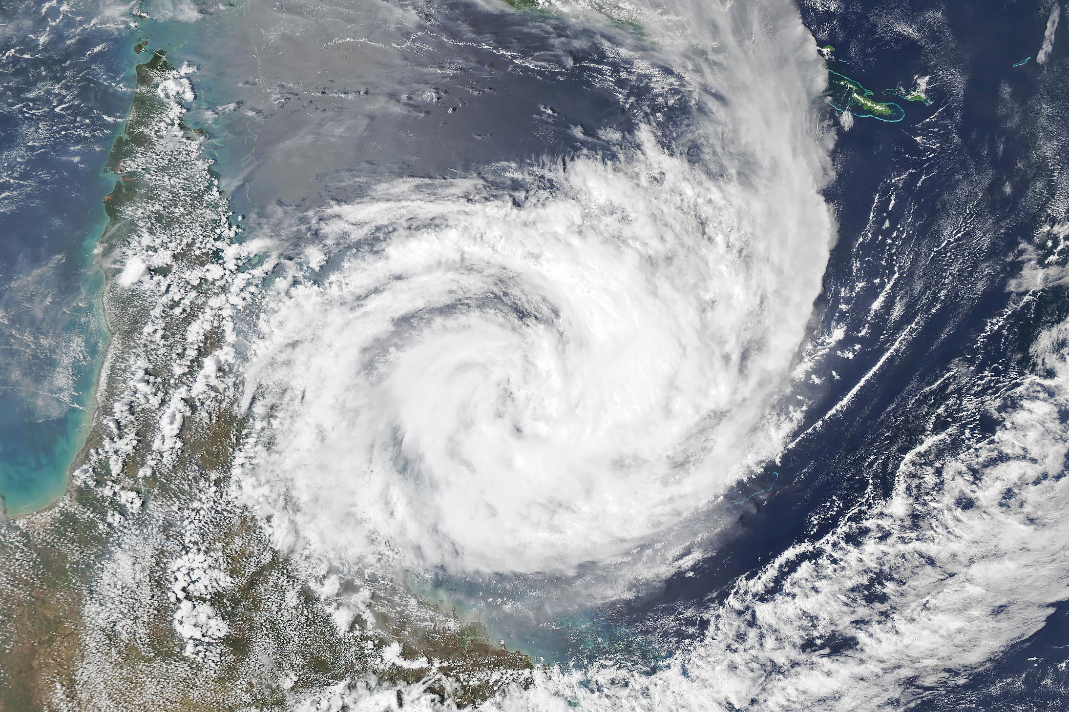
The MODIS (Moderate Resolution Imaging Spectroradiometer) on NASA’s Aqua satellite captured this image of Tropical Cyclone Jasper at 4:10 Universal Time (3:10 p.m. local time) on December 12 as it neared northeastern Queensland.
With top wind speeds of 220 kilometers (140 miles) per hour, the storm previously underwent rapid intensification to reach category-4 strength on the Saffir-Simpson scale. It later weakened when it faced dry air and wind shear, preventing a more symmetrical structure and clear eye by the time of this image.
Forecasters with the Joint Typhoon Warning Center expect Jasper to strengthen slightly on its final approach and make landfall near Port Douglas with 120 kilometers (75 miles) per hour winds, making it the equivalent of a weak category 1 storm. Some areas could receive up to 30 centimeters (12 inches) of rain over six hours and up to 50 centimeters over 24 hours, according to Australia’s Bureau of Meteorology.
Forecasters from the Joint Typhoon Warning Center used observations from NASA’s TROPICS (Time-Resolved Observations of Precipitation structure and storm Intensity with a Constellation of Smallsats) mission in their analysis of the storm’s intensity in the runup to landfall. Tracking storms with TROPICS is expected to improve understanding of processes that drive the rapid intensification of tropical cyclones. Each of the five satellites in the constellation carries cross-track microwave sounders that make observations at 205 gigahertz, which provides improved observations of the structure of storm clouds.
In its seasonal outlook released in October, Australia’s Bureau of Meteorology projected that Australia would see fewer tropical cyclones than usual this season due to the presence of El Niño. Satellite observations collected since the 1970s show a gradual decline in the number of such storms forming near Australia. The Sixth Assessment Report from the Intergovernmental Panel on Climate Change projects a continued downward trend in the frequency of Australian tropical cyclones in the future but an increase in the proportion of severe storms.
NASA Earth Observatory image by Michala Garrison, using MODIS data from NASA EOSDIS LANCE and GIBS/Worldview.
Never miss a breakthrough: Join the SciTechDaily newsletter.
Follow us on Google and Google News.