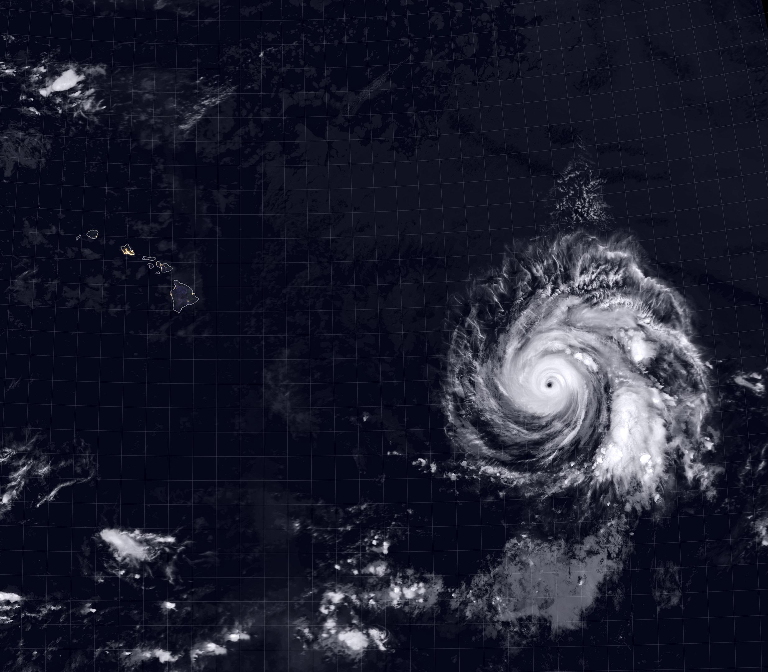
In July 2020, the Eastern Pacific experienced its first major hurricane of the year. After intensifying to category 4 strength on July 23, Douglas rapidly moved across the central Pacific and is predicted to make landfall in the eastern Hawaiian Islands by July 26.
The image above shows Douglas on July 23, 2020, at approximately 9:45 p.m. Hawaiian Standard Time. Clouds are shown in infrared using brightness temperature data, which is useful for distinguishing cooler cloud structures from the warmer surface below, from the Moderate Resolution Imaging Spectroradiometer (MODIS) on NASA’s Terra satellite. The image is overlaid with composite imagery of city lights from NASA’s Black Marble data. As of the morning of July 24, Douglas was a category 3 hurricane with maximum sustained winds near 120 miles (195 kilometers) per hour.
Douglas has moved over slightly cooler water and is slowly weakening as it encounters drier air. According to the Central Pacific Hurricane Center (CPHC), Douglas will likely downgrade to a category 1 hurricane or strong tropical storm as it approaches the Hawaiian Islands.
However, heavy rains and strong winds associated with the storm may result in flash flooding, landslides, and life-threatening surf and rip current conditions. Officials are organizing shelters on the “Big Island” of Hawaii and urging residents to stock up on food. Depending on how fast the storm degrades, the storm’s track could affect one or several islands.
As Douglas churns in the Pacific, the Atlantic basin is also stirring with two storms. Tropical storm Gonzalo is forecasted to bring heavy rain and potentially life-threatening flash flooding to the southern Windward Islands on July 25. Hurricane and tropical storm warnings are in effect for some of them. Tropical storm Hanna is moving across the Gulf of Mexico and is expected to bring heavy rain to parts of southern Texas on July 25.
NASA Earth Observatory image by Joshua Stevens, using VIIRS day-night band data from the Suomi National Polar-orbiting Partnership and MODIS data from NASA EOSDIS/LANCE and GIBS/Worldview.
Never miss a breakthrough: Join the SciTechDaily newsletter.
Follow us on Google and Google News.