Cyclone Mocha, a powerful storm, wreaked havoc across the Bay of Bengal in May 2023. The Copernicus Sentinel-3 mission provided vital satellite imagery, aiding disaster response and revealing large-scale global dynamics, including the eastern part of the Himalayas and the Tibetan Plateau.
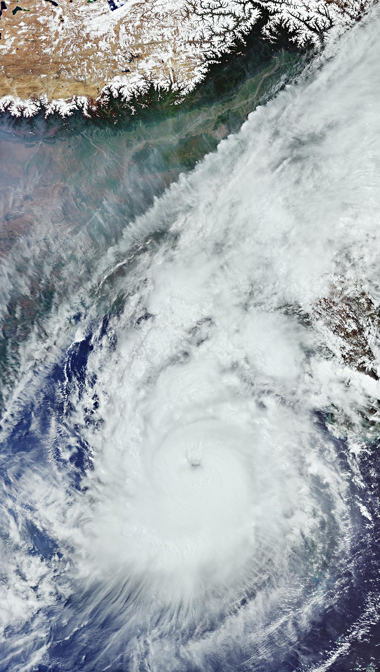
The Copernicus Sentinel-3 mission captured this image of the powerful Cyclone Mocha on May 13, 2023, as it made its way across the Bay of Bengal heading northeast towards Bangladesh and Myanmar.
Cyclone Mocha originated in the Indian Ocean, and it gradually intensified while moving toward the Bay of Bengal. Winds topped 280 km per hour (175 miles per hour), making it one the strongest storms on record in the North Indian Ocean, similar to Cyclone Fani, which hit the same area in May 2019.
Although the storm weakened slightly as it approached Myanmar and Bangladesh, it caused widespread destruction as it made landfall on May 14.
With thousands of people losing their houses, infrastructure seriously damaged and croplands inundated, both the International Charter Space and Major Disasters and the Copernicus Emergency Mapping Service were triggered to supply maps based on satellite data to help civil protection authorities and the international humanitarian community with their emergency response efforts.
Satellites orbiting Earth can provide indispensable up-to-date information to observe such events, as shown here from Copernicus Sentinel-3. The mission is designed to measure, monitor and understand large-scale global dynamics and provides essential information in near-real time for ocean and weather forecasting.
Acquired with the Ocean and Land Colour Instrument, this wide view covers an area of over 2,000 km (1,200 mi) from north to south. The storm is estimated to be more than 1,000 km (600 miles) across.
In the cloud-free portion on top of the image, we can see parts of India, Nepal, Bangladesh, and Myanmar, as well as the entire country of Bhutan. The white snow-capped mountains of the eastern part of the Himalayas, including Mount Everest, the highest mountain on the planet, are clearly visible. The Tibetan Plateau – part of China – appears in brownish colors owing to the absence of vegetation.
Never miss a breakthrough: Join the SciTechDaily newsletter.
Follow us on Google and Google News.