The Philippines’ Taal volcano erupted on January 12, 2020 – spewing an ash plume approximately 15 km (9 mi) high and forcing large-scale evacuations in the nearby area.
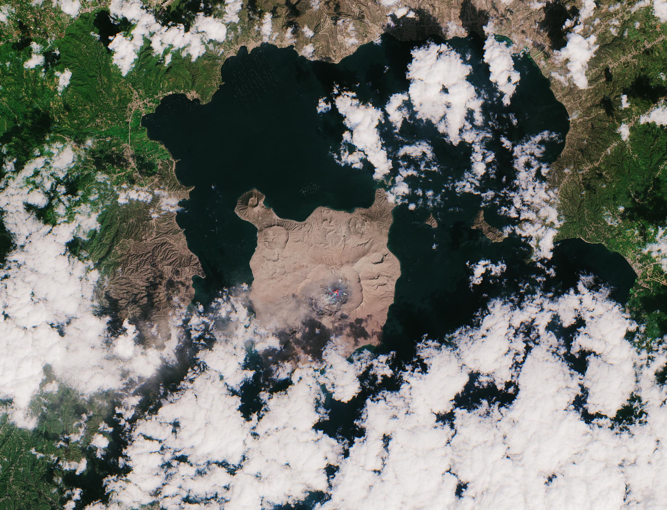
This almost cloud-free image was captured on January 23, 2020, at 02:20 GMT (10:20 local time) by the Copernicus Sentinel-2 mission, and shows the island, in the center of the image, completely covered in a thick layer of ash.
This optical image has also been processed using the mission’s short-wave infrared band to show the ongoing activity in the crater, visible in bright red. Ash blown by strong winds can be seen in Agoncillo, visible southwest of the Taal volcano. Ash has also been recorded in other areas of the Batangas province, as well as Manila and Quezon.
According to The Philippine Institute of Volcanology and Seismology bulletin published on January 23, sulfur dioxide emissions were measured at an average of around 140 tonnes. The Taal volcano still remains on alert level four, meaning an explosive eruption is possible in the coming hours or days. The highest alert level is five which indicates an eruption is taking place.
According to the National Disaster Risk Reduction and Management Council, over 50 000 people have been affected so far. In response to the eruption, the Copernicus Emergency Mapping Service was activated. The service uses satellite observations to help civil protection authorities and, in cases of disaster, the international humanitarian community, respond to emergencies.
Never miss a breakthrough: Join the SciTechDaily newsletter.
Follow us on Google and Google News.