Most comprehensive study of the temple complex and its surrounding land and water scapes identifies the earliest period of occupation and points to a possible connection with a creation myth.
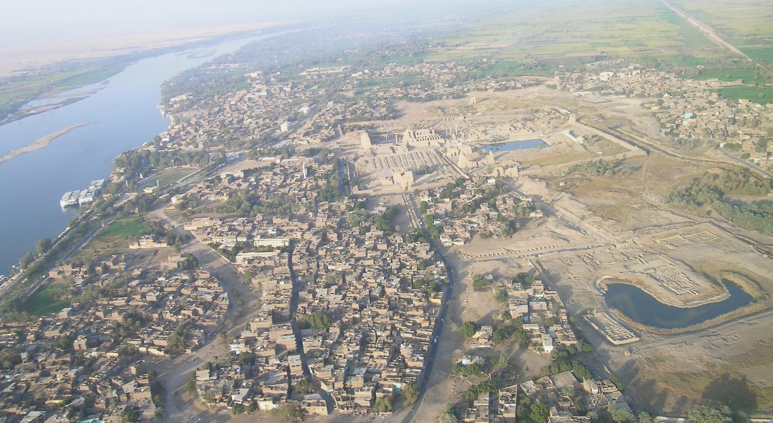
An international team of researchers led by Uppsala University has completed the most extensive geoarchaeological investigation of Egypt’s Karnak Temple complex to date. Situated within modern Luxor, Karnak is among the largest religious sites of the ancient world and forms part of a UNESCO World Heritage area.
Published in Antiquity, the study provides new evidence about the temple’s origins, its possible connections to ancient Egyptian creation myths, and how its surrounding river landscape shaped the site’s establishment, occupation, and growth over three millennia.
“Our research presents the clearest understanding of the landscape upon which the ancient Egyptians founded their temple at Karnak approximately 4000 years ago,” says Dr. Angus Graham, Uppsala University, who led the team.
From Flooded Land to Temple Foundation
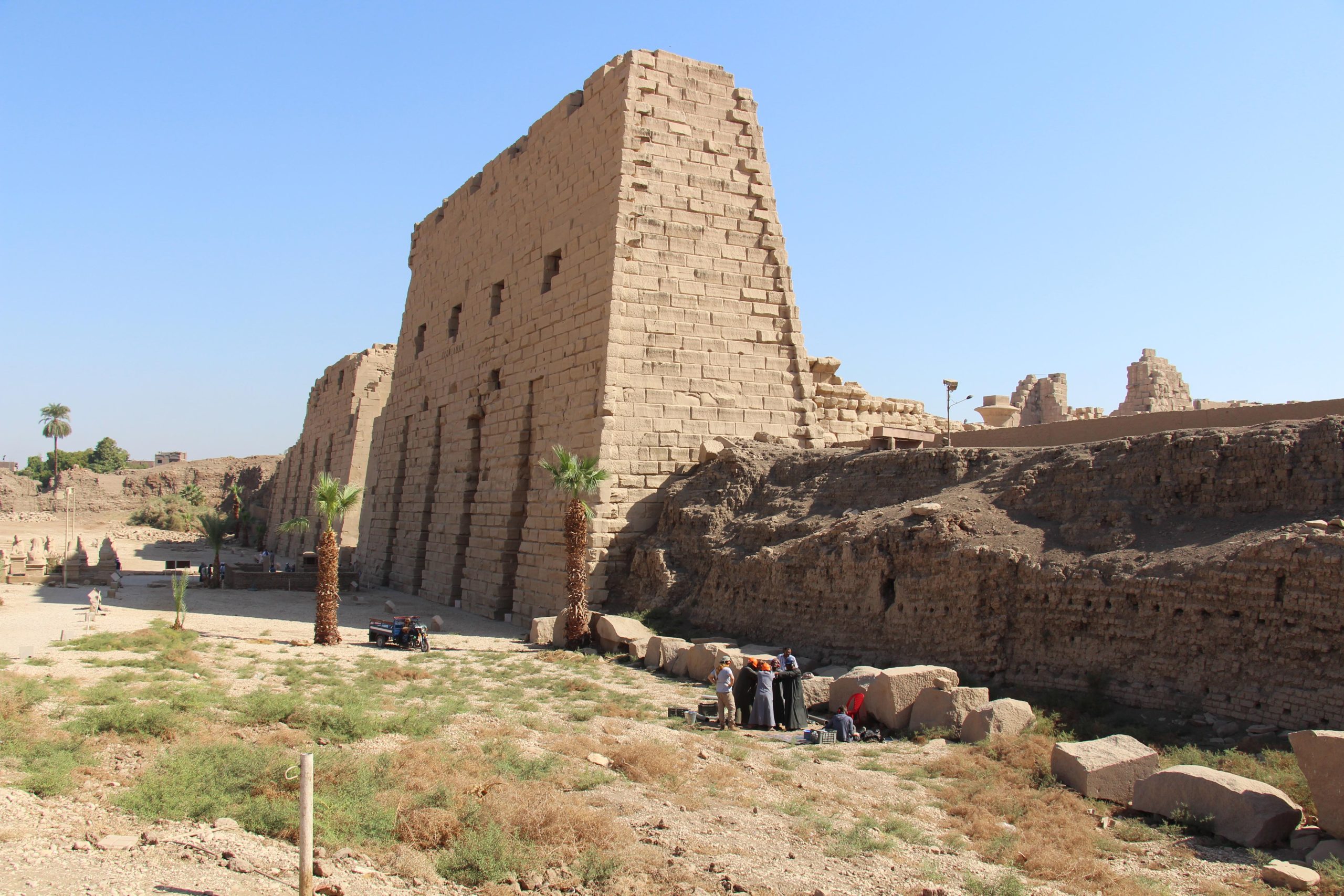
Karnak stands about 500 meters east of today’s River Nile, near the ancient city of Thebes, once Egypt’s religious capital. However, the terrain looked very different when the site was first settled.
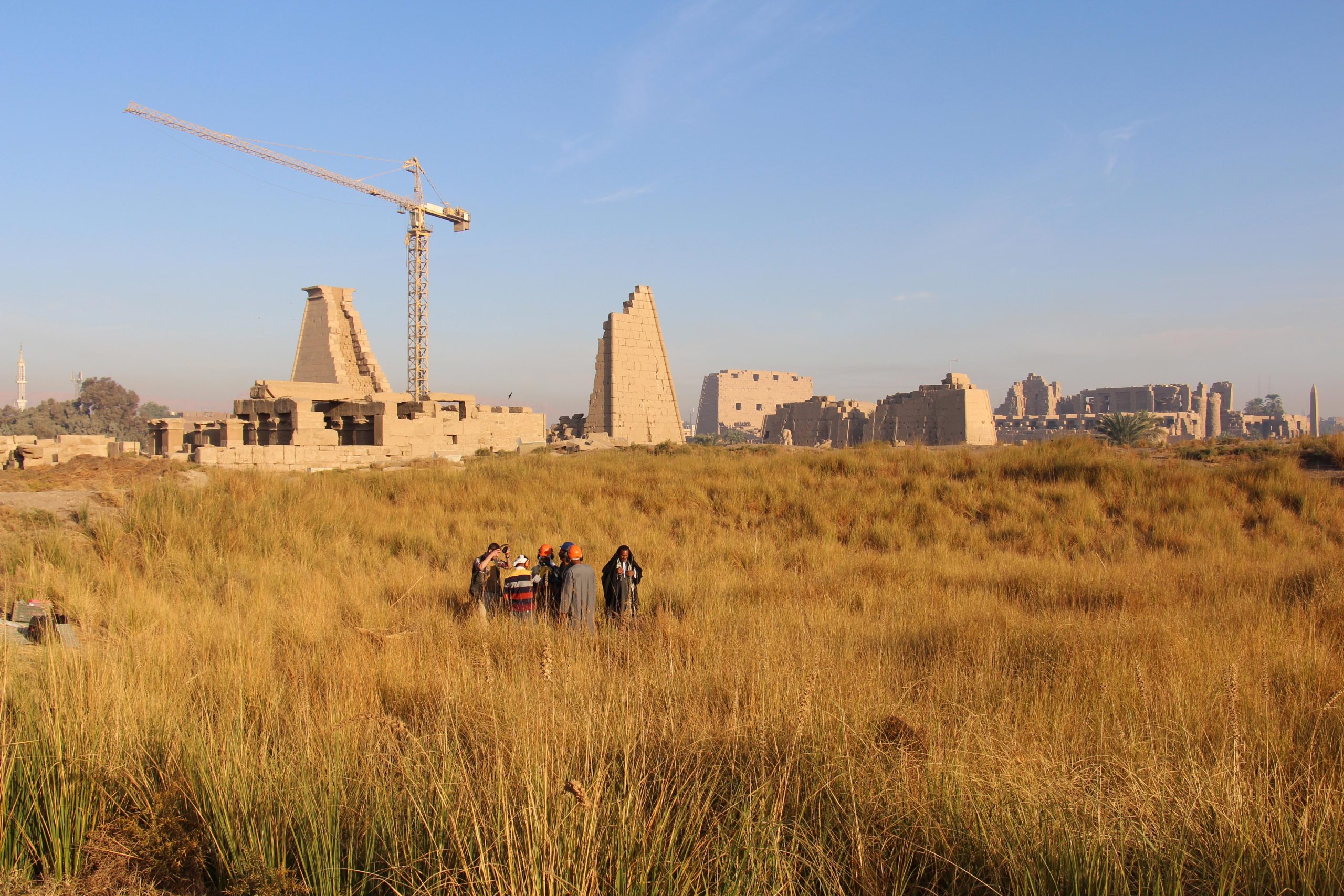
The team examined 61 sediment cores taken from in and around the temple complex and analyzed tens of thousands of ceramic fragments to establish a timeline of environmental change. Their findings reveal how the Nile’s channels and flood patterns evolved over thousands of years, influencing where and when people could live and build.

Before around 2520 BCE, the site was likely uninhabitable due to frequent flooding by strong Nile currents. Evidence from ceramics indicates that the first permanent activity at Karnak probably began during the Old Kingdom (c.2591–2152 BCE), with the earliest material dating to between c.2305 and 1980 BCE.
The foundation of Karnak emerged when shifting river channels carved paths to the west and east of a natural terrace, isolating a raised area of land. This elevated ground became a stable island in the landscape—providing the ideal base for the first settlements and the early phases of temple construction.
A New Interpretation of the Temple Site’s Role
Over subsequent centuries and millennia, the river channels on either side of the site migrated, creating more space for the temple complex to develop.
Researchers were surprised to find that the eastern channel – until this study, not much more than a supposition – was more well-defined, and perhaps even larger than the channel to the west, which archaeologists had previously focused on.
“What also surprised us was the longevity of this eastern channel. It remains a very minor channel until the arrival of the Romans in the first century BCE. We also have evidence of how the Ancient Egyptians engineered the landscape. They may well have been impatient to expand their temple footprint as they dumped desert sands into a minor river channel that was already starting to silt up,” adds Angus Graham.
The Landscape Reflects the Creation Myth
This new knowledge of the temple’s landscape has striking similarities to an Ancient Egyptian creation myth, leading the team to believe that the decision to locate the temple here could have been linked to the religious views of its inhabitants.
Ancient Egyptian texts of the Old Kingdom say that the creator god manifested as high ground, emerging from ‘the lake’. The island upon which Karnak was found is the only known such area of high ground surrounded by water in the area.
“It’s tempting to suggest the Theban elites chose Karnak’s location for the dwelling place of a new form of the creator god, ‘Ra-Amun’, as it fitted the cosmogonical scene of high ground emerging from surrounding water,” says Dr. Ben Pennington, lead author of the paper and a Visiting Fellow in Geoarchaeology at the University of Southampton.
“Later texts of the Middle Kingdom (c.1980–1760 BC) develop this idea, with the ‘primeval mound’ rising from the ‘Waters of Chaos’. During this period, the abating of the annual flood would have echoed this scene, with the mound on which Karnak was built appearing to ‘rise’ and grow from the receding floodwaters.”
The paper has built upon the project’s 2024 Nature Geoscience paper, which demonstrates how climatic and environmental changes have shaped the landscape of the Egyptian Nile Valley over the past 11,500 years.
The work was carried out under the auspices of the Egypt Exploration Society (London) with a permit from the Ministry of Tourism and Antiquities (Egypt).
Reference: “Conceptual origins and geomorphic evolution of the temple of Amun-Ra at Karnak (Luxor, Egypt)” by Benjamin Thomas Pennington, Angus Graham, Aurélia Masson-Berghoff, Marie Millet, Jan Peeters, Willem H.J. Toonen, Timotheus G. Winkels, Luke H. Sollars, Virginia L. Emery, Kristian David Strutt and Dominic Simon Barker, 6 October 2025, Antiquity.
DOI: 10.15184/aqy.2025.10185
Funding: Knut och Alice Wallenbergs Stiftelse, Uppsala Universitet, M och S Wångstedts Stiftelse
Never miss a breakthrough: Join the SciTechDaily newsletter.
Follow us on Google and Google News.
1 Comment
I found an Egyptian Prophesy Stone with a Hindu Prayer Stone with three heads engraved of equalporportion on one side the reverse side having visable lay out lines by the artist with what appear to be two lines of numbers possibly lat long figures with an horse should shaped piece of metal, what appeared to be slag turned out to be three gargoyles with faint Yukatan writing in the bay area near what appears to be a temple in the middle of a creek which was likely a river long ago